Rochester (CDP), Vermont facts for kids
Quick facts for kids
Rochester, Vermont
|
|
|---|---|

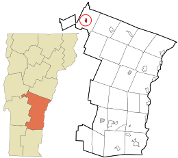
Location in Windsor County and the state of Vermont.
|
|
| Country | United States |
| State | Vermont |
| County | Windsor |
| Area | |
| • Total | 0.64 sq mi (1.67 km2) |
| • Land | 0.63 sq mi (1.64 km2) |
| • Water | 0.01 sq mi (0.03 km2) |
| Elevation | 870 ft (270 m) |
| Population
(2010)
|
|
| • Total | 299 |
| • Density | 463.7/sq mi (179.0/km2) |
| Time zone | UTC-5 (Eastern (EST)) |
| • Summer (DST) | UTC-4 (EDT) |
| ZIP code |
05767
|
| Area code(s) | 802 |
| FIPS code | 50-60025 |
| GNIS feature ID | 1461345 |
Rochester is a small village in Vermont, United States. It is known as a census-designated place (CDP). This means it is a special area defined by the government for counting people. Rochester is located in Windsor County.
In 2010, about 299 people lived in this village. The entire town of Rochester, which is a larger area, had 1,139 people.
Where is Rochester?
Rochester is found in the very northwest part of Windsor County. It sits right along the White River. This river is an important natural feature in the area.
Main Roads in Rochester
Vermont Route 100 is a major road that goes through the village. If you head north on this road, you can reach towns like Hancock and Warren. Going south on Route 100 will take you to Stockbridge.
Another road, Vermont Route 73, starts in Rochester and goes west. This route crosses the Green Mountains, which are a famous mountain range in Vermont. It eventually leads to the town of Brandon.
See also
 In Spanish: Rochester (condado de Windsor) para niños
 | Aaron Henry |
 | T. R. M. Howard |
 | Jesse Jackson |

