Rock Falls, Illinois facts for kids
Quick facts for kids
Rock Falls
|
|
|---|---|

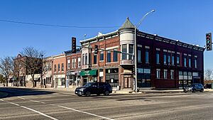
View of downtown buildings in Rock Falls, IL
|
|

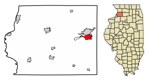
Location of Rock Falls in Whiteside County, Illinois.
|
|

Location of Illinois in the United States
|
|
| Country | United States |
| State | Illinois |
| County | Whiteside |
| Founded by | A.P. Smith |
| Government | |
| • Type | Mayor-council |
| Area | |
| • Total | 4.12 sq mi (10.68 km2) |
| • Land | 3.98 sq mi (10.32 km2) |
| • Water | 0.14 sq mi (0.36 km2) |
| Population
(2020)
|
|
| • Total | 8,789 |
| • Density | 2,206.63/sq mi (852.02/km2) |
| Time zone | UTC−6 (CST) |
| • Summer (DST) | UTC−5 (CDT) |
| ZIP Code(s) |
61071
|
| Area code(s) | 815 |
| FIPS code | 17-64928 |
| Wikimedia Commons | Rock Falls, Illinois |
Rock Falls is a city in Whiteside County, Illinois, United States. It is home to about 8,789 people, based on the 2020 census. The city is located right on the Rock River. It sits across from its "twin city," Sterling.
Contents
City Geography
Rock Falls is located in Whiteside County, Illinois. The Rock River separates Rock Falls from its neighbor, Sterling, to the north.
In 2010, the city covered about 3.795 square miles (9.83 square kilometers). Most of this area, about 3.66 square miles (9.48 square kilometers), is land. The rest, about 0.135 square miles (0.35 square kilometers), is water.
Population Changes
The number of people living in Rock Falls has changed over the years. Here is a look at the population from 1870 to 2020:
| Historical population | |||
|---|---|---|---|
| Census | Pop. | %± | |
| 1870 | 471 | — | |
| 1880 | 894 | 89.8% | |
| 1890 | 1,900 | 112.5% | |
| 1900 | 2,176 | 14.5% | |
| 1910 | 2,657 | 22.1% | |
| 1920 | 2,927 | 10.2% | |
| 1930 | 3,893 | 33.0% | |
| 1940 | 4,987 | 28.1% | |
| 1950 | 7,983 | 60.1% | |
| 1960 | 10,261 | 28.5% | |
| 1970 | 10,287 | 0.3% | |
| 1980 | 10,633 | 3.4% | |
| 1990 | 9,654 | −9.2% | |
| 2000 | 9,580 | −0.8% | |
| 2010 | 9,266 | −3.3% | |
| 2020 | 8,789 | −5.1% | |
| U.S. Decennial Census | |||
In 2000, there were 9,580 people living in Rock Falls. There were 3,895 households, which are groups of people living together. About 30.7% of these households had children under 18. The average household had 2.43 people.
The median age in the city was 36 years old. This means half the people were younger than 36, and half were older.
Local Education
Rock Falls has several school districts. Most students attend schools in the Rock Falls Elementary School District 13. Some parts of the city are in the East Coloma-Nelson Consolidated Elementary School District 20. A small area is part of the Montmorency Community Consolidated School District 145. All high school students attend Rock Falls Township High School District 301.
- Rock Falls Elementary School District #13 includes:
* Riverdale Preschool Center * Dillon Elementary School * Merrill Intermediate School * Rock Falls Middle School
- East Coloma-Nelson CESD #20 runs East Coloma-Nelson grade school.
- Montmorency CCSD #145 runs Montmorency grade school.
- Thome School helps students with special needs.
The Roman Catholic Diocese of Rockford also runs St. Andrew's School. This school serves as both a grade school and a middle school for the local St. Andrew Catholic Church.
Arts and Fun Events
Rock Falls hosts many fun events throughout the year. Some popular ones include:
- Percussion-Paloosa (February)
- Rock Falls Spring Challenge (May)
- Bass Pro Shop's Big Cat Quest Catfish Tournament (June)
- Summer Splash (June)
- River Chase Boat Races (June)
- Pink Heals Tour (July)
- Whiteside County Barn Tour (July)
- Touch a Truck (August)
- Fiesta Days (September)
- Bridge the Communities 5K/10K race (September)
- The Hennepin Hundred 100k Ultra race (October)
- Hometown Holidays (November)
Parks and Recreation
The City of Rock Falls and Coloma Township have 16 parks. These parks cover over 100 acres (40 hectares). You can find many things to do there, such as:
- Baseball diamonds
- Basketball courts
- Tennis courts
- Disc golf courses
- Open fields for play
- Playground equipment
- Pavilions and picnic areas
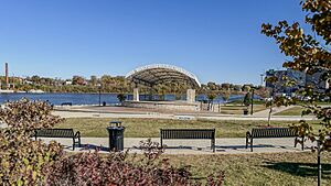
- A bandshell for performances
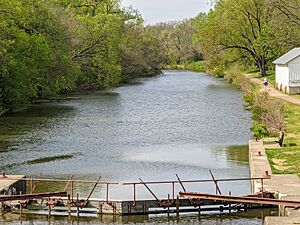
Because the Rock River and the Hennepin Canal are nearby, you can also enjoy water activities. Centennial Park has a lake where you can use boat ramps, canoes, paddle boats, or go fishing.
Rock Falls has two eighteen-hole disc golf courses. You can play disc golf at Nims Park and Joshua Park.
City Transportation
Airport
The Whiteside County Airport is located about 2 miles (3.2 km) south of the city.
Main Roads
Several major highways pass through or near Rock Falls:
 Interstate 88
 U.S. Route 30
 Illinois Route 40
 Illinois Route 110
Electricity
Rock Falls has its own electrical system. It generates some of its power using a 2-megawatt hydro-electric plant on the Rock River.
Famous People from Rock Falls
Many interesting people have connections to Rock Falls:
- Otis Adelbert Kline (born 1891), a songwriter and adventure novelist.
- Zelma O'Neal (born 1903), an actress and singer.
- Louie Bellson (born 1924), a famous drummer who created the double bass drumkit.
- Cal Howe (born 1924), a professional baseball player for the Chicago Cubs.
- Gary Kolb (born 1940), a professional baseball player for teams like the St. Louis Cardinals.
- Mariya Takeuchi (born 1955), a Japanese singer and songwriter who was an exchange student here.
- David Turk, who became the 21st United States deputy secretary of energy.
- Frank Harts (born 1979), an actor.
- Seth Blair (born 1989), a minor league baseball player for the Boston Red Sox.
- Jake Junis (born 1992), a professional baseball player for teams like the Kansas City Royals.
See also
 In Spanish: Rock Falls (Illinois) para niños
 | Emma Amos |
 | Edward Mitchell Bannister |
 | Larry D. Alexander |
 | Ernie Barnes |


