Quick facts for kids
Roe Island

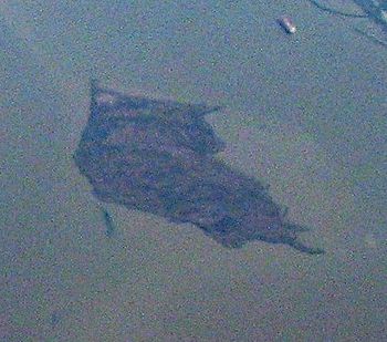
Roe Island in an aerial photo from 2009.
|
Location in Sacramento-San Joaquin River Delta
Show map of Sacramento-San Joaquin River Delta
Location in San Francisco Bay Area
Show map of San Francisco Bay Area
Location in California
Show map of California
Location in the United States
Show map of the United States
|
| Geography |
| Location |
Northern California |
| Coordinates |
38°04′21″N 122°02′05″W / 38.07250°N 122.03472°W / 38.07250; -122.03472 (Roe Island) |
| Adjacent bodies of water |
Suisun Bay |
| Administration |
|
|
| State |
 California California |
| County |
Solano |
Roe Island is a small island located in Suisun Bay in Northern California. It sits near where the Sacramento-San Joaquin River Delta meets the bay. This island is part of Solano County, California, and is about 10 kilometers (6 miles) east of the city of Benicia.
About Roe Island
Roe Island has two main points. Its western tip is called Preston Point. The eastern tip is known as Gillespie Point. Long ago, on maps from the 1850s, Roe Island was sometimes called "Preston Island." These old maps were made by people like Cadwalader Ringgold and Henry Lange. They helped explore and map the San Francisco Bay Area.
An Island Rescue Story
Roe Island is usually quiet, but it was once the scene of an interesting rescue. On November 22, 2010, a man named Brian Hopper was rescued from the island. He had been stranded there for five days! His rubber raft had gotten a leak, leaving him stuck. Luckily, he had his cell phone with him. He was able to call a cousin, who then told the U.S. Coast Guard. The Coast Guard quickly came to his rescue.


