
Rohrsburg, Pennsylvania facts for kids
Quick facts for kids
Rohrsburg, Pennsylvania
|
|
|---|---|

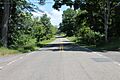
Rohrsburg Road on the southeastern edge of town
|
|

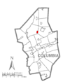
Location within Columbia County
|
|

Rohrsburg, Pennsylvania
Location in Pennsylvania

Rohrsburg, Pennsylvania
Location in the United States
|
|
| Country | United States |
| State | Pennsylvania |
| County | Columbia |
| Township | Greenwood |
| Area | |
| • Total | 0.74 sq mi (1.93 km2) |
| • Land | 0.74 sq mi (1.91 km2) |
| • Water | 0.01 sq mi (0.02 km2) |
| Elevation | 661 ft (201 m) |
| Population
(2020)
|
|
| • Total | 150 |
| • Density | 202.98/sq mi (78.37/km2) |
| Time zone | UTC-5 (Eastern (EST)) |
| • Summer (DST) | UTC-4 (EDT) |
| ZIP Code |
17859
|
| FIPS code | 42-65872 |
| GNIS feature ID | 1185401 |
Rohrsburg is a small community in Columbia County, Pennsylvania, United States. It is known as a census-designated place (CDP). This means it's a special area defined by the government for counting people. Rohrsburg is located in the northeastern part of Pennsylvania. In 2020, about 150 people lived there. It is also part of the larger Bloomsburg-Berwick area.
Contents
History of Rohrsburg
Rohrsburg got its name from a man named Frederick Rohr. He was from Prussia, a country that used to exist in Europe. Frederick Rohr received the land for Rohrsburg in 1825. He got it from someone named Samuel Sherts.
Early Businesses and Growth
In 1826, Rohrsburg was very small. It only had one shop where a wheelwright worked. A wheelwright is a person who builds or repairs wooden wheels. But over the next few years, more businesses started to appear.
- A sawmill was built in 1820. Sawmills cut logs into lumber.
- A fulling and carding-mill was built in 1832. These mills processed wool. Fulling made cloth thicker, and carding prepared wool fibers for spinning.
- A pottery shop opened in 1847. Here, people made things like pots and dishes from clay.
Later, a train line called the Susquehanna, Bloomsburg, and Berwick Railroad had a station in Rohrsburg. This was important for travel and moving goods in the late 1800s and early 1900s.
Geography and Landscape

Rohrsburg is in the northern part of Columbia County. It is located in the southeastern section of Greenwood Township. The area of Rohrsburg is about 0.74 square miles (1.93 square kilometers). Most of this area is land, with a very small amount of water.
Natural Features
The land in Rohrsburg is mostly flat. However, there are some small hills in the northeast part of the area. A small stream called Little Green Creek flows through Rohrsburg. This creek then joins Green Creek. Green Creek is a tributary, which means it flows into a larger stream called Fishing Creek. Fishing Creek then flows into the North Branch Susquehanna River.
Land Use
Most of Rohrsburg is covered by farmland. This means there are many fields where crops are grown. You can also find some woods along Green Creek. There are also houses located near Pennsylvania Route 254, which is a road that goes through Rohrsburg.
Population and People
| Historical population | |||
|---|---|---|---|
| Census | Pop. | %± | |
| 2020 | 150 | — | |
| U.S. Decennial Census | |||
In 2020, the population of Rohrsburg was 150 people. This number comes from the official 2020 United States Census.
Past Population Details
Back in 2000, there were 164 people living in Rohrsburg. There were 56 households, which are groups of people living together in one home. Most of these households were married couples.
The people in Rohrsburg were of different ages:
- About 25.6% were under 18 years old.
- About 29.3% were between 25 and 44 years old.
- About 14.0% were 65 years old or older.
The average age of people in Rohrsburg in 2000 was 37 years old.
Education
If you live in Rohrsburg and want to go to college, the closest large college is the Bloomsburg University of Pennsylvania. This university has more than 2,000 students.
Climate and Weather
Rohrsburg experiences different weather throughout the year.
Temperatures
- In January, which is winter, the average high temperature is 34°F (1°C). The average low temperature is 19°F (-7°C).
- In July, which is summer, the average high temperature is 84°F (29°C). The average low temperature is 62°F (17°C).
The hottest temperature ever recorded in Rohrsburg was 106°F (41°C) in July 1936. The coldest temperature ever recorded was -20°F (-29°C) in January 1994.
Rainfall
Rohrsburg gets the most rain in June. On average, it rains more than 4.5 inches (114 mm) during this month. February is the driest month, with an average of just over 2 inches (51 mm) of rain.
Images for kids
-
Rohrsburg Road on the southeastern edge of town
-
Location within Columbia County
See also
 In Spanish: Rohrsburg para niños
