Romine Corner, Indiana facts for kids
Quick facts for kids
Romine Corner, Indiana
|
|
|---|---|
| Country | United States |
| State | Indiana |
| County | Warren |
| Township | Mound |
| Elevation | 568 ft (173 m) |
| Time zone | UTC-5 (Eastern (EST)) |
| • Summer (DST) | UTC-4 (EDT) |
| ZIP code |
47932
|
| Area code(s) | 765 |
| GNIS feature ID | 442270 |
Romine Corner is a place in Indiana, United States, that used to be a town but isn't anymore. It's sometimes called an "extinct town" or a ghost town. It's located in Mound Township in Warren County, west of a town called Covington.
Even though it's not a town anymore, a few buildings are still there. The USGS (United States Geological Survey) still lists it on their maps. A company called Flex-N-Gate has a factory close by.
Where is Romine Corner Located?
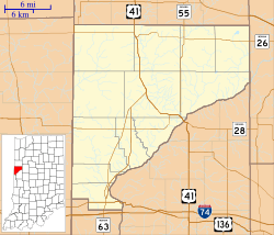
Romine Corner is found at the corner of US Route 136 and Warren County Road 600 West. It's near State Road 63 to the west. The major highway Interstate 74 is also close by, to the south. The Wabash River flows to the northeast of this location.

All content from Kiddle encyclopedia articles (including the article images and facts) can be freely used under Attribution-ShareAlike license, unless stated otherwise. Cite this article:
Romine Corner, Indiana Facts for Kids. Kiddle Encyclopedia.

