Rosepine, Louisiana facts for kids
Quick facts for kids
Rosepine, Louisiana
|
|
|---|---|
|
Town
|
|
| Town of Rosepine | |

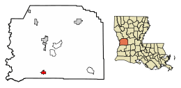
Location of Rosepine in Vernon Parish, Louisiana.
|
|

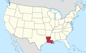
Location of Louisiana in the United States
|
|
| Country | United States |
| State | Louisiana |
| Parish | Vernon |
| Area | |
| • Total | 2.43 sq mi (6.30 km2) |
| • Land | 2.43 sq mi (6.28 km2) |
| • Water | 0.01 sq mi (0.01 km2) |
| Elevation | 230 ft (70 m) |
| Population
(2020)
|
|
| • Total | 1,519 |
| • Density | 625.88/sq mi (241.69/km2) |
| Time zone | UTC-6 (CST) |
| • Summer (DST) | UTC-5 (CDT) |
| ZIP code |
70659
|
| Area code(s) | 337 |
| FIPS code | 22-66200 |
Rosepine is a small town located in Vernon Parish, Louisiana, in the United States. In 2010, about 1,692 people lived there. It is part of the area around Fort Johnson South.
Contents
A Look Back at Rosepine's History
Rosepine's story began with the arrival of the railway. In 1897, the Kansas City, Shreveport & Gulf Railway Company completed its tracks through Rosepine. This railway helped connect the town to other places like Dequincy and Port Arthur, Texas.
Soon after the railway, several sawmills started operating in the area by 1901. These included Brice Brothers and Craft, Diamond Lumber Company Ltd, Lewis and Williams, and Rosepine Lumber Company. These sawmills were important for the town's early growth.
Rosepine officially became a town in 1902, with J.J. Cryer as its first mayor. It was reincorporated in 1950. In 1900, only 75 people lived in Rosepine. However, by 1906, the population had grown to more than 1,000 people!
Where is Rosepine Located?
Rosepine is found at 30°55′11″N 93°16′58″W / 30.91972°N 93.28278°W. This is its exact spot on a map.
The United States Census Bureau says that Rosepine covers a total area of about 2.2 square miles (5.8 square kilometers). All of this area is land. Rosepine is located about sixteen miles southwest of Leesville.
Who Lives in Rosepine?
Demographics is the study of a population. It helps us understand who lives in a town. The table below shows how Rosepine's population has changed over many years.
| Historical population | |||
|---|---|---|---|
| Census | Pop. | %± | |
| 1910 | 325 | — | |
| 1930 | 214 | — | |
| 1940 | 407 | 90.2% | |
| 1950 | 334 | −17.9% | |
| 1960 | 414 | 24.0% | |
| 1970 | 587 | 41.8% | |
| 1980 | 953 | 62.4% | |
| 1990 | 1,135 | 19.1% | |
| 2000 | 1,390 | 22.5% | |
| 2010 | 1,692 | 21.7% | |
| 2020 | 1,519 | −10.2% | |
| U.S. Decennial Census | |||
Rosepine's Population in 2020
The 2020 United States census counted 1,519 people living in Rosepine. There were 697 households and 404 families in the town.
The table below shows the different groups of people who lived in Rosepine in 2020.
| Race | Number | Percentage |
|---|---|---|
| White (non-Hispanic) | 1,167 | 76.83% |
| Black or African American (non-Hispanic) | 123 | 8.1% |
| Native American | 19 | 1.25% |
| Asian | 8 | 0.53% |
| Pacific Islander | 2 | 0.13% |
| Other/Mixed | 66 | 4.34% |
| Hispanic or Latino | 134 | 8.82% |
See also
 In Spanish: Rosepine para niños
 | Frances Mary Albrier |
 | Whitney Young |
 | Muhammad Ali |

