Ross Barnett Reservoir facts for kids
Quick facts for kids Ross Barnett Reservoir |
|
|---|---|

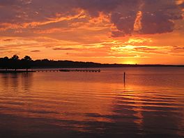
July sunset at the Ross Barnett Reservoir, showing the public fishing pier on Spillway Road.
|
|
| Location | Rankin / Madison counties, Mississippi, US |
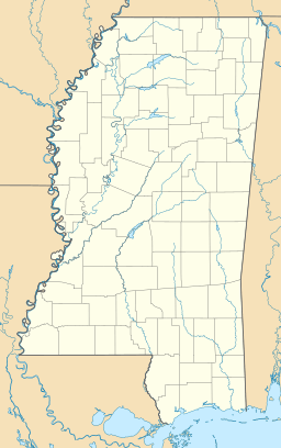
| Coordinates | 32°27′26″N 90°01′04″W / 32.4571°N 90.0179°W |
| Lake type | Reservoir |
| Primary inflows | Pearl River |
| Primary outflows | Pearl River |
| Basin countries | United States |
| Max. length | 16 mi (25.74 km) |
| Max. width | 7 mi (11.26 km) |
| Surface area | 52 sq mi (134.67 sq km) |
| Average depth | 12 ft (3.66 m) |
| Max. depth | 60 ft (10.67 m) |
| Shore length1 | 105 mi (168.95 km) |
| Settlements | Jackson / Brandon / Ridgeland / Madison |
| 1 Shore length is not a well-defined measure. | |
The Ross Barnett Reservoir is a large, man-made lake in Mississippi, USA. It was created from the Pearl River and sits between Madison and Rankin counties. This huge lake covers about 52 square miles (134.67 square kilometers). It is the state's biggest source of drinking water. The Pearl River Valley Water Supply District takes care of the reservoir. It has 105 miles (168.95 km) of shoreline. A 3.5-mile (5.6 km) dam and spillway hold the water back on the south side. The famous Natchez Trace Parkway runs along its western edge.
Contents
How the Ross Barnett Reservoir Was Built
The Ross Barnett Reservoir is named after Ross R. Barnett. He was the 53rd Governor of Mississippi. Work on the reservoir started in 1960. The company MWH Engineering led the project. The main goal was to create a steady supply of drinking water. This water was for Jackson, the capital city of Mississippi.
Why Was the Reservoir Needed?
Before the reservoir, the Pearl River in Jackson often flooded. The U.S. Army Corps of Engineers had studied these floods since the 1930s. City leaders also hoped to gain new land for businesses. They wanted to control floods and help the area grow. The Jackson Chamber of Commerce thought the reservoir would bring new industries. They also planned a new highway on a levee and a straighter river channel.
Building and Early Years
The lake was finished in 1963. By 1965, it was full of water. In 1969, Hurricane Camille passed over the reservoir. This caused the water level at the dam to rise by one foot. In 1973, a study found the reservoir's water to be "eutrophic." This means it had a lot of nutrients, which can lead to too much plant growth. In the 1980s, power companies wanted to change the dam. They hoped to use it to make electricity.
Floods and Water Levels
A big flood in Jackson in 1979 led to plans for more levees below the reservoir. There were also studies for a large, dry dam called Shoccoe above the reservoir. Waterspouts, which are like tornadoes over water, were seen on the reservoir in 2011, 2012, and 2014.
Growth Around the Lake
After the lake was formed, plans began for parks and fun areas. Today, the Ross Barnett Reservoir is very important. It provides water, offers many ways to have fun, and has helped homes and businesses grow. There are now 4,600 homes built along the reservoir.
Managing the Ross Barnett Reservoir
The Pearl River Valley Water Supply District (PRVWSD) manages the Ross Barnett Reservoir. This is a state agency. The reservoir is the main source of drinking water for Jackson's O. B. Curtis Water Treatment Plant.
How Water Levels Are Controlled
Water is let out into the Pearl River through a special spillway and gate system. This system is part of the large, man-made dam on the lake's southern side. The spillway has 10 gates. It can release a lot of water very quickly if needed. The reservoir was not designed to stop all floods. The goal for the lake's water level is 297.5 feet (90.7 meters) above sea level in summer. In winter, it is 297.0 feet (90.5 meters).
Water Characteristics
The average depth of the lake is 11 feet (3.35 meters). The water is usually clear for about 2 feet (0.6 meters), but sometimes up to 8 feet (2.4 meters). The water has a stained color. In 2007, there was a drought, and the water level dropped. In 2012, energy companies did tests 80 feet (24.4 meters) below the surface.
Fun Things to Do at Ross Barnett Reservoir
More than two million people visit the Ross Barnett Reservoir every year. They come for outdoor fun and activities.
Popular Activities
- Boating: Many people enjoy taking their boats out on the lake.
- Fishing: Fishing is very popular here.
- Water-skiing: You can also go water-skiing on the reservoir.
- Camping: There are five campgrounds where you can stay overnight.
Parks and Trails
The reservoir has 16 parks and 22 places to launch boats. There are also three trails that are easy for people with disabilities to use. Two other trails are for different activities, and there's a mountain bike trail near Mule Jail Lake.
Fishing Records
The reservoir is known for some big fish! Two state records for fish were caught here:
- A Smallmouth buffalo weighing 57 pounds 12 ounces (26.2 kg).
- A Bowfin weighing 18 pounds 14 ounces (8.6 kg).
In 1974, a state record Paddlefish of 65 pounds (29.5 kg) was caught at the spillway. The Bassmaster Classic World Championship, a famous fishing contest, was held at the reservoir in 1978. In 2019, fishermen reported catching many large Black crappie, which was unusual. Usually, White crappie are the main catch.
 | Claudette Colvin |
 | Myrlie Evers-Williams |
 | Alberta Odell Jones |


