Roswell, Ohio facts for kids
Quick facts for kids
Roswell, Ohio
|
|
|---|---|
|
Village
|
|

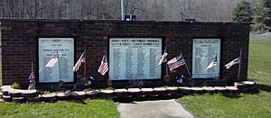
War veterans are commemorated in this park
|
|

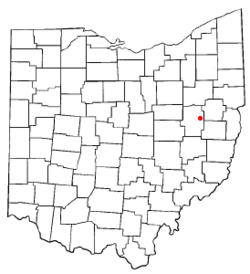
Location of Roswell, Ohio
|
|

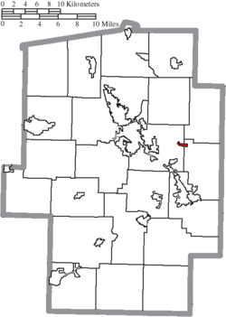
Location of Roswell in Tuscarawas County
|
|
| Country | United States |
| State | Ohio |
| County | Tuscarawas |
| Townships | Goshen, Union |
| Area | |
| • Total | 0.28 sq mi (0.72 km2) |
| • Land | 0.28 sq mi (0.72 km2) |
| • Water | 0.00 sq mi (0.00 km2) |
| Elevation | 1,014 ft (309 m) |
| Population
(2020)
|
|
| • Total | 219 |
| • Density | 784.95/sq mi (302.95/km2) |
| Time zone | UTC-5 (Eastern (EST)) |
| • Summer (DST) | UTC-4 (EDT) |
| FIPS code | 39-68742 |
| GNIS feature ID | 2399128 |
Roswell is a small village located in Tuscarawas County, Ohio, in the United States. In 2020, about 219 people lived there.
Contents
About Roswell's Location
Roswell is a small place. The United States Census Bureau says it covers about 0.28 square miles (0.72 square kilometers). This entire area is land, with no water.
Population and People
This section tells us about the people who live in Roswell. Every ten years, the United States counts its population in something called a census. This helps us understand how many people live in different places and what they are like.
Roswell's Population Over Time
The number of people living in Roswell has changed over many years:
| Historical population | |||
|---|---|---|---|
| Census | Pop. | %± | |
| 1910 | 514 | — | |
| 1920 | 420 | −18.3% | |
| 1930 | 286 | −31.9% | |
| 1940 | 283 | −1.0% | |
| 1950 | 267 | −5.7% | |
| 1960 | 379 | 41.9% | |
| 1970 | 317 | −16.4% | |
| 1980 | 264 | −16.7% | |
| 1990 | 257 | −2.7% | |
| 2000 | 276 | 7.4% | |
| 2010 | 219 | −20.7% | |
| 2020 | 219 | 0.0% | |
| U.S. Decennial Census | |||
What the 2010 Census Showed
In 2010, the census counted 219 people living in Roswell. These people lived in 85 different homes, and 59 of those were families.
- Population Density: There were about 842 people per square mile (325 people per square kilometer). This tells us how crowded an area is.
- Housing: There were 98 housing units, like houses or apartments. On average, there were about 377 housing units per square mile (146 per square kilometer).
- Backgrounds: Most people (98.6%) were White. A small number were African American or from other backgrounds. About 0.5% of the population identified as Hispanic or Latino.
Homes and Families
Out of the 85 homes in Roswell:
- 40% had children under 18 living there.
- 47.1% were married couples living together.
- Some homes had a single parent (either a mother or a father) raising children.
- About 30.6% were not families, meaning individuals or groups of friends living together.
- 25.9% of all homes had just one person living there.
- 10.6% had someone aged 65 or older living alone.
The average number of people in a household was about 2.58. For families, the average was about 3.02 people.
Age and Gender
The average age of people in Roswell in 2010 was 34.1 years old.
- About 28.3% of residents were under 18 years old.
- About 10.8% were between 18 and 24 years old.
- About 23.7% were between 25 and 44 years old.
- About 27.8% were between 45 and 64 years old.
- About 9.1% were 65 years old or older.
When it came to gender, 47.5% of the population was male and 52.5% was female.
See also
 In Spanish: Roswell (Ohio) para niños
 | Sharif Bey |
 | Hale Woodruff |
 | Richmond Barthé |
 | Purvis Young |

