Rufina, Guayanilla, Puerto Rico facts for kids
Quick facts for kids
Rufina
|
|
|---|---|
|
Barrio
|
|

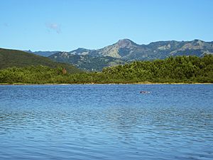
Guayanilla Bay
|
|

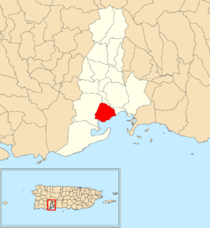
Location of Rufina within the municipality of Guayanilla shown in red
|
|
| Commonwealth | |
| Municipality | |
| Area | |
| • Total | 2.34 sq mi (6.1 km2) |
| • Land | 1.81 sq mi (4.7 km2) |
| • Water | 0.53 sq mi (1.4 km2) |
| Elevation | 10 ft (3 m) |
| Population
(2010)
|
|
| • Total | 220 |
| • Density | 121.5/sq mi (46.9/km2) |
| Source: 2010 Census | |
| Time zone | UTC−4 (AST) |
Rufina is a small, quiet area known as a barrio in the municipality of Guayanilla, Puerto Rico. It's a rural place, meaning it has more open spaces and fewer big buildings. In 2010, about 220 people lived there.
Rufina was created in 1935. It was formed from parts of two other areas in Guayanilla: the Guayanilla barrio-pueblo and the Indios barrio.
What is Rufina Like?
Rufina covers about 1.81 square miles of land. It also has about 0.53 square miles of water. This water area might include rivers, lakes, or parts of the coast.
In 2010, the population density was about 121.5 people per square mile. This means there weren't many people living very close together.
How Many People Have Lived in Rufina?
The number of people living in Rufina has changed over the years. Here's a look at the population from different census counts:
| Historical population | |||
|---|---|---|---|
| Census | Pop. | %± | |
| 1940 | 1,261 | — | |
| 1950 | 799 | −36.6% | |
| 1980 | 232 | — | |
| 1990 | 220 | −5.2% | |
| 2000 | 210 | −4.5% | |
| 2010 | 220 | 4.8% | |
| U.S. Decennial Census 1899 (shown as 1900) 1910-1930 1930-1950 1980-2000 2010 |
|||
More to Explore
- List of communities in Puerto Rico
 You can also find information about Rufina (Guayanilla) in Spanish for kids on Kiddle!
 | George Robert Carruthers |
 | Patricia Bath |
 | Jan Ernst Matzeliger |
 | Alexander Miles |


