Richfield Township, Genesee County, Michigan facts for kids
Quick facts for kids
Richfield Township, Michigan
|
|
|---|---|

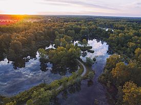
Aerial view from Fishing Access Road
|
|

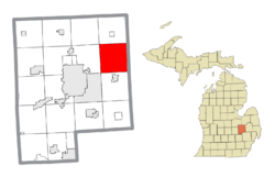
Location within Genesee County
|
|
| Country | United States |
| State | Michigan |
| County | Genesee |
| Settled | 1836 |
| Organized | 1837 |
| Area | |
| • Total | 36.4 sq mi (94.2 km2) |
| • Land | 35.3 sq mi (91.4 km2) |
| • Water | 1.1 sq mi (2.8 km2) 2.94% |
| Elevation | 778 ft (237 m) |
| Population
(2020)
|
|
| • Total | 8,991 |
| • Density | 247.0/sq mi (95.45/km2) |
| Time zone | UTC-5 (EST) |
| • Summer (DST) | UTC-4 (EDT) |
| ZIP code(s) | |
| Area code(s) | 810 |
| FIPS code | 26-68180 |
| GNIS feature ID | 1626968 |
Richfield Township is a special kind of local government area called a civil township in Genesee County, Michigan. It's a part of the U.S. state of Michigan. In 2020, about 8,991 people lived here. This was a bit more than the 8,730 people counted in 2010.
Contents
What Are the Communities in Richfield Township?
Richfield Township has a few smaller areas within it. These are called unincorporated communities, meaning they don't have their own separate local government.
Richfield Center
Richfield Center is a small community located where M-15 and Coldwater Road meet. It's like the central spot of the township.
Rogersville
Rogersville is another small community. You can find it on Mt. Morris Road, just east of Vassar Road. It's right on the edge of Genesee Township.
Russellville
Russellville is a small community located at the intersection of Coldwater Road and Irish Road.
When Was Richfield Township Established?
Richfield Township was first settled by people in 1836. It was officially organized as a township in 1837. This means it started to have its own local government and rules.
How Richfield Township Gets Its Water
On November 27, 2017, Richfield Township and some nearby towns started getting their water from a new source. This water comes from the Karegnondi Water Authority pipeline. The water is then cleaned by the Genesee County Drain Commission Water and Waste Division before it reaches homes.
What is the Geography of Richfield Township Like?
Richfield Township covers an area of about 36.4 square miles (which is about 94.2 square kilometers). Most of this area is land, around 35.3 square miles (91.4 square kilometers). The rest, about 1.1 square miles (2.8 square kilometers), is water. This means about 2.94% of the township is covered by water.
Who Lives in Richfield Township?
In 2000, there were 8,170 people living in Richfield Township. These people lived in 2,967 households, and 2,358 of these were families.
How Many People Are in Each Household?
The average household in Richfield Township had about 2.75 people. For families, the average size was a bit larger, with about 3.07 people.
What Ages Are the People in Richfield Township?
The population in the township is spread out across different age groups:
- About 26.5% of the people were under 18 years old.
- About 8.2% were between 18 and 24 years old.
- About 29.7% were between 25 and 44 years old.
- About 26.2% were between 45 and 64 years old.
- About 9.4% were 65 years old or older.
The average age of people in the township was 37 years.
What is the Income Like in Richfield Township?
In 2000, the average income for a household in Richfield Township was $51,265 per year. For families, the average income was $58,467 per year. The average income for each person in the township was $21,177.
A small number of families (about 4.3%) and individuals (about 5.3%) lived below the poverty line. This included about 8.1% of those under 18 and 4.2% of those 65 or older.
See also
 In Spanish: Municipio de Richfield (condado de Genesee) para niños


