
Genesee County, Michigan facts for kids
Quick facts for kids
Genesee County
|
|||
|---|---|---|---|

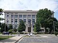
Genesee County Courthouse in Flint
|
|||
|
|||

Location within the U.S. state of Michigan
|
|||
 Michigan's location within the U.S. |
|||
| Country | |||
| State | |||
| Founded | March 28, 1835 (created) 1836 (organized) |
||
| Named for | Genesee County, New York | ||
| Seat | Flint | ||
| Largest city | Flint | ||
| Area | |||
| • Total | 650 sq mi (1,700 km2) | ||
| • Land | 637 sq mi (1,650 km2) | ||
| • Water | 13 sq mi (30 km2) 1.9%% | ||
| Population
(2020)
|
|||
| • Total | 406,211 | ||
| • Density | 640/sq mi (250/km2) | ||
| Time zone | UTC−5 (Eastern) | ||
| • Summer (DST) | UTC−4 (EDT) | ||
| Congressional districts | 7th, 8th | ||

Genesee County (pronounced JEN-uh-see) is a county located in the state of Michigan in the United States. In 2020, about 406,211 people lived here. This makes it the fifth-largest county in Michigan by population.
The main city and county seat is Flint. Flint is famous as the birthplace of General Motors. Genesee County includes 33 different cities, townships, and villages. It is considered part of the "Mid Michigan" region.
The county got its name from Genesee County, New York. That name comes from a Seneca word, Gen-nis'-hee-yo, which means "Beautiful Valley." Genesee County is also known for a very old whale fossil. This fossil, from a whale called Balaenoptera Lacepede, was found in Thetford Township. It is estimated to be about 11,000 years old!
Contents
History
How Genesee County Started
Genesee County was officially created on March 28, 1835. It was formed from parts of Lapeer, Shiawassee, and Saginaw counties. At first, it was connected to Oakland County for legal matters.
The first area organized within Genesee County was Grand Blanc in 1833. Then, Flint Township was formed in 1836. On April 4, 1836, Genesee County became fully organized. Over the next few years, more townships like Argentine, Mundy, Vienna, Genesee, Fenton, and Flushing were created.
In 1843, the county grew bigger. It added more townships from Lapeer County, including Forest, Richfield, Davison, and Atlas. By 1855, most of the townships we know today were in place.
Recent History
In 1968, Genesee County started its park system. This was made possible with money from the Charles Stewart Mott Foundation. They wanted to make sure there were green spaces for everyone to enjoy.
Flint Community Junior College became a county-wide college in 1969. It was later renamed Genesee Community College in 1970. In 1973, it became Mott Community College to honor Charles Stewart Mott.
In 2010, Genesee County joined the Karegnondi Water Authority. This group helps manage water for the region. The county is also known for having many tornadoes. Since 1950, 45 tornadoes have been confirmed here. This is more than any other county in Michigan.
Geography
Genesee County covers about 650 square miles. Most of this area, about 637 square miles, is land. The rest, about 13 square miles, is water.
Much of the county's land is flat. However, the southern part has hills and several lakes. The Flint River flows through most of the county. It is held back by dams to form Mott Lake and the Holloway Reservoir. The Shiawassee River drains the southeastern and southern parts of the county.
Neighboring Counties
Genesee County shares borders with these other counties:
- Tuscola County (to the northeast)
- Lapeer County (to the east)
- Oakland County (to the southeast)
- Livingston County (to the southwest)
- Shiawassee County (to the west)
- Saginaw County (to the northwest)
Transportation
Genesee County has several ways to travel:
- Bishop International Airport: This airport offers flights with several major airlines.
- Flint Amtrak station: You can catch a train here on the Blue Water route. This train goes west to Chicago and east to Port Huron. The station also serves as a bus stop for Greyhound Lines, Indian Trails, and Flint Mass Transportation Authority.
Main Roads
Many important highways run through Genesee County:
 I-75: Runs north and south through the middle of the county.
 US 23: Also runs north and south, joining I-75 in Mundy Township.
 I-475: An alternate route to I-75/US 23, also running north and south.
 M-54: Runs north and south.
 M-13: Runs north and south along the western edge of the county.
 M-15: Runs north and south through the eastern part of the county.
 I-69: Runs east and west through the middle of the county.
 M-21: Runs east and west, west of I-475.
 M-57: Runs east and west through the northern part of the county.
Demographics
| Historical population | |||
|---|---|---|---|
| Census | Pop. | %± | |
| 1840 | 4,268 | — | |
| 1850 | 12,031 | 181.9% | |
| 1860 | 22,498 | 87.0% | |
| 1870 | 33,900 | 50.7% | |
| 1880 | 39,220 | 15.7% | |
| 1890 | 39,430 | 0.5% | |
| 1900 | 41,804 | 6.0% | |
| 1910 | 64,555 | 54.4% | |
| 1920 | 125,668 | 94.7% | |
| 1930 | 211,641 | 68.4% | |
| 1940 | 227,944 | 7.7% | |
| 1950 | 270,963 | 18.9% | |
| 1960 | 374,313 | 38.1% | |
| 1970 | 444,341 | 18.7% | |
| 1980 | 450,449 | 1.4% | |
| 1990 | 430,459 | −4.4% | |
| 2000 | 436,141 | 1.3% | |
| 2010 | 425,790 | −2.4% | |
| 2020 | 406,211 | −4.6% | |
| 2023 (est.) | 401,522 | −5.7% | |
| U.S. Decennial Census 1790–1960 1900–1990 1990–2000 2010–2019 |
|||
In 2010, Genesee County had a population of 425,790 people. This was a small decrease from the year 2000. The average number of people living in each square mile was about 668.
Most of the people in Genesee County are White (74.5%). About 20.7% are Black or African American. Other groups include Asian (0.9%), Native American (0.5%), and people of two or more races (2.6%). About 3.0% of the population is Hispanic or Latino.
Many people in the county have roots from different countries. The largest groups include German (18.0%), Irish (11.0%), English (10.6%), and Polish (5.5%) ancestry.
In 2010, about 25% of the population was under 18 years old. The median age was 39 years. This means half the people were younger than 39, and half were older.
Recreation
Genesee County has a great park system managed by the Parks and Recreation Commission. This commission works to provide fun outdoor spaces for everyone.
The park system started in 1968 with help from the Charles Stewart Mott Foundation. They bought land to create parks for the community. In 2018, a new park called Atlas County Park opened.
The county park system has over 11,500 acres of land. Here are some of the parks and attractions:
- Buell Lake Park: A place for fishing, picnics, playgrounds, and even a snowmobile area.
- Davison Roadside Park: A picnic spot with a small hill for sledding.
- Flushing County Park: Offers picnic areas, ball fields, playgrounds, tennis courts, and cross-country ski trails.
- Holloway Reservoir Regional Park: A huge park with areas for canoeing, boating, and camping.
- Buttercup Beach
- Elba Equestrian Complex (for horses)
- Hogback Hills (for snowmobiling and sledding)
- Wolverine Campground
- Linden County Park: Has picnic spots, playgrounds, ball fields, and trails.
- Clover Beach on Byram Lake
- Richfield County Park: Features ball fields, a bicycle-motocross track, canoe launches, and cross-country ski trails.
- Goldenrod Disc Golf Course: An 18-basket course for disc golf.
- Genesee Recreation Area on Mott Lake:
- Bluebell Beach and Splash Pad
- For-Mar Nature Preserve and Arboretum: A place to explore nature and see different types of trees.
- Atlas County Park: A newer park along Kearsley Creek.
- Crossroads Village and Huckleberry Railroad: A living history village with an old-fashioned train ride.
- Stepping Stones Falls: A beautiful waterfall with a trail that connects to the Flint River Trail.
Genesee County is unique because it is the only county in Michigan without a state park.
Communities

Genesee County is made up of many different communities.
Cities
- Burton
- Clio
- Davison
- Fenton (partially in Genesee County)
- Flint (the county seat)
- Flushing
- Grand Blanc
- Linden
- Montrose
- Mount Morris
- Swartz Creek
Villages
- Gaines
- Goodrich
- Lennon (partially in Genesee County)
- Otisville
- Otter Lake (partially in Genesee County)
Charter Townships
- Clayton Charter Township
- Fenton Charter Township
- Flint Charter Township
- Flushing Charter Township
- Genesee Charter Township
- Grand Blanc Charter Township
- Montrose Charter Township
- Mount Morris Charter Township
- Mundy Charter Township
- Vienna Charter Township
Civil Townships
- Argentine Township
- Atlas Township
- Davison Township
- Forest Township
- Gaines Township
- Richfield Township
- Thetford Township
Census-Designated Places (CDPs)
These are areas that are like towns but are not officially incorporated as cities or villages.
Other Unincorporated Communities
These are smaller communities that are not officially incorporated.
- Atlas
- Bayport Park
- Brent Creek
- Duffield
- Farrandville
- Genesee
- Huntingtown
- Kipp Corners
- Lakeside
- Pine Run
- Rankin
- Richfield Center
- Rogersville
- Russellville
- Thetford Center
- Whigville
- Whitesburg
Education
Genesee County has many public school districts that serve its students:
- Atherton Community Schools
- Beecher Community School District
- Bendle Public Schools
- Bentley Community Schools
- Birch Run Area School District
- Brandon School District
- Byron Area Schools
- Carman-Ainsworth Community School District
- Clio Area School District
- Davison Community Schools
- Durand Area Schools
- Fenton Area Public Schools
- Flint City School District
- Flushing Community Schools
- Genesee School District
- Goodrich Area Schools
- Grand Blanc Community Schools
- Kearsley Community Schools
- Lake Fenton Community Schools
- Lakeville Community Schools
- Linden Community Schools
- Millington Community Schools
- Montrose Community Schools
- Mount Morris Consolidated School District
- Swartz Creek Community Schools
- Westwood Heights Schools
There is also a special state-operated school in the county:
- Michigan School for the Deaf (MSD)
In 1994, the Michigan School for the Blind moved to Flint and joined the Michigan School for the Deaf.
See also
 In Spanish: Condado de Genesee (Míchigan) para niños
Images for kids
-
Genesee County Courthouse in Flint
