Shiawassee County, Michigan facts for kids
Quick facts for kids
Shiawassee County
|
|
|---|---|

|
|

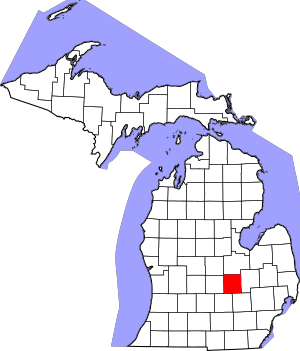
Location within the U.S. state of Michigan
|
|
 Michigan's location within the U.S. |
|
| Country | |
| State | |
| Founded | September 10, 1822 (created) 1837 (organized) |
| Named for | Shiawassee River |
| Seat | Corunna |
| Largest city | Owosso |
| Area | |
| • Total | 541 sq mi (1,400 km2) |
| • Land | 531 sq mi (1,380 km2) |
| • Water | 10 sq mi (30 km2) 1.9%% |
| Population
(2020)
|
|
| • Total | 68,094 |
| • Density | 130/sq mi (51/km2) |
| Time zone | UTC−5 (Eastern) |
| • Summer (DST) | UTC−4 (EDT) |
| Congressional district | 7th |
Shiawassee County (/ˌʃaɪəˈwɒsi/ SHY-uh-WAH-see) is a county in the U.S. state of Michigan. It's like a special area with its own local government. In 2020, about 68,094 people lived here.
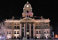
The main town, called the county seat, is Corunna. The biggest city in the county is Owosso. Shiawassee County is also part of the larger Lansing-East Lansing area.
Contents
History of Shiawassee County
How the County Started
In 1822, when Michigan was still a territory (not yet a state), a new area called Shiawassee County was created. It was named after the Shiawassee River. This new county was made from parts of Oakland and St. Clair counties.
At first, Shiawassee County didn't have its own full government. It was managed by nearby counties for things like laws and taxes. Then, in 1837, Michigan became a state! That same year, the new Michigan State government allowed Shiawassee County to set up its own official county government.
Geography of Shiawassee County
Land and Water
Shiawassee County covers about 541 square miles. Most of this is land (531 square miles), and a small part is water (10 square miles). That's about 1.9% water.
The Shiawassee River flows into the county from the southeast. It goes through the towns of Corunna and Owosso in the middle of the county. Then, it leaves the county to the north. Shiawassee County is considered part of Central Michigan.
Neighboring Counties
Shiawassee County shares its borders with several other counties:
- Saginaw County – to the north
- Genesee County – to the east
- Livingston County – to the southeast
- Ingham County – to the southwest
- Clinton County – to the west
- Gratiot County – to the northwest
Getting Around Shiawassee County
Major Roads
Several important roads help people travel through Shiawassee County:
 I-69 - This highway enters the county near the southwest corner. It goes northeast past towns like Shaftsburg, Perry, Morrice, Bancroft, and Durand. Then, it leaves the county to the east.
 M-13 - This road runs along the eastern edge of the county.
 M-21 - This road goes east to west through the middle of the county, passing through Corunna and Owosso.
 M-52 - This road enters the county from the north at Oakley. It goes south to Owosso, then southwest and south to Perry. It then leaves the county to the south.
 M-71 - This road starts in Owosso and goes southeast.
Train Travel
The Durand Union Station in Durand is a train station. You can catch the Amtrak Blue Water train here. This train travels from Port Huron all the way to Chicago.
Local Airport
The Owosso Community Airport is about 2 miles east of Owosso. It's a public airport mainly used for smaller planes and private flights.
People of Shiawassee County
Population Changes
In 2010, Shiawassee County had 70,648 people. This was a small decrease from the year 2000. By 2020, the population was 68,094.
Who Lives Here
In 2010, most people in Shiawassee County were White (96.7%). There were also smaller groups of Native American, Black, and Asian people. About 2.4% of the people were Hispanic or Latino.
Many families live in Shiawassee County. In 2010, about 32.5% of households had children under 18 living with them. The average household had about 2.54 people.
Age Groups
The people in Shiawassee County come in all ages. In 2010:
- About 24.1% of the people were under 18 years old.
- About 14.3% were 65 years old or older.
The average age in the county was 40 years old.
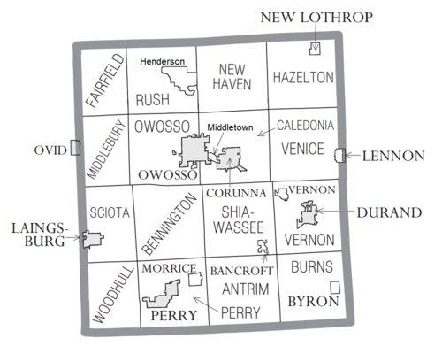
Towns and Villages in Shiawassee County
Cities
Villages
Special Townships (Charter Townships)
Other Townships (Civil Townships)
- Antrim Township
- Bennington Township
- Burns Township
- Fairfield Township
- Hazelton Township
- Middlebury Township
- New Haven Township
- Perry Township
- Rush Township
- Sciota Township
- Shiawassee Township
- Venice Township
- Vernon Township
- Woodhull Township
Census-Designated Places (CDPs)
These are areas that are like towns but not officially incorporated:
Other Small Communities
See also
 In Spanish: Condado de Shiawassee para niños
 | William Lucy |
 | Charles Hayes |
 | Cleveland Robinson |


