Ryan's Creek Aerodrome facts for kids
Quick facts for kids
Ryan's Creek Aerodrome
|
|||||||||||
|---|---|---|---|---|---|---|---|---|---|---|---|
 |
|||||||||||
| Summary | |||||||||||
| Airport type | Public | ||||||||||
| Operator | South East Air | ||||||||||
| Serves | Oban, New Zealand | ||||||||||
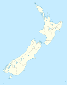
| Location | Stewart Island, New Zealand | ||||||||||
| Elevation AMSL | 288 ft / 88 m | ||||||||||
| Coordinates | 46°53′59″S 168°06′06″E / 46.89972°S 168.10167°E | ||||||||||
| Map | |||||||||||
| Runway | |||||||||||
|
|||||||||||
|
Source: New Zealand AIP
|
|||||||||||
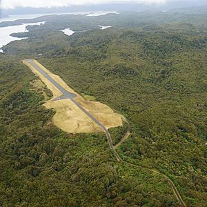
Ryan's Creek Aerodrome (IATA: SZS, ICAO: NZRC) is a small airstrip on Stewart Island in southern New Zealand. It's like a small airport, but usually just for smaller planes. This aerodrome helps people travel to and from the island.
History of the Aerodrome
The Ryan's Creek Aerodrome was built in the late 1970s. It was made to help a company called Stewart Island Air Services fly planes.
Over time, the aerodrome got some important upgrades. In the mid-1980s, the runway and taxiways were covered with asphalt. This made them smoother and stronger, like paving a road. In 1990, a small hill at one end of the airstrip was made flat. This gave planes more room to land safely and made it easier for them to get to the airstrip.
Today, the aerodrome is used by Stewart Island Flights. They offer regular flights to Invercargill Airport.
What's at the Airport?
The airport is located about 88 meters (or 288 feet) above sea level. This means it's not right at the beach, but a bit higher up.
It has one main runway. A runway is the long strip where planes take off and land. This runway is called "04/22". It is 800 meters long and 66 meters wide. That's about the length of eight football fields!
Where Can You Fly From Here?
Even though it's a small aerodrome, you can still fly to a couple of places from Ryan's Creek. Here are the airlines that fly there and their destinations:
| Airlines | Destinations |
|---|---|
| Stewart Island Flights | Invercargill |
| Glenorchy Air | Queenstown |
 | James Van Der Zee |
 | Alma Thomas |
 | Ellis Wilson |
 | Margaret Taylor-Burroughs |


