Sacramento Deep Water Ship Channel facts for kids
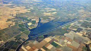
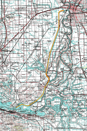
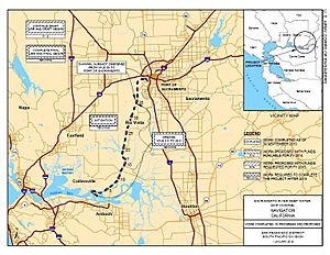
The Sacramento Deep Water Ship Channel is a special waterway, like a big river-road, that connects the Port of Sacramento in West Sacramento, California, to the Sacramento River. The Sacramento River then flows all the way to San Francisco Bay. This important channel was finished in 1963 by the United States Army Corps of Engineers.
This channel is about 30 feet (9 meters) deep, 200 feet (61 meters) wide, and stretches for 43 miles (69 kilometers). It helps ships carry goods to and from the Port of Sacramento.
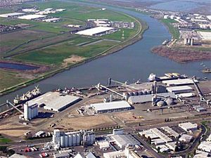
The Port of Sacramento is a key port on the West Coast of the United States. Even though it's important, it doesn't get as much ship traffic as some bigger ports. It mostly handles farm products and other large, loose goods, not the big metal boxes called shipping containers that many other ports use.
There was a plan to make the channel even deeper, about 35 feet (10 meters). This project got stuck in 1990 because the Port of Sacramento couldn't pay its part of the cost. But some people are still interested in making the channel deeper in the future.
The channel also has a set of ship locks called The William B. Stone Sacramento Locks. These locks are located where the channel meets the Sacramento River. Locks are like water elevators that help ships move between different water levels. These locks stopped working in the mid-1980s and were officially closed in 2000. They were briefly used in 2003 and 2004 to study fish, but they are not working now.
Building the Channel
The idea for the Sacramento Deep Water Ship Channel was approved way back in 1946. It was designed to improve an older, shallower river project that started in 1899.
Building the deep channel began in 1949, but it stopped in 1950. Work started again in 1956, and ships finally began using the channel in June 1963.
A Greener Way to Move Goods
This channel is part of something called the California Green Trade Corridor project. Moving goods by ship is often better for the environment than using trucks or trains. Ships can carry a lot more cargo while using less fuel per item.
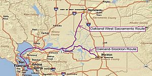
This "Green Trade Corridor Marine Highway" connects ports like Oakland, Stockton, and West Sacramento. It helps move goods through Northern California in a more eco-friendly way.
Animals in the Channel
You might be surprised to know that different animals have been seen near the Sacramento Deep Water Ship Channel.
Sea lions have been spotted at the far eastern end of the channel. These playful marine mammals sometimes swim far up rivers. You might also see American White Pelicans, which are large birds with big pouches under their beaks for catching fish.
 | Aaron Henry |
 | T. R. M. Howard |
 | Jesse Jackson |


