Saja (river) facts for kids
Quick facts for kids Saja |
|
|---|---|

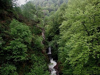
Pozo del Amo reserve
|
|
| Country | Spain |
| State | Cantabria |
| Region | Saja-Nansa |
| City | Torrelavega |
| Physical characteristics | |
| Main source | Northern Sierra del Cordel Mancomunidad Campoo-Cabuérniga, Cantabria, Spain 1,700 m (5,600 ft) |
| River mouth | Ría San Martín de la Arena Suances and Miengo, Cantabria, Spain 0 m (0 ft) |
| Length | 67 km (42 mi) |
| Basin features | |
| Basin size | 442 km2 (171 sq mi) |
| Tributaries |
|
The Saja is a river in northern Spain, located in the region of Cantabria. It flows into the Cantabric sea, which is part of the Atlantic Ocean. A large part of the Saja River's journey takes place inside the beautiful Saja-Besaya Natural Park.
Contents
The Saja River: A Journey Through Cantabria
The Saja River is about 67 kilometers (42 miles) long. It starts high in the mountains and flows through different landscapes before reaching the sea. The river's basin, which is the area of land that drains into the river, covers about 442 square kilometers (171 square miles).
Where Does the Saja River Start?
The Saja River begins its journey high up in the Northern Sierra del Cordel mountains. Its source is about 1,700 meters (5,577 feet) above sea level. In its first few kilometers, the river flows very quickly. It carves a steep, V-shaped valley through the mountains.
The River's Path to the Sea
As the Saja River flows past the village of Fresneda, its valley starts to become wider. Here, it forms a wide, flat area called an alluvial plain in the Cabuerniga valley. This is where the river slows down a bit and deposits sediment.
The Saja River has several smaller rivers and streams that join it. On its left side, it is joined by the Diablo River and the Navas del Rey. On its right side, it meets the Argoza, Bayones, and Besaya rivers. The river finally empties into the Ría San Martín de la Arena, which is an estuary (where the river meets the sea), near the towns of Suances and Miengo.
How Clean Is the River?
The health of the Saja River changes along its path. From where it starts, high in the mountains, down to the Santa Lucía bridge, the river water is quite clean. It is considered to be in good condition.
However, after the Santa Lucía bridge, the river starts to show some changes. The water quality becomes less good, and it is described as moderately clean. Further downstream, especially after the Besaya River joins it, the water quality becomes more serious. In these lower parts, the river is considered to be in poor condition.
See also
 You can also find information about the Saja River for kids in Spanish on Kiddle: Río Saja para niños
 | Selma Burke |
 | Pauline Powell Burns |
 | Frederick J. Brown |
 | Robert Blackburn |


