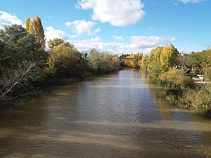
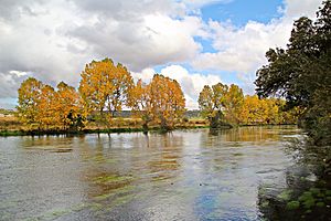
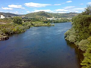
List of rivers of Spain facts for kids
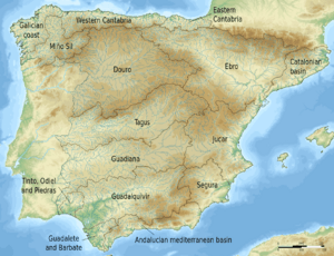
Spain is home to many important rivers! These rivers flow across the land and eventually reach the sea. You can think of them like giant water highways. Rivers in mainland Spain generally flow into one of three big areas: the Mediterranean Sea, the Atlantic Ocean, or the Cantabrian Sea (which is part of the Atlantic Ocean, located north of Spain).
This list will help you explore some of Spain's rivers. Rivers that flow directly into the sea are listed as you move along the coast. Rivers that join other rivers (called tributaries) are listed under the main river they flow into.
To make it easier to understand, we use some special labels:
- ms means main stem. This is the main river itself.
- l means a left-bank tributary. This is a smaller river that joins the main river from your left side as you look downstream (the direction the water is flowing).
- r means a right-bank tributary. This is a smaller river that joins the main river from your right side as you look downstream.
- ls and rs are for left and right forks. Sometimes, a river starts from two smaller rivers that come together. These are the left and right starting branches.
- int means an international river. These rivers flow through Spain and at least one other country, like Portugal or France.
We'll start our journey with the rivers in the northeast of Spain, near the French border, and move clockwise around the Iberian Peninsula.
Outside of mainland Spain, like in the Canary Islands or Balearic Islands, most streams only have water during certain times of the year, especially after it rains. The Santa Eulàlia river in Ibiza used to flow all the time, but now it's mostly dry.
Contents
Rivers Flowing to the Mediterranean Sea
This section covers rivers that empty into the Mediterranean Sea. We'll start in the north and move south.
Catalan River Basins
These are the rivers in the Catalonia region that flow into the Mediterranean Sea, north of the Ebro River.
- Muga (ms · 65 km)
- Manol (r · 42 km)
- Fluvià (ms · 98 km)
- Llierca (l · 30 km)
- Ter (ms · 209 km)
- Freser (r · 31 km)
- Núria
- Gurri (r)
- Mèder (l)
- Onyar (r · 34 km)
- Freser (r · 31 km)
- Tordera (ms · 50 km)
- Besòs (ms · 50 km)
- Llobregat (ms · 157 km)
- Foix (ms · 49 km)
- Gaià (ms)
- Francolí (ms · 58 km)
The Mighty Ebro River System
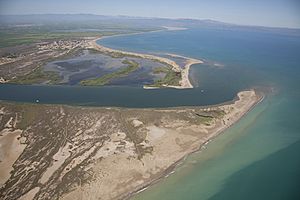
The Ebro is one of Spain's most important rivers. It flows into the Mediterranean Sea.
- Ebro (ms · 910 km)
- Híjar (r · 28 km; some people say the Ebro actually starts from the Híjar!)
- Nela (l · 74 km)
- Zadorra (l · 88 km)
- Tirón (r · 64 km)
- Ega (l · 115 km)
- Aragón (l · 197 km)
- Jalón (r · 224 km)
- Huerva (r · 135 km)
- Gállego (l · 203 km)
- Guadalope (r · 182 km)
- Segre (l · int · 261 km)
- Valira (r · int)
- Noguera Pallaresa (r · 143 km)
- Noguera Ribagorçana (r · 130 km)
- Cinca (r · 177 km)
- Matarranya (r · 101 km)
Levante Rivers
These rivers flow into the Mediterranean Sea, from south of the Ebro to the border with Andalusia. Many streams here only flow when it rains a lot.
- Cenia (ms)
- Mijares (ms · 156 km)
- Turia (280 km)
- Alfambra (l · 99 km)
- Júcar (ms · 498 km)
- Cabriel (l · 263 km)
- Magre (l · 125 km)
- Serpis (ms · 75 km)
- Vinalopó (ms · 82 km)
- Segura (ms · 325 km)
- Mundo (l · 108 km)
- Mula (r · 61 km)
- Guadalentín (r · 95 km)
Andalusian Mediterranean Rivers
These rivers are in the southern region of Andalusia and flow into the Mediterranean Sea.
- Almanzora (ms · 105 km)
- Andarax (ms · 62 km)
- Adra (ms · 47 km)
- Guadalfeo (ms · 72 km)
- Vélez (ms · 36 km)
- Guadalmedina (ms · 48 km)
- Guadalhorce (ms · 154 km)
- Guadiaro (ms · 79 km)
- Guadalevín
- Genal (l · 48 km)
Rivers Flowing to the Atlantic Ocean
This section covers rivers that flow into the Atlantic Ocean, starting from the very south of Spain and moving north.
Gulf of Cádiz Rivers
These rivers empty into the Gulf of Cádiz, which is part of the Atlantic Ocean, near the southwestern coast of Spain.
- Guadalete (ms · 173 km)
- Guadalquivir (ms · 657 km)
- Guadiana Menor (l · 182 km)
- Guadalimar (r · 167 km)
- Jándula (r · 90 km)
- Genil (l · 337 km)
- Darro (r)
- Guadiamar (r · 60 km)
- Tinto (ms · 93 km)
- Odiel (ms · 121 km)
- Guadiana (ms · int · 818 km)
The Tagus River System
The Tagus is the longest river in the Iberian Peninsula. It flows through Spain and Portugal.
- Tagus (ms · int · 1007 km; 816 km in Spain)
- Gallo (l · 98 km)
- Guadiela (l · 117 km)
- Jarama (r · 194 km)
- Lozoya (r · 91 km)
- Henares (r · 160 km)
- Sorbe (r · 80 km)
- Manzanares (r · 87 km)
- Tajuña (l · 226 km)
- Algodor (l · 96 km)
- Guadarrama (r · 96 km)
- Alberche (r · 182 km)
- Tiétar (r · 170 km)
- Almonte (l · 160 km)
- Alagón (r · 201 km)
- Jerte (l · 70 km)
The Douro River System
The Douro is another major river that flows through Spain and Portugal.
- Douro (ms · int · 897 km; 572 km in Spain)
Lima River
- Lima (ms · int · 126 km; 41 km in Spain)
Minho-Sil River System
The Minho is a significant river in northwest Spain, forming part of the border with Portugal.
- Minho (ms · int · 345 km; last 75.5 km form the border)
Rias Baixas and Rias Altas Rivers
These rivers are in the northwest region of Galicia, flowing into the Atlantic Ocean through unique coastal inlets called rías.
- Verdugo (39 km)
- Lérez (60 km)
- Umia (64 km)
- Ulla (126 km)
- Sar (42 km)
- Tambre (134 km)
- Xallas (62 km)
- Anllóns (55 km)
- Mandeo (57 km)
- Eume (84 km)
Rivers Flowing to the Cantabrian Sea
These rivers flow into the Cantabrian Sea, which is the part of the Atlantic Ocean north of Spain. These rivers are usually shorter because they flow down from the nearby mountains.
- Eo (ms · 79 km)
- Nalón (ms · 129 km)
- Narcea (l · 107 km)
- Navia (ms · 159 km)
- Sella (ms · 56 km)
- Deva (ms · 60 km)
- Cares (r · 50 km)
- Nansa (ms · 50 km)
- Saja (ms · 58 km)
- Besaya (r · 47 km)
- Pas (ms · 50 km)
- Miera (ms · 39 km)
- Asón (ms · 39 km)
- Nervión (ms · 69 km)
- Oria (ms · 66 km)
- Urola (ms · 55 km)
- Urumea (ms · 40 km)
- Bidasoa (ms · int · 41.6 km; part of it forms the border with France)
- Garonne (ms · int · 602 km; about 40 km in Spain)
See also
 In Spanish: Anexo:Ríos de España para niños
- List of rivers of Catalonia
 | Delilah Pierce |
 | Gordon Parks |
 | Augusta Savage |
 | Charles Ethan Porter |


