Muga (river) facts for kids

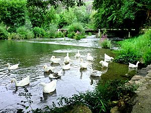
The Muga is an important river located in Catalonia, a region in northeastern Spain. It starts its journey high up in the Alberes mountains. These mountains are part of the eastern Pyrenees, a large mountain range. The Muga then flows across the land and finally reaches the Mediterranean Sea, where it empties into the Gulf of Roses.
Contents
The Muga River's Journey
From Mountains to Sea
The Muga river is about 58 kilometers (around 36 miles) long. Its source, or where it begins, is below the peak of Montnegre mountain. This mountain stands at an elevation of 1,186 meters (about 3,891 feet) above sea level.
As the river flows, it passes through several interesting places. One of these is the village of Pont de Molins. The Muga also flows into the Boadella Reservoir. This is a large lake created by a dam across the river. The dam helps to control the water flow and store water for different uses.
A Look at History
The Muga Valley Through Time
The area around the Muga Valley has a long and interesting history. Long ago, the Muga Valley was given to the County of Empúries. This happened thanks to Ramon Berenguer III, a powerful count. Before that, the valley was part of the County of Besalú.
The people living in the Muga Valley have faced difficult times throughout history. They experienced hardships during major conflicts, such as the Peninsular War and the Spanish Civil War. Despite these challenges, the Muga River has continued to flow, supporting life and communities in the region.
See also
 In Spanish: Río Muga para niños
 | Percy Lavon Julian |
 | Katherine Johnson |
 | George Washington Carver |
 | Annie Easley |

