Manzanares (river) facts for kids
Quick facts for kids Manzanares |
|
|---|---|
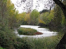
The Manzanares through El Pardo
|
|
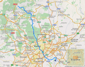
The Manzanares river
|
|
| Country | Spain |
| Region | Iberian Peninsula |
| Physical characteristics | |
| Main source | Confluence of Arroyo de la Condesa and Arroyo de Valdemartín Manzanares el Real c. 1,810 m (5,940 ft) 40°46′28″N 3°57′20″W / 40.77444°N 3.95556°W |
| River mouth | Jarama river Rivas Vaciamadrid 533 m (1,749 ft) 40°18′13″N 3°32′23″W / 40.30361°N 3.53972°W |
| Length | 92 km (57 mi) |
| Depth |
|
| Basin features | |
| Progression | Jarama→ Tagus→ Atlantic Ocean |
The Manzanares is a river in the center of Spain. It starts in the Sierra de Guadarrama mountains. The river flows through the city of Madrid. Eventually, it joins the Jarama river, which then flows into the Tagus river.
For many years, the part of the Manzanares River that flows through Madrid was changed. It was made deeper and wider in some places. This allowed small boats like canoes to use it. Recently, a project has been working to make the river more natural again. This helps bring back plants and animals.
Contents
What's in a Name?
The name "Manzanares" has been used since the 1500s. However, people sometimes used other names for the river until the 1600s. These names included Guadarrama, Henarejos, and Jarama. By the 1700s, "Manzanares" became the most popular name.
The river's name is linked to the nearby village of Manzanares el Real. This village was founded around the 1200s. It is not fully clear how the river and the village got their names.
The River's Journey
Where the River Begins
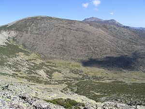
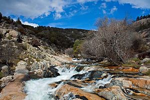
The Manzanares River starts in the southern part of the Sierra de Guadarrama mountains. These mountains are in the Madrid region of Spain. The exact starting point is in the area of Manzanares el Real.
The river officially becomes the Manzanares after two smaller streams join together. These streams are called Arroyo de la Condesa and Arroyo de Valdemartín.
The Arroyo de la Condesa stream begins in a place called Ventisquero de la Condesa. This area often has snow that stays for a long time. This stream gets its water from the slopes of mountains like La Maliciosa and Bola del Mundo.
The Arroyo de Valdemartín stream gets its water from the slopes of Alto de Valdemartín and Cabeza de Hierro Menor.
The Upper River Course
The upper part of the Manzanares River basin is a special protected area. It is called the Parque Regional de la Cuenca Alta del Manzanares. This park is a nature reserve. UNESCO recognizes it as a biosphere reserve, which means it's important for both nature and people.
From its source, the Manzanares flows towards the southeast. It passes through the old town of Manzanares el Real. Here, a dam creates the Santillana reservoir. This reservoir is very important because it provides a lot of drinking water for Madrid.
After the reservoir, the river turns south. It then enters the Monte de El Pardo. This is a valuable natural area located right next to Madrid.
The Urban River Course
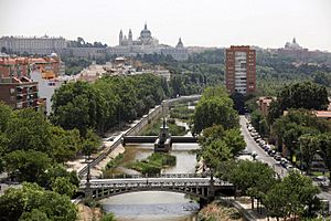
As the river flows through Madrid, it was once made into a straight channel. This was done to control the water flow. However, in the 21st century, efforts were made to restore the river. This project helped bring back different kinds of plants and animals. It also created new places for people in Madrid to enjoy.
The Manzanares River flows along the western edge of Madrid. Further downstream, it acts as a border between the old city center and neighborhoods like Carabanchel and Usera. Along this part of the river, you can see the former football stadium of Atlético Madrid, called the Vicente Calderón. The river then leaves the city at its southernmost point.
The Lower River Course
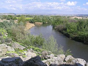
After leaving Madrid, the Manzanares makes a sharp turn to the east. It flows past the village of Perales del Río. Finally, the Manzanares River flows into the Jarama river within the area of Rivas Vaciamadrid.
Why the River is Important
The Manzanares River is not very big, but it has played a big role in history. This is because of its close connection to the city of Madrid. Madrid was founded by the Moors in the 800s. It started as a fortress overlooking the river.
The Manzanares River also appears in many paintings by Francisco Goya. He was a famous Spanish painter from the late 1700s and early 1800s. His paintings show people from Madrid dancing or having picnics next to the river.
During the Spanish Civil War, the Manzanares River was an important defense line. This was during the Siege of Madrid. Many old bunkers can still be seen near the village of Perales del Río. The Bridge of the French was very important. Its location made it a key spot. Forces trying to enter Madrid's city center were stopped there many times.
See also
 In Spanish: Río Manzanares para niños
 | Delilah Pierce |
 | Gordon Parks |
 | Augusta Savage |
 | Charles Ethan Porter |


