
Salado River (Antofagasta) facts for kids
Quick facts for kids Salado River |
|
|---|---|
 |
|
.svg)
Loa and its tributaries San Pedro, Silala and Salado Rivers
|
|
| Country | Chile |
| Physical characteristics | |
| Main source | Thermal springs 4,200 m (13,800 ft) |
| River mouth | Loa River |
| Length | 80 km (50 mi) |
| Basin features | |
| Basin size | 2,210 km2 (850 sq mi) |
The Salado River is a river in Chile, located in the northern part of the country. It flows through the El Loa Province in the Antofagasta Region. This river is special because it starts from many small streams that come out of the ground near El Tatio. This area is famous for its amazing hot springs and geysers!
The Salado River is about 80 kilometers (50 miles) long. It plays an important role in the dry desert landscape of northern Chile.
Contents
Where the Salado River Begins
The Salado River starts high up in the mountains, around 4,200 meters (13,800 feet) above sea level. It is formed when more than 30 small streams join together. These streams come from the El Tatio area, which is known for its natural hot springs.
After forming, the river flows south for a short distance. Then, it turns west and cuts through a narrow valley. This valley was carved out of volcanic rocks over many years.
How the River Flows
As the Salado River continues its journey, other smaller rivers join it. These smaller rivers are called tributaries. From the north, the Toconce River flows into the Salado. The Toconce River starts near the Linzor volcano. From the south, the Caspana River also joins the Salado.
A lot of the water from these rivers is used by people. It is sent through pipes to provide drinking water for towns like Antofagasta and Tocopilla. This helps many people in the dry desert region.
Life Along the River
After the Toconce and Caspana rivers join, the Salado River flows into a flat area. This area is called a floodplain. It is a good place for animals to graze, so local people use it for their livestock. Towns like Toconce, Caspana, and Aiquina are located near this floodplain.
The Salado River then enters another narrow valley. Here, you can find a cool spot called the Devil's Bridge. It's a natural cut through the rock, about 5 meters (16 feet) wide. It shows how powerful the river has been over time.
Where the River Ends
Finally, the Salado River flows into the Loa River. The Loa River is the longest river in Chile and the main waterway in the northern desert. The Salado River joins the Loa River about 3 kilometers (2 miles) south of the town of Chiuchiu.
Images for kids
-

The Salado River in the Antofagasta Region of Chile.
-
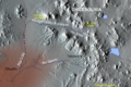
Map showing the Loa River and its tributaries, including the Salado River.
See also
 In Spanish: Río Salado (Loa) para niños
