Salem (hamlet), New York facts for kids
Quick facts for kids
Salem, New York
|
|
|---|---|
|
Hamlet and CDP
|
|

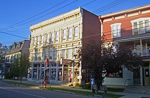
Buildings on North Main Street downtown
|
|

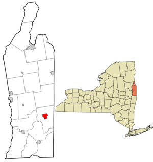
Location in Washington County and the state of New York.
|
|

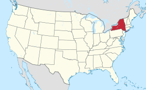
Location of New York in the United States
|
|
| Country | United States |
| State | New York |
| County | Washington |
| Settled | 1761 |
| Incorporated | April 4, 1803 |
| Dissolved | March 31, 2016 |
| Area | |
| • Total | 2.93 sq mi (7.60 km2) |
| • Land | 2.93 sq mi (7.60 km2) |
| • Water | 0.00 sq mi (0.00 km2) |
| Population
(2020)
|
|
| • Total | 811 |
| • Density | 276.51/sq mi (106.74/km2) |
| Time zone | UTC-5 (Eastern (EST)) |
| • Summer (DST) | UTC-4 (EDT) |
| ZIP code |
12865
|
| Area code(s) | 518 |
| FIPS code | 36-64771 |
| 0964292 | 0964292 |
Salem is a small community in Washington County, New York. It is known as a hamlet and a census-designated place. A hamlet is a small settlement, and a census-designated place is an area that the US Census Bureau defines for statistics. Salem is part of the Glens Falls Metropolitan Statistical Area, which means it's connected to the larger Glens Falls city area for economic and social reasons. In 2010, about 946 people lived here.
Salem is located in the northern part of the Town of Salem. It sits where New York State Route 22 meets Washington County routes 30 and 153. From 1803 to 2016, Salem was an official village. Some county government offices, like the Sheriff's Department, used to be here. The old courthouse, built in 1869, is a historic building. It was a jail until 2004. The Town of Salem's government offices are still located in the hamlet.
Contents
History of Salem
Early Settlement and Village Status
Salem was first settled in 1762. The first residents came from New England and Scotland. At that time, this area was part of Albany County. Salem became an official village in 1803.
Historic Places
Two important historical sites in Salem are listed on the National Register of Historic Places. These are the Salem Historic District and the Revolutionary War Cemetery. These places help preserve the history of the area.
Village Dissolution
In 2014, residents of Salem voted to dissolve the village. This means it would no longer be a separate village government. The vote was 192 in favor and 49 against. The village officially dissolved on March 31, 2016. Now, the Town of Salem handles all government activities that the village used to manage. The U.S. Census Bureau will likely classify it as a census-designated place soon.
Geography
Salem covers an area of about 2.9 square miles (7.6 square kilometers). There is no water area within the hamlet.
NY Route 22, also known as Main Street, runs through Salem. It connects with County Roads 30 and 153 in the hamlet.
Population Information
| Historical population | |||
|---|---|---|---|
| Census | Pop. | %± | |
| 1900 | 1,391 | — | |
| 1910 | 1,250 | −10.1% | |
| 1920 | 1,083 | −13.4% | |
| 1930 | 1,081 | −0.2% | |
| 1940 | 1,034 | −4.3% | |
| 1950 | 1,067 | 3.2% | |
| 1960 | 1,076 | 0.8% | |
| 1970 | 1,025 | −4.7% | |
| 1980 | 959 | −6.4% | |
| 1990 | 958 | −0.1% | |
| 2000 | 964 | 0.6% | |
| 2010 | 946 | −1.9% | |
| 2020 | 811 | −14.3% | |
| U.S. Decennial Census | |||
In 2000, when Salem was still a village, 964 people lived there. There were 363 households, and 257 of these were families. The population density was about 329 people per square mile. Most residents were white (97.61%). A small percentage were black (1.14%) or from other racial backgrounds. About 0.62% of the population was Hispanic or Latino.
About 34.4% of households had children under 18 living with them. The average household had 2.51 people. The average family had 2.98 people. The median age in the village was 38 years old.
The median income for a household was $37,357. For families, the median income was $44,375. The average income per person was $19,233. A small number of people, 4.5%, lived below the poverty line.
Notable People
- David Rumsey (New York politician) was a US Congressman who came from Salem.
See also
 In Spanish: Salem (villa) para niños
 | William L. Dawson |
 | W. E. B. Du Bois |
 | Harry Belafonte |

