Salomon Islands facts for kids
The Salomon Islands or Salomon Atoll is a small group of islands in the Chagos Archipelago. This area is part of the British Indian Ocean Territory. An atoll is a ring-shaped island, or a ring of islands, that surrounds a body of water called a lagoon.
Discovering the Salomon Islands
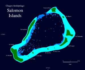
The Salomon Islands are found in the northeast part of the Chagos Archipelago. They are located between Blenheim Reef and Peros Banhos. The two main islands in this group are Île Boddam and Île Anglaise. Both of these islands are on the western edge of the atoll's reef.
There were also smaller communities of people, called Chagossians, on Fouquet and Takamaka Islands. Other islands like Île de la Passe and Île Mapou are smaller. The rest of the islets are even tinier. All together, the land area of these islands is about 3.56 square kilometers (1.37 square miles).
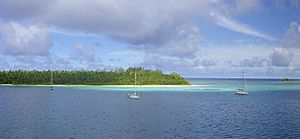
There is a way to enter the lagoon from the north side. It is called Baie de Salomon, and it's between Île Anglaise and Île de la Passe. The Salomon Islands are a popular stop for sailors and yachtsmen traveling through the Chagos. However, you need a special permit from the British Indian Ocean Territory to visit. The islands are not lived on anymore. Thick jungle has grown over the old coconut trees, making it hard to find signs of the past settlements.
A Look Back in Time
People first settled on this atoll in the late 1700s. These were workers who came from Isle de France (which is now Mauritius) to work on coconut plantations. We don't know much about how these workers lived. Most of them were from Africa and were likely forced to work without pay, in conditions similar to slavery. The company that ran the plantation was called the Chagos Agalega Company.
In 1837, Commander Robert Moresby of the Indian Navy explored the Salomon Islands. He created the first detailed map of the atoll. Later, in 1905, Commander B.T. Sommerville made an even more accurate map. Some of the Salomon Islands were home to the Chagossians. But when the British government decided to move people out of the Chagos, only Île Boddam was still inhabited.
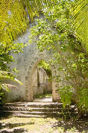
Between 1967 and 1973, about 500 people living on the Salomon Islands were moved from their homes. This was done by the British government to make space for an American military base. The people were resettled in Mauritius and Seychelles. Île Boddam used to have a jetty (a landing place for boats), shops, offices, a school, a church, and a house for the plantation manager. Today, all these buildings are hidden by the dense jungle. There are still wells on Boddam and Takamaka islands that sailors use to get fresh water.
The Islands of the Atoll
Here are the individual islands that make up the Salomon Atoll, listed clockwise starting from the North:
- Île de la Passe
- Île Mapou
- Île Takamaka
- Île Fouquet
- Île Sepulture
- Île Jacobin
- Île du Sel
- Île Poule
- Île Boddam
- Île Diable
- Île Anglaise
See also
 In Spanish: Islas Salomón (archipiélago de Chagos) para niños
 | Stephanie Wilson |
 | Charles Bolden |
 | Ronald McNair |
 | Frederick D. Gregory |


