British Indian Ocean Territory facts for kids
Quick facts for kids
British Indian Ocean Territory
|
|||
|---|---|---|---|
|
|||
| Motto(s): | |||
| Anthem: "God Save the King" | |||
 |
|||
| Sovereign state | |||
| Capital and settlement
|
Administered from London Local government from Camp Thunder Cove 7°18′S 72°24′E / 7.300°S 72.400°E |
||
| Official languages | English | ||
| Ethnic groups
(2001)
|
|
||
| Government | Directly administered dependency under a constitutional monarchy | ||
|
• Monarch
|
Charles III | ||
| Nishi Dholakia (acting) | |||
|
• Administrator
|
Bob Fairweather | ||
| Area | |||
|
• Total
|
54 km2 (21 sq mi) | ||
|
• Water (%)
|
99.89 | ||
|
• Land
|
60 km2 (23 sq mi) | ||
| Population | |||
|
• Non-permanent 2018 estimate
|
|||
|
• Permanent
|
0 | ||
|
• Density
|
50.0/km2 (129.5/sq mi) | ||
| Currency |
|
||
| Time zone | UTC+06:00 | ||
| Mains electricity | 230 Volt, 50 Hertz | ||
| Driving side | right | ||
| Calling code | +246 | ||
| UK postcode |
BBND 1ZZ
|
||
| ISO 3166 code | IO | ||
| Internet TLD | .io | ||
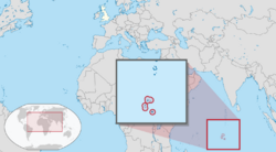
The British Indian Ocean Territory (BIOT) is a special area of land and sea that belongs to the United Kingdom. It is located in the Indian Ocean, about halfway between Tanzania and Indonesia. This territory is made up of seven atolls, which are ring-shaped coral islands, and more than 1,000 smaller islands.
The total land area is quite small, only about 60 square kilometers. The biggest island is Diego Garcia, which is about 27 square kilometers. This island is very important because it has a joint military base used by both the United Kingdom and the United States. The territory is managed from London, but the main local office is on Diego Garcia.
Only British and American military people and their helpers live here, about 3,000 in total. There are no permanent residents. This is because, between 1968 and 1973, the original people of these islands, called the Chagossians, were moved away by the UK government. They were sent to Mauritius and Seychelles. Today, the Chagossians are still trying to return to their homeland. However, the UK government has not allowed them to, despite many groups asking for their right to return. The islands are currently closed to tourists, media, and the Chagossians.
Since the 1980s, the government of Mauritius has been trying to get control of the Chagos Archipelago. The UK separated these islands from Mauritius in 1965 to create the BIOT. In 2019, the International Court of Justice said the islands should be given to Mauritius. Other international groups agreed. In 2022, the UK and Mauritius started talking about who should own the territory. On October 3, 2024, the UK agreed to give the territory to Mauritius, but the important military base on Diego Garcia will stay.
Contents
History of the Chagos Islands
Early Discoveries and Settlements
Maldivian sailors knew about the Chagos Islands a long time ago. In their old stories, the islands were called Fōlhavahi or Hollhavai. Sometimes, traders and fishermen from the Maldives would get lost at sea and end up on one of the Chagos islands. They were eventually rescued and brought home. The Maldivians decided these islands were too far away to live on permanently. So, for many centuries, the Chagos Islands were mostly left alone.
In the early 1500s, Vasco da Gama mapped the Chagos Islands. Then, in the 1700s, France claimed them as part of Mauritius. The first people to settle there were African slaves and Indian workers. They were brought by French-Mauritians to start coconut farms. At one point, Diego Garcia even had a place for people with leprosy from Mauritius.
In 1810, the United Kingdom took control of Mauritius. France officially gave up the territory in the Treaty of Paris in 1814. The UK ended slavery in 1833, but the workers on the islands continued to work as indentured laborers. By 1900, there were 426 families on the islands. Most of them were descendants of the first African and Malagasy slaves. Others were from South Asia. They developed a common language called Chagossian creole.
During World War II, an airstrip and other military buildings were built on Diego Garcia. But after the war, the military left. In 1962, a company from the Seychelles bought the coconut farms.
How the Territory Was Formed
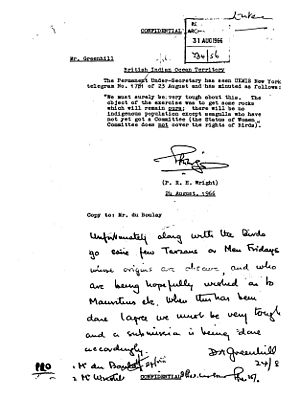
In 1964, the UK and US began secret talks about building a military base on Diego Garcia. The US wanted a place with very few people. In 1965, the UK separated the Chagos Archipelago from Mauritius. They also took the islands of Aldabra, Farquhar, and Desroches from the Seychelles. These islands together formed the British Indian Ocean Territory (BIOT). The main reason was to build military bases for both the UK and the US. The territory was officially created on November 8, 1965. Mauritius received £3 million for the islands.
A few weeks later, the United Nations General Assembly passed a resolution. It said that taking part of a colony like Mauritius was against international law. This law stated that trying to break up a country's unity was wrong.
The people who lived on the islands, descendants of the coconut farm workers, became known as the Chagossians. In 1968, there were about 866 Chagossians living on the islands. Their lives were simple, with homes made from wood and coconut leaves. They grew coconuts, fished, and grew fruit. The UK told the United Nations that BIOT had no native people. This meant the UK did not have to report on the territory to the UN.
Mauritius became an independent country in 1968.
Moving the Chagossians Away
In April 1967, the UK government bought the coconut farms for £600,000 and closed them. Over the next five years, the British authorities moved all 2,000 Chagossians from Diego Garcia and two other atolls, Peros Banhos and Salomon Islands. They were sent to Mauritius and the Seychelles. The UK stopped Chagossians who had left from returning. By January 1971, all remaining people were moved from Diego Garcia. The people from Peros Banhos and the Salomon Islands were moved starting in June 1972.
In 1971, the UK and the US signed a deal. The UK leased Diego Garcia to the US military to build a large air and naval base. This deal was important for the UK. In return for the base, the US gave the UK a big discount on Polaris nuclear missiles. The island's location in the middle of the Indian Ocean was also very important for defense.
Developing the Territory
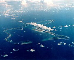
In 1976, the islands of Aldabra, Farquhar, and Desroches were given back to the Seychelles. The Seychelles became an independent country. After this, the BIOT only included the six main island groups of the Chagos Archipelago.
Work on the military base started in 1971. A large airbase with long runways was built, along with a harbor for big naval ships. Even though it's a joint UK/US base, it's mostly run by the US military. However, the UK always has a small group of soldiers there. Royal Air Force (RAF) planes also use the base.
In the 1980s, Mauritius said the 1965 separation of the islands was illegal. The UK did not agree with this legal argument. However, the UK said it would give the territory to Mauritius when it was no longer needed for defense. In 1990, the first BIOT flag was raised. It shows the Union Jack, wavy blue and white lines for the Indian Ocean, and a palm tree with a British crown.
During the Gulf War, 20 Boeing B-52 Stratofortress bombers with nuclear weapons were at the base. The base was also used in the 2001 War in Afghanistan and the 2003 Iraq War.
The Chagossians, who now live mostly in Mauritius and Seychelles, have continued to fight for their right to return. They won important court cases in England in 2000, 2006, and 2007. After the 2000 ruling, the UK government said Chagossians could return to the outer islands, but not Diego Garcia. However, this decision was changed in 2004. The UK offered citizenship to some Chagossians starting in 2002.
In 2010, the UK government created the BIOT Marine Protected Area. This area protects the ocean around the Chagos Archipelago. Some Chagossians worried this would stop them from returning because they couldn't fish in a protected area.
International Decisions and Talks
The dispute over who owns the islands became more known internationally. In 2017, the United Nations General Assembly voted to ask the International Court of Justice (ICJ) for an opinion. In 2019, the ICJ said that the UK should end its control of the Chagos Archipelago as soon as possible. In May 2019, the UN General Assembly agreed, saying the Chagos Archipelago is part of Mauritius.
In January 2021, another international court, the International Tribunal for the Law of the Sea, also ruled that the UK has no right to the Chagos Archipelago. The UK does not agree with this decision. In 2021, the Universal Postal Union voted to ban BIOT postage stamps. They said Mauritian stamps should be used instead.
On November 3, 2022, the UK and Mauritius announced they would start talks about who owns the territory. Both sides agreed that the joint UK/US military base on Diego Garcia would continue to operate. This change in approach is partly because of new strategies by the US and UK in Asia.
In February 2022, some exiled islanders visited an island in the Chagos Archipelago for the first time without supervision. The Mauritian flag was raised on Peros Banhos.
In October 2021, asylum seekers from Sri Lanka landed on Diego Garcia. The rules for refugees do not apply to the BIOT. Some were moved to Rwanda.
Recent Negotiations
In November 2022, news reports confirmed that the UK and Mauritius had begun talks about who should own the British Indian Ocean Territory. On October 3, 2024, the UK Prime Minister and the Mauritian Prime Minister announced an agreement. The UK will eventually give up control of the territory. However, the military base will stay for at least 99 years.
Government and Laws
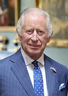
The head of state for the British Indian Ocean Territory is King Charles III. There is no Governor living on the islands because there are no permanent residents.
The main leader of the government is the Commissioner. This person and other senior officials live in the United Kingdom. The Commissioner's representative on the island is the leader of the British military forces there.
The laws of the territory are based on its constitution, called the British Indian Ocean Territory (Constitution) Order 2004. This gives the Commissioner the power to make laws. If there isn't a specific law, then the laws of England and Wales usually apply. There are no elections because no one lives there permanently. Most residents are US military members, so crimes are often handled under United States military law.
Agreements between the UK and the US control how the military base is used. The US usually needs permission from the UK to use the base for military attacks.
Naval Party 1002 (NP 1002) is a group of Royal Navy and Royal Marine personnel on the islands. They are in charge of local government and enforcing laws. They act as police and customs officers. Royal Marines also provide security.
Before 2017, the BIOT had a patrol ship called MV Pacific Marlin. It patrolled the marine reserve. Since the marine reserve was created in 2010, more illegal fishing boats have been caught.
In 2016, a new ship called MV Grampian Frontier took over. It is a 70-meter-long vessel that carries up to 24 people. It helps with patrols and research. This ship works with NP 1002 on fishing and military tasks. It also carries scientists who do research, especially on conservation. In 2022, the Grampian Frontier followed a Mauritian ship that was taking Chagossian exiles to Blenheim Reef.
The Royal Navy also has two patrol ships, HMS Tamar and HMS Spey, in the Indo-Pacific region. They sometimes help protect the BIOT waters.
Geography and Climate
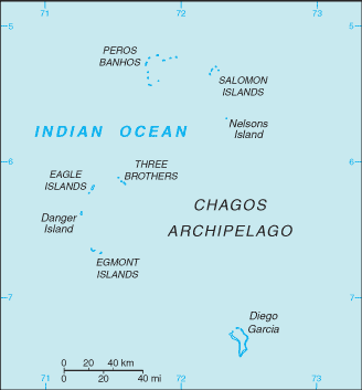
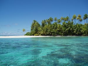
The territory has 55 islands. Diego Garcia is the largest and the only one where people live. It makes up almost half of the total land area. The islands are flat and low, usually only about 1.33 meters above sea level. In 2010, a huge area of ocean, 545,000 square kilometers, was made a marine reserve.
The British Indian Ocean Territory (Constitution) Order 2004 lists the main islands:
- Diego Garcia
- Three Brothers Islands
- Egmont Islands
- Nelson Island
- Peros Banhos
- Eagle Islands
- Salomon Islands
- Danger Island
The climate is tropical marine. This means it is hot and humid, with steady winds. The Diego Garcia military base is one of the US military's overseas bases most at risk from climate change.
Transportation on Diego Garcia
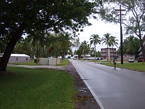
On Diego Garcia, there are short paved roads between the port and the airfield. People mostly get around by bicycle or walking. In the past, there were small railways pulled by donkeys to carry coconuts, but these are no longer used.
Diego Garcia's military base has the territory's only airport. Its runway is 3,000 meters long. This is long enough for large US Air Force bombers like the B-52. It also has a big naval seaport.
Sailors on yachts can get permission to moor near the uninhabited Outer Islands. However, they must stay at least 3 nautical miles away from certain protected islands. No unauthorized boats or people are allowed near Diego Garcia.
Protecting Nature
The territory is part of the International Whaling Commission's 1979 Indian Ocean Whale Sanctuary. This means it's a safe place for whales. The area is also protected by other international agreements that help save wildlife and the environment.
On April 1, 2010, the Chagos Marine Protected Area (MPA) was created. This area protects the waters around the Chagos Archipelago. Mauritius disagreed with this, saying it went against their rights. In 2015, a court ruled that the MPA was illegal because Mauritius had rights to fish and to the islands themselves.
The MPA is important because it helps protect a large area of the ocean. It acts as a natural laboratory to study climate change and biodiversity. It also provides a safe place for species that are in danger elsewhere. Since the MPA was created, fishing is no longer allowed in the area.
The BIOT Administration has allowed some of the oldest Chagossians to visit the territory. They also offer environmental training for Chagossians living in the UK. This lets some of them help with scientific work.
Population and People
The laws of the British Indian Ocean Territory say that no one has the right to live there permanently. This is because the territory is set aside for the defense needs of the United Kingdom and the United States. So, no one can enter or stay in the territory unless they have special permission.
Since there are no permanent residents, it's hard to know exactly how many people are there. The number changes depending on military needs. Diego Garcia is the only island where people live. It has an estimated population density of about 110 people per square kilometer.
Only official visitors and military staff are usually allowed on Diego Garcia. Family members are not allowed to live there, so there are no schools. In 2018, the total population was around 3,000 people. This included US military personnel, contractors, and British armed forces members. The rest of the islands are usually empty.
Economy and Services
All money-making activities happen on Diego Garcia. This is where the joint UK/US defense facilities are located. Building projects and running services for the military bases are done by military staff and workers from Britain, Mauritius, the Philippines, and the United States. There are no factories or farms on the islands. Before the marine sanctuary was created, selling licenses for commercial fishing brought in about $1 million each year.
Services for Residents
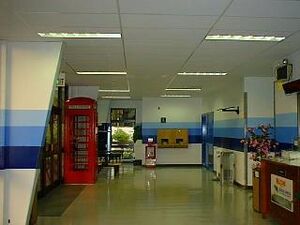
The Navy Morale, Welfare and Recreation (MWR) provides many services on Diego Garcia. These include a library, an outdoor cinema, shops, and sports centers. Prices are in US dollars. The BIOT Post Office handles mail, and the territory has issued its own postage stamps since 1968. Basic medical services are available, and people can be flown out if they need more serious care. There are no schools on the island.
Communications
Cable & Wireless started providing phone and internet services in 1982. In 2013, the company became Sure (Diego Garcia) Ltd.
Because of its location near the Equator, Diego Garcia has a clear view of many satellites. The island is home to Diego Garcia Station (DGS). This is a remote tracking station that helps control US Space Force satellites.
In 2022, Diego Garcia was connected to a fiber-optic submarine communications cable. This cable links Perth, Australia, to Muscat, Oman. It also has a connection to Australia's Cocos Islands. The cable cost $300 million, with the US military paying about one-third.
Radio and Internet
The territory has three FM radio stations. These are provided by the American Forces Network (AFN) and the British Forces Broadcasting Service (BFBS). Amateur radio operators can use the British callsign prefix VQ9 from Diego Garcia.
The .io (Indian Ocean) country-code top-level domain was given to a British businessman in 1997. He ran it for profit until 2017, when he sold it for $70 million. In 2021, a group representing the Chagossians asked the Irish government to return the .io domain to them. They also asked for past earnings from the domain.
Sports
The Chagos Islands national football team was started by the descendants of the exiled Chagossians. They have played in football competitions that are not part of FIFA, like the 2016 CONIFA World Football Cup.
See also
 In Spanish: Territorio Británico del Océano Índico para niños
- British Overseas Territories
- Chagos Archipelago sovereignty dispute
- Index of United Kingdom–related articles
- Legal Consequences of the Separation of the Chagos Archipelago from Mauritius in 1965
- List of sovereign states and dependent territories in the Indian Ocean
Images for kids
 | Madam C. J. Walker |
 | Janet Emerson Bashen |
 | Annie Turnbo Malone |
 | Maggie L. Walker |


