Saluda Mountains facts for kids
Quick facts for kids Saluda Mountains |
|
|---|---|
| Highest point | |
| Peak | Grassy Top Mountain |
| Elevation | 3,258 ft (993 m) |
| Geography | |
| Country | |
| Parent range | Blue Ridge Mountains |
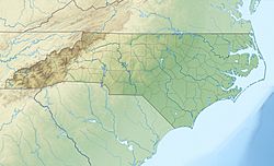
The Saluda Mountains are a group of mountains found right on the border between North Carolina and South Carolina in the southeastern United States. They are a part of the larger Blue Ridge Mountains, which are themselves a big part of the Appalachian Mountains.
Where are the Saluda Mountains Located?
This mountain range starts near Caesars Head State Park at a peak called Standingstone Mountain. From there, it stretches northeast all the way to Blakes Peak, which is close to the town of Saluda, North Carolina. The mountains sit right on the state line between North and South Carolina. They have two rivers on their sides: the Green River and the Saluda River.
What are the Tallest Mountains?
Here are the ten highest mountain peaks in the Saluda Mountains. The tallest one is Grassy Top Mountain.
| Mountain | Height | Location | Nearby Area | Named After |
|---|---|---|---|---|
| Grassy Top Mountain | 3,258 feet (993 m) | 35°09′21″N 82°31′36″W / 35.15583°N 82.52667°W | Greenville County, SC–Henderson County, NC | |
| Standingstone Mountain | 3,209 feet (978 m) | 35°08′39″N 82°34′22″W / 35.14417°N 82.57278°W | Greenville County, SC–Henderson County, NC | |
| Hogback Mountain | 3,130 feet (950 m) | 35°09′57″N 82°30′15″W / 35.16583°N 82.50417°W | Greenville County, SC–Henderson County, NC | |
| Big Top | 3,048 feet (929 m) | 35°09′57″N 82°29′39″W / 35.16583°N 82.49417°W | Greenville County, SC–Henderson County, NC | |
| Mackerel Mountain | 3,038 feet (926 m) | 35°10′28″N 82°29′11″W / 35.17444°N 82.48639°W | Greenville County, SC–Henderson County, NC | |
| Corbin Mountain | 3,031 feet (924 m) | 35°10′05″N 82°26′05″W / 35.16806°N 82.43472°W | Greenville County, SC–Henderson County, NC | |
| Pruett Mountain | 3,022 feet (921 m) | 35°10′03″N 82°26′04″W / 35.16750°N 82.43444°W | Greenville County, SC | |
| McCarrol Mountain | 2,982 feet (909 m) | 35°10′27″N 82°28′27″W / 35.17417°N 82.47417°W | Greenville County, SC–Henderson County, NC | |
| Frank Mountain | 2,933 feet (894 m) | 35°10′40″N 82°27′37″W / 35.17778°N 82.46028°W | Greenville County, SC–Henderson County, NC | |
| Long Mountain | 2,923 feet (891 m) | 35°11′30″N 82°28′05″W / 35.19167°N 82.46806°W | Henderson County, NC |

All content from Kiddle encyclopedia articles (including the article images and facts) can be freely used under Attribution-ShareAlike license, unless stated otherwise. Cite this article:
Saluda Mountains Facts for Kids. Kiddle Encyclopedia.


