Samalá River facts for kids
Quick facts for kids Samalá River |
|
|---|---|

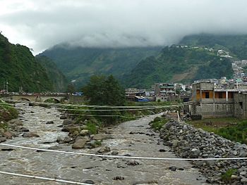
The Samalá River at Zunil
|
|
|
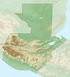
Location of mouth
|
|
| Country | Guatemala |
| Physical characteristics | |
| Main source | Sierra Madre in the Valle De Écija, San Carlos Sija 3,200 m (10,500 ft) 15°02′05″N 91°34′22″W / 15.034759°N 91.572847°W |
| River mouth | Pacific Ocean 0 m (0 ft) 14°11′31″N 91°47′08″W / 14.191934°N 91.785450°W |
| Length | 145 km (90 mi) |
The Samalá River is an important river located in the southwestern part of Guatemala. It starts high up in the mountains and flows all the way down to the Pacific Ocean. This river is a vital part of the landscape and supports many communities along its path.
Contents
The Samalá River's Journey
Where the River Begins
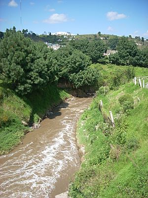
The Samalá River begins its journey in the Sierra Madre mountain range. This area is found in the departments of Quetzaltenango and Totonicapán. The exact starting point is in a valley called Valle De Écija, near the town of San Carlos Sija.
Flowing to the Ocean
From the mountains, the Samalá River flows downwards. It passes by several towns and cities. These include Quetzaltenango, San Cristóbal Totonicapán, El Palmar, and Zunil. After flowing through these areas, it reaches the flat coastal plains of Retalhuleu. Finally, the river empties into the Pacific Ocean.
River Basin and Local Life
What is a River Basin?
A river basin is the land area where all the water drains into a specific river. The Samalá River basin covers a large area of about 1,510 square kilometres (580 sq mi). This means all the rain and smaller streams in this area eventually flow into the Samalá River.
People Living Near the River
Around 400,000 people live within the Samalá River basin. These communities rely on the river for various needs. The river helps shape the lives and activities of the people living along its banks.
Volcanoes and River Safety
Nearby Volcanoes
The Samalá River flows close to the active Santa Maria and Santiaguito volcanoes. These volcanoes are known for their frequent activity. They can produce lava flows and lahars. Lahars are dangerous mudslides made of volcanic ash, rock, and water.
Risk of Flooding
Because of the nearby volcanoes, the Samalá River basin faces a higher risk of serious flooding. When volcanoes erupt, they can melt snow or ice, or cause heavy rains. This can lead to a lot of water and debris flowing into the river. This makes it important for communities to be prepared for potential floods.
See also
 In Spanish: Río Samalá para niños
 | Leon Lynch |
 | Milton P. Webster |
 | Ferdinand Smith |


