San Antonio Palopó facts for kids
Quick facts for kids
San Antonio Palopó
|
|
|---|---|
|
Municipality and village
|
|
 |
|
| Country | |
| Department | |
| Named for | St. Anthony of Padua |
| Government | |
| • Type | Municipal |
| Lowest elevation | 1,562 m (5,125 ft) |
| Time zone | UTC-6 (Central Time) |
| Country calling code | 502 |
| Climate | Cwb |
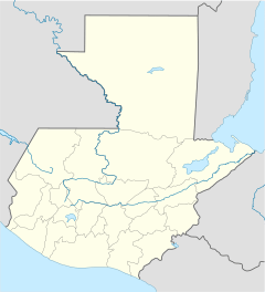
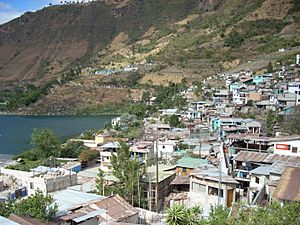
San Antonio Palopó is a small town in the Sololá Department of Guatemala. It is located on the eastern shore of Lake Atitlán. The lowest point in the town is 1,562 meters (about 5,125 feet) above sea level, right by the lake.
Most people living here are Kaqchikel Maya. They are known for their special traditional clothes. The town's patron saint is St. Anthony of Padua. Every year, on June 13, the town celebrates its main festival.
Contents
History of San Antonio Palopó
Early Spanish Influence
After the Spanish took control of Guatemala, the town of San Antonio Palopó was managed by a group of Catholic priests called Franciscans. These priests set up churches and taught Christian beliefs in many areas, including where San Antonio Palopó is today.
The Franciscans wanted everyone to learn about their religion. They held daily classes for children aged six and older. These classes involved memorizing prayers and church teachings. Adults also attended church services every Sunday and on holidays. The priests often taught in the local language.
In 1754, the Franciscans had to hand over their churches to other priests. So, by 1770, San Antonio Palopó became part of a larger church area called "San Francisco Panajachel parish."
Explorer Alfred Maudslay's Visit in 1892
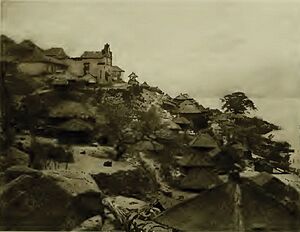
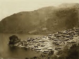
In 1892, a British explorer named Alfred Percival Maudslay and his wife, Anne Maudslay, visited Guatemala. They traveled around the country, often on mules. When they reached San Antonio Palopó, Anne Maudslay wrote about her experiences in her book, A Glimpse at Guatemala.
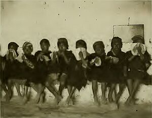
They found it hard to find a place to stay. The town hall was full, and the only other rooms were a crowded prison and an office. They ended up staying in the local school's girls' classroom, which had no windows or lights. They also noticed that the town's church had no roof because of earthquakes.
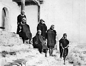
At that time, very few non-native people lived in San Antonio Palopó. Most residents were native Guatemalans, and the town was run by them. Even though a new road had been built, connecting the area to other parts of Guatemala, the town still felt a bit isolated. Anne Maudslay noticed that women and girls were shy and did not want their pictures taken. However, she saw that the women kept their clothes very clean.
The Maudslays also saw a special Sunday custom. All the town leaders, dressed in black and carrying special sticks, walked from house to house. They talked to people about what needed to be done in the coming days. After visiting all the houses, one man would shout instructions, which were repeated by others, and then the group would break up.
Since they stayed at the school, they saw a class. Little boys came early, dressed like their fathers. They were shy and kept their faces in their books until the teacher called their names. The teacher couldn't speak their language, and the children didn't know Spanish. So, for three hours, they just looked at their books. The girls didn't have class that day because the visitors were using their classroom.
The Maudslays also observed that the people made all their own clothes by hand, using old methods.
How San Antonio Palopó is Organized
The town of San Antonio Palopó covers an area of 34 square kilometers (about 13 square miles). It includes the main town, two villages, five smaller settlements, and several neighborhoods.
| Location Type | Names |
|---|---|
| Main Town | San Antonio Palopó |
| Villages |
|
| Settlements |
|
| Neighborhoods |
|
Climate in San Antonio Palopó
San Antonio Palopó has a mild, temperate climate. It's known as a "Csb" climate type, which means it has dry, warm summers and cool, wet winters.
| Climate data for San Antonio Palopó | |||||||||||||
|---|---|---|---|---|---|---|---|---|---|---|---|---|---|
| Month | Jan | Feb | Mar | Apr | May | Jun | Jul | Aug | Sep | Oct | Nov | Dec | Year |
| Mean daily maximum °C (°F) | 22.6 (72.7) |
23.0 (73.4) |
24.2 (75.6) |
24.4 (75.9) |
24.2 (75.6) |
22.1 (71.8) |
22.9 (73.2) |
22.3 (72.1) |
22.6 (72.7) |
22.6 (72.7) |
22.7 (72.9) |
22.4 (72.3) |
23.0 (73.4) |
| Daily mean °C (°F) | 16.2 (61.2) |
16.3 (61.3) |
17.4 (63.3) |
18.2 (64.8) |
18.7 (65.7) |
17.7 (63.9) |
18.0 (64.4) |
18.0 (64.4) |
17.7 (63.9) |
17.5 (63.5) |
16.8 (62.2) |
16.1 (61.0) |
17.4 (63.3) |
| Mean daily minimum °C (°F) | 9.8 (49.6) |
9.6 (49.3) |
10.7 (51.3) |
12.1 (53.8) |
13.2 (55.8) |
13.4 (56.1) |
13.1 (55.6) |
12.7 (54.9) |
12.8 (55.0) |
12.5 (54.5) |
11.0 (51.8) |
9.8 (49.6) |
11.7 (53.1) |
| Average precipitation mm (inches) | 1 (0.0) |
7 (0.3) |
6 (0.2) |
30 (1.2) |
102 (4.0) |
298 (11.7) |
168 (6.6) |
168 (6.6) |
304 (12.0) |
156 (6.1) |
44 (1.7) |
7 (0.3) |
1,291 (50.7) |
| Source: Climate-Data.org | |||||||||||||
Where San Antonio Palopó is Located
San Antonio Palopó is about 27 kilometers (17 miles) south of Sololá, which is the capital city of the department. It is also about 158 kilometers (98 miles) west of Guatemala City.
The town is surrounded by other towns in the Sololá Department. The only exception is to the east, where it shares a border with Patzún, a town in the Chimaltenango Department.
 |
San Andrés Semetabaj and Santa Catarina Palopó |  |
||
| Lake Atitlán | Patzún, Chimaltenango Department municipality | |||
| San Lucas Tolimán |
See also
 In Spanish: San Antonio Palopó para niños
 | Sharif Bey |
 | Hale Woodruff |
 | Richmond Barthé |
 | Purvis Young |


