San Fernando, Trinidad and Tobago facts for kids
Quick facts for kids
San Fernando
|
|
|---|---|
| City of San Fernando | |
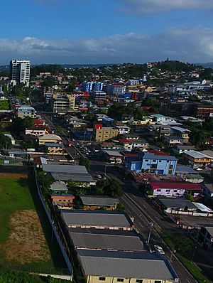
Independence Avenue in Downtown San Fernando
|
|
| Nicknames:
Sando
|
|
| Motto(s):
Sanitas Fortis
In a Healthy Environment We Will Find Strength. |
|
| Country | |
| Jurisdiction | City of San Fernando |
| Settled | 1595 |
| Borough | 19 August 1853 |
| City | 18 November 1988 |
| Named for | Saint Ferdinand III of Castile |
| Government | |
| • Body | San Fernando City Corporation |
| City Corporation seats | 9 electoral districts |
| House seats | 2/41 |
| Area | |
| • City | 19 km2 (7 sq mi) |
| Elevation | 1 m (3 ft) |
| Population
(2011)
|
|
| • City | 48,838 |
| • Rank | 2nd |
| • Density | 2,570/km2 (6,700/sq mi) |
| • Urban | 82,997 |
| Time zone | UTC-4 (AST) |
| Postal Code |
60xxxx, 61xxxx, 65xxxx
|
| Area code(s) | (868) |
| ISO 3166 code | TT-SFO |
| Telephone Exchanges | 652, 653, 657, 658, 697, 831 |
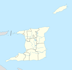
San Fernando, also known as the City of San Fernando, is a very important city in Trinidad and Tobago. It has the most people after Chaguanas. Many locals call it Sando. The city covers 19 square kilometers (about 7.3 square miles). It is located in the southwest part of the island of Trinidad.
San Fernando is bordered by the Guaracara River to the north and the Oropouche River to the south. To the east is the Sir Solomon Hochoy Highway, and to the west is the Gulf of Paria. San Fernando became a city on November 18, 1988. Its motto is "Sanitas Fortis" which means "In a Healthy Environment We Will Find Strength". People often call San Fernando Trinidad and Tobago's "industrial capital." This is because it is close to the Pointe-à-Pierre oil refinery. It is also near many other factories that make things like chemicals, LNG (liquefied natural gas), iron, steel, and aluminum. These factories are in places like Point Lisas, Point Fortin, and La Brea.
Contents
Exploring San Fernando's Geography
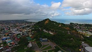
San Fernando is a city right on the coast. The Guaracara River is to its north, and the Sir Solomon Hochoy Highway is to its east. The Southern Main Road is to the southeast, and the Oropouche River is to the south. The city itself sits on the sides of two hills. These are San Fernando Hill, which used to be called Naparima Hill, and Alexander Hill. Some very important families in San Fernando live in large houses on top of Alexander Hill. Several rivers, like the Cipero, Vistabella, Marabella, and Godineau, flow into the sea within the city's borders.
What Does San Fernando Look Like?
San Fernando is different from Port of Spain because it does not have many very tall buildings. The tallest building in the city is the San Fernando Teaching Hospital. This hospital is 18 stories high and is an addition to the San Fernando General Hospital. Here are some important areas within San Fernando:
- Downtown is the main business area of the city. Independence Avenue, also known as Broadway, runs through this part of the city. High Street is where most of the shopping and business happens. It stretches from Chancery Lane/Independence Avenue to Pointe a Pierre Road. This area also has King's Wharf and the San Fernando Waterfront. The waterfront is currently being updated and improved. The Water Taxi and Bus Terminals are located right on the Waterfront. Many schools and hospitals are also in this area.
- Pleasantville is a neighborhood located east of the city. It is between the San Fernando Bypass and the Sir Solomon Hochoy Highway.
- Vistabella, Sumadh Gardens, and St. Joseph are neighborhoods just north of the city. They surround San Fernando Hill.
- Marabella is a town often thought of as part of the larger San Fernando area. It is a big business center. It is well-known for being close to the old Petrotrin oil refinery. Marabella is often seen as the northern edge of the city.
- Cocoyea and Mon Repos are located to the east of the city, along the San Fernando Bypass.
Some of the main roads in the city include the San Fernando Bypass, Lady Hailes Avenue, Independence Avenue, Pointe a Pierre Road, Cipero Street, Coffee Street, Rushworth Street, Royal Road, Navet Road, and the Southern Main Road.
San Fernando is famous for the Southern Academy for the Performing Arts (SAPA). Other notable places include Skinner Park, Mannie Ramjohn Stadium, King's Wharf, and the San Fernando General Hospital. It also has many shopping centers and malls. These include South Park, C3 Centre, Carlton Centre, Gopaul Lands, and many smaller shops around High Street and Cipero Street.
People sometimes call San Fernando the "Southern capital" of the country. This is because it is a major hub for many activities in South Trinidad. Many people go to school and work in the city every day.
San Fernando's Climate and Weather
San Fernando has a tropical rainforest climate. This means it is warm and wet all year round. It is almost a tropical monsoon climate. Even though it doesn't have a true dry season, it is noticeably drier from February to April.
| Climate data for San Fernando, Trinidad and Tobago (1991–2020 normals) | |||||||||||||
|---|---|---|---|---|---|---|---|---|---|---|---|---|---|
| Month | Jan | Feb | Mar | Apr | May | Jun | Jul | Aug | Sep | Oct | Nov | Dec | Year |
| Mean daily maximum °C (°F) | 30.18 (86.32) |
30.47 (86.85) |
30.98 (87.76) |
31.81 (89.26) |
31.62 (88.92) |
30.80 (87.44) |
30.77 (87.39) |
31.24 (88.23) |
31.63 (88.93) |
31.47 (88.65) |
30.96 (87.73) |
30.36 (86.65) |
31.02 (87.84) |
| Daily mean °C (°F) | 25.58 (78.04) |
25.67 (78.21) |
26.18 (79.12) |
27.02 (80.64) |
27.23 (81.01) |
26.90 (80.42) |
26.77 (80.19) |
27.04 (80.67) |
27.23 (81.01) |
27.07 (80.73) |
26.76 (80.17) |
26.07 (78.93) |
26.63 (79.93) |
| Mean daily minimum °C (°F) | 21.08 (69.94) |
20.88 (69.58) |
21.38 (70.48) |
22.32 (72.18) |
22.93 (73.27) |
23.10 (73.58) |
22.78 (73.00) |
22.84 (73.11) |
22.83 (73.09) |
22.77 (72.99) |
22.57 (72.63) |
21.87 (71.37) |
22.28 (72.10) |
| Average rainfall mm (inches) | 109.69 (4.32) |
72.67 (2.86) |
63.84 (2.51) |
91.04 (3.58) |
141.60 (5.57) |
261.90 (10.31) |
238.16 (9.38) |
259.00 (10.20) |
188.43 (7.42) |
215.54 (8.49) |
255.61 (10.06) |
189.11 (7.45) |
2,086.59 (82.15) |
| Source: Climate Change Knowledge Portal | |||||||||||||
Who Lives in San Fernando?
| Historical populations | ||
|---|---|---|
| Year | Pop. | ±% |
| 1980 | 33,395 | — |
| 1990 | 26,483 | −20.7% |
| 2000 | 48,784 | +84.2% |
| 2011 | 48,838 | +0.1% |
In 2011, San Fernando had a population of 48,838 people.
Different Backgrounds in San Fernando
San Fernando is a city where people from many different backgrounds live together. Here is a look at the different groups that made up the city's population in 2011:
| Racial composition | 2011 |
|---|---|
| African (Afro-Trinidadian/Tobagonian) | 35.7% |
| South Asian (Indo-Trinidadian) | 30.3% |
| Multiracial | 17.3% |
| Dougla (South Asian and Black) | 8.2% |
| European (White Trinidadian) | 0.5% |
| East Asian (Chinese) | 0.6% |
| Native American (Amerindian) | 0.08% |
| Arab (Syrian/Lebanese) | 0.9% |
| Other | 0.02% |
| Not stated | 6.7% |
How San Fernando Works: Transport and More
Getting Around San Fernando
Roads and Driving
Most people in San Fernando travel by private car. The city has a very large network of roads. There are many ways to enter the city.
- The Rienzi Kirton Highway connects Cipero Street to Ruth Avenue. It then becomes Independence Avenue.
- The San Fernando Bypass goes around the edges of the city. It helps people get to many of the neighborhoods outside the main center.
- The Golconda Connector Road links the Sir Solomon Hochoy Highway to Cipero Street and the San Fernando Bypass. The Tarouba Link Road also connects the Sir Solomon Hochoy Highway to the San Fernando Bypass in the northern part of the city.
- Another way to enter the city is by exiting at Corinth. From there, you can use the Naparima Mayaro Road and Royal Road, or go through Pleasantville.
- Lady Hailes Avenue runs along the city's waterfront. It goes from Cipero Street to Kings Wharf. This road connects to the Reinzi Kirton Highway/Independence Avenue at only three points. It is a faster way to get to the city center. There are plans to make Lady Hailes Avenue wider, with four lanes. Much of this work is already done as part of the waterfront improvement project.
The city often has heavy traffic jams.
Buses, Taxis, and Water Taxis
The main San Fernando Bus Terminal is located north of Kings Wharf. You can find many taxi stands around High Street. There is also a water taxi service that connects San Fernando to Port of Spain by sea. This trip takes about 1 hour.
Air Travel
Like the rest of the island, San Fernando uses the Piarco International Airport. This airport is about 37 kilometers (23 miles) away from the city center.
Famous People from San Fernando
Many talented people have come from San Fernando. Here are a few of them:
- Stephen Ames (born 1964), a professional golfer on the PGA Tour.
- Keston Bledman, a fast sprinter.
- Hasely Crawford (born 1950), an Olympic gold medalist in 1976.
- Hedy Fry, PC, MP (born 1941), a Canadian politician and doctor who was born in Trinidad.
- Noor Hassanali (1918–2006), who served as the President of Trinidad and Tobago from 1987 to 1997.
- Rikki Jai (born 1986), a popular chutney and chutney soca artist.
- Christine Kangaloo, the current President of Trinidad and Tobago (since 2023).
- Patrick Manning (1946–2016), who was the Prime Minister of Trinidad and Tobago twice (1991–1995, 2002–2010).
- Sir Trevor McDonald (born 1939), a famous news reporter.
- Mishael Morgan (born 1986), a TV actress.
- Manny Ramjohn (1915–1998), a long-distance runner. He was the first person to win a gold medal for Trinidad and Tobago in a major athletics event.
- George Maxwell Richards (1931–2018), who was the President of Trinidad and Tobago from 2003 to 2013.
- Samuel Selvon (1923–1994), a well-known writer.
- Jlloyd Samuel (1981–2018), a footballer.
See also
 In Spanish: San Fernando (Trinidad y Tobago) para niños
 | Precious Adams |
 | Lauren Anderson |
 | Janet Collins |


