San Javier, Murcia facts for kids
Quick facts for kids
San Javier
|
|||
|---|---|---|---|
 |
|||
|
|||

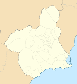
Location in Murcia
|
|||
| Country | |||
| Autonomous Community | |||
| Province | |||
| Comarca | Comarca del Mar Menor | ||
| Area | |||
| • Total | 74 km2 (29 sq mi) | ||
| Elevation
(AMSL)
|
4 m (13 ft) | ||
| Population
(2018)
|
|||
| • Total | 31,905 | ||
| • Density | 431.1/km2 (1,117/sq mi) | ||
| Time zone | UTC+1 (CET) | ||
| • Summer (DST) | UTC+2 (CEST (GMT +2)) | ||
| Postal code |
30730
|
||
| Area code(s) | +34 (Spain) + 968 (Murcia) | ||
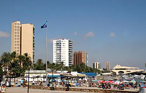
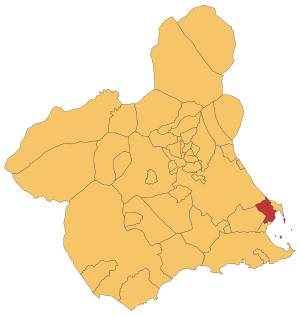
San Javier is a small town and municipality in southeastern Spain. It is located in the Murcia region. The town sits at the northern end of Murcia's Mediterranean coastline. This area is known as the Costa Cálida, which means "Warm Coast."
Contents
History of San Javier
There isn't much evidence of very early people living right in San Javier. However, we know people lived nearby a long time ago. They were found at Cabezo Gordo hill and near the salty Mar Menor lagoon.
Ancient Times
In Roman times, San Javier was valued for its climate. The Mar Menor was important for making salt. You can still find signs of Roman and Carthaginian people here. A big Roman road, the Via Augusta, goes through the area. Divers have found old pots and jars underwater.
Islamic Rule
During Islamic rule in Spain, few Arabs or Berbers lived in San Javier. But they used their special fishing methods here. These methods are called encañizada in Spanish. Nearby Los Alcázares also has old walls and water tanks from this time.
After the Reconquest
When King Alfonso X took over Murcia, the coast had few people. Only shepherds and fishermen lived there. More people slowly moved to the area between the 1200s and 1500s. Some families took their names from the local area, like Roda and Saavedra. New churches and chapels were built as more villages grew. In the early 1700s, one small church started the village of San Javier.
By 1809, the villages of San Javier, Roda, and La Calavera had 428 people.
Becoming a Municipality
From 1820 to 1823, during a time called the Trienio Liberal, many town councils were created. San Javier got its own town council then. But when this period ended, San Javier's council was removed. It became part of Murcia again. Luckily, the San Javier town council was brought back in 1836.
Hard Times and Growth
In the late 1800s, many people in San Javier were poor. They moved to find work as farmers or miners. Some went to La Unión in Murcia or even Oran in Algeria. By the end of the 1800s, San Javier had 3,770 people. About half were farmers, and the rest were fishermen or craftspeople.
Some families became rich by buying and selling land. A new group of wealthy people grew. These included estate managers, business owners, mine owners, and moneylenders.
The area now called Santiago de la Ribera started to be settled in 1888.
Modern Developments
A Naval Flying School was opened in San Javier in 1932. Later, in 1943, the San Javier General Air Force Academy was built. This led to a new neighborhood called Ciudad del Aire.
Villages in San Javier
The municipality of San Javier includes the main town and ten smaller villages. Two of these villages are right on the coast:
- El Mirador
- La Grajuela
- Roda
- Los Sáez de Tarquinales
- Pozo Aledo
- Los Pinos
- Lo Llerena
- La Calavera
- Santiago de la Ribera
- La Manga del Mar Menor
Climate
San Javier has a warm climate, which is why it's part of the "Warm Coast." Here is some information about the weather:
| Climate data for Murcia—San Javier (Airport 4 m, near sea) (1981–2010), extremes (1930–) | |||||||||||||
|---|---|---|---|---|---|---|---|---|---|---|---|---|---|
| Month | Jan | Feb | Mar | Apr | May | Jun | Jul | Aug | Sep | Oct | Nov | Dec | Year |
| Record high °C (°F) | 26.2 (79.2) |
27.8 (82.0) |
31.5 (88.7) |
32.0 (89.6) |
36.0 (96.8) |
36.9 (98.4) |
40.5 (104.9) |
40.0 (104.0) |
39.4 (102.9) |
35.5 (95.9) |
30.0 (86.0) |
27.0 (80.6) |
40.5 (104.9) |
| Mean daily maximum °C (°F) | 16.0 (60.8) |
16.7 (62.1) |
18.5 (65.3) |
20.4 (68.7) |
22.9 (73.2) |
26.4 (79.5) |
28.9 (84.0) |
29.5 (85.1) |
27.5 (81.5) |
24.0 (75.2) |
19.8 (67.6) |
17.6 (63.7) |
22.3 (72.1) |
| Daily mean °C (°F) | 10.8 (51.4) |
11.6 (52.9) |
13.4 (56.1) |
15.3 (59.5) |
18.4 (65.1) |
22.2 (72.0) |
24.8 (76.6) |
25.5 (77.9) |
23.2 (73.8) |
19.4 (66.9) |
14.9 (58.8) |
11.9 (53.4) |
17.6 (63.7) |
| Mean daily minimum °C (°F) | 5.5 (41.9) |
6.5 (43.7) |
8.4 (47.1) |
10.2 (50.4) |
13.8 (56.8) |
17.9 (64.2) |
20.7 (69.3) |
21.5 (70.7) |
18.9 (66.0) |
14.7 (58.5) |
10.0 (50.0) |
6.8 (44.2) |
12.9 (55.2) |
| Record low °C (°F) | −3.8 (25.2) |
−4.0 (24.8) |
−3.0 (26.6) |
1.0 (33.8) |
4.8 (40.6) |
9.5 (49.1) |
11.0 (51.8) |
12.0 (53.6) |
7.9 (46.2) |
4.0 (39.2) |
−1.5 (29.3) |
−5.4 (22.3) |
−5.4 (22.3) |
| Average precipitation mm (inches) | 42 (1.7) |
27 (1.1) |
24 (0.9) |
23 (0.9) |
25 (1.0) |
7 (0.3) |
2 (0.1) |
7 (0.3) |
39 (1.5) |
39 (1.5) |
47 (1.9) |
30 (1.2) |
313 (12.3) |
| Average precipitation days (≥ 1 mm) | 4 | 3 | 3 | 3 | 3 | 1 | 0 | 1 | 3 | 4 | 4 | 4 | 33 |
| Mean monthly sunshine hours | 173 | 171 | 206 | 224 | 266 | 288 | 307 | 283 | 224 | 200 | 162 | 156 | 2,621 |
| Source: Agencia Estatal de Meteorología | |||||||||||||
The Aerodrome
An military aerodrome (a military airfield) was built in Santiago de la Ribera before the Spanish Civil War. It had schools for training military pilots. These schools taught pilots how to fly fast bomber planes and planes with many engines.
After the Civil War, the Spanish Air Force used the airfield for occasional landings. Today, it is the location of Murcia–San Javier Airport. Until August 2018, it was the biggest airport in the Region of Murcia.
Famous People from San Javier
- Antonio Cañadas, a professional footballer (soccer player).
See also
 In Spanish: San Javier (España) para niños
 | Aurelia Browder |
 | Nannie Helen Burroughs |
 | Michelle Alexander |


