San Lorenzo, San Marcos facts for kids
Quick facts for kids
San Lorenzo
|
|
|---|---|

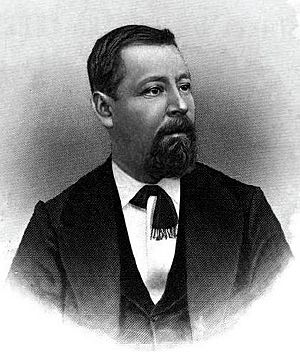
General Justo Rufino Barrios, President of Guatemala from 1873 to 1885, was born in San Lorenzo.
|
|
| Country | |
| Department | |
| Climate | Cwb |
San Lorenzo (pronounced san lo-REN-so) is a small town, also known as a municipality, located in the San Marcos department of Guatemala. Spanish families founded this town in 1812.
It is famous as the birthplace of Justo Rufino Barrios. He was a very important person who served as the President of Guatemala from 1873 until 1885. His childhood home in San Lorenzo is now a special place, declared a National Heritage site.
Contents
Exploring San Lorenzo: History and Landmarks
San Lorenzo has a very special historical place called the "Justo Rufino Barrios" hacienda. This was the home where General Barrios was born. The government has declared it a National Heritage site. This means it's a very important place to protect and remember.
Understanding San Lorenzo's Climate
San Lorenzo has a mild or temperate climate. This type of climate is known as Cwb in the Köppen climate classification system. This means it has warm, rainy summers and dry, cool winters.
| Climate data for San Lorenzo | |||||||||||||
|---|---|---|---|---|---|---|---|---|---|---|---|---|---|
| Month | Jan | Feb | Mar | Apr | May | Jun | Jul | Aug | Sep | Oct | Nov | Dec | Year |
| Mean daily maximum °C (°F) | 17.2 (63.0) |
17.6 (63.7) |
19.1 (66.4) |
19.8 (67.6) |
19.4 (66.9) |
18.5 (65.3) |
18.4 (65.1) |
18.9 (66.0) |
18.3 (64.9) |
17.7 (63.9) |
17.8 (64.0) |
17.5 (63.5) |
18.4 (65.0) |
| Daily mean °C (°F) | 9.8 (49.6) |
10.0 (50.0) |
11.4 (52.5) |
12.7 (54.9) |
13.7 (56.7) |
13.6 (56.5) |
13.4 (56.1) |
13.3 (55.9) |
13.4 (56.1) |
12.7 (54.9) |
11.5 (52.7) |
10.7 (51.3) |
12.2 (53.9) |
| Mean daily minimum °C (°F) | 2.4 (36.3) |
2.5 (36.5) |
3.8 (38.8) |
5.7 (42.3) |
8.0 (46.4) |
8.7 (47.7) |
8.5 (47.3) |
7.7 (45.9) |
8.5 (47.3) |
7.7 (45.9) |
5.2 (41.4) |
4.0 (39.2) |
6.1 (42.9) |
| Average precipitation mm (inches) | 5 (0.2) |
6 (0.2) |
19 (0.7) |
58 (2.3) |
179 (7.0) |
248 (9.8) |
176 (6.9) |
207 (8.1) |
262 (10.3) |
174 (6.9) |
26 (1.0) |
10 (0.4) |
1,370 (53.8) |
| Source: Climate-Data.org | |||||||||||||
Where is San Lorenzo Located?
San Lorenzo covers an area of about 25 square kilometers. This makes it one of the smallest municipalities in both the San Marcos Department and all of Guatemala. It is located about 23 kilometers west of San Marcos, which is the capital city of the department. San Lorenzo is surrounded by other towns and areas within the San Marcos department.
 |
Comitancillo |  |
||
| Río Blanco | Tejutla and San Marcos | |||
| San Antonio Sacatepéquez and San Pedro Sacatepéquez |
See also
In Spanish: San Lorenzo (San Marcos) para niños
 | Misty Copeland |
 | Raven Wilkinson |
 | Debra Austin |
 | Aesha Ash |


