San Onofre State Beach facts for kids
Quick facts for kids San Onofre State Beach |
|
|---|---|
 |
|
| Location | San Diego County, California |
| Nearest city | San Clemente |
| Area | 3,000-acre (1,214 ha) |
| Governing body | California Department of Parks and Recreation |
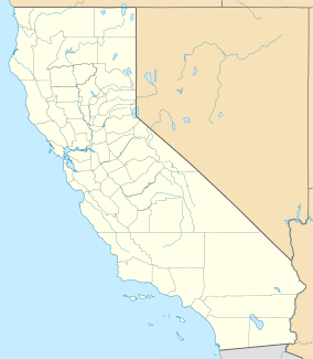
San Onofre State Beach is a huge state park in San Diego County, California. It covers about 3,000 acres (1,214 hectares) of land. You can find this beach about 3 miles (5 km) south of San Clemente. It's right off Interstate 5 at Basilone Road. The United States Marine Corps leases this land to the state of California. Governor Ronald Reagan helped create San Onofre State Beach in 1971. Over 2.5 million people visit this park every year. This makes it one of the most popular state parks in California! People come here to swim, camp, kayak, watch birds, fish, bike, sunbathe, and surf. It's also home to a very important Native American site called Panhe.
Contents
History of San Onofre State Beach
Panhe is an ancient village site at San Onofre. It is over 8,000 years old! For the Acjachemen people, Panhe is a sacred place. They use it for ceremonies and it's also a burial site. Many Acjachemen people can trace their family history back to Panhe. This spot was also where the first baptism in California happened. In 1769, Spanish explorers and Catholic missionaries met the Acjachemen people here for the first time. Groups like the United Coalition to Protect Panhe work to keep this site safe. The area was named after St. Onuphrius, a holy person from the 4th century.
During the time of Mexican California, the land where the state beach is now was part of Rancho de San Onofrio. This large ranch belonged to Pio Pico. He was the last Mexican governor of California. Later, the Forster, Flood, and O'Neill families owned this ranch. The area around San Onofre Creek was even called Forster City. About 175 people lived there in 1880. The town got smaller, but the land was still important. The Santa Fe Railroad built a train station called San Onofre there in 1888.
In the early 1900s, the O'Neills leased the land near the train station to Norm Haven. He grew crops like beans, melons, and lettuce there. Most of the 150 or so workers on Haven's Ranch were Hispanic or Japanese-American. Haven's Ranch had a Catholic Church and a school. Travelers on the Coast Highway could stop at Frank Ulrich's cafe. The highway was finished in 1929. During World War II, many Japanese-American workers left. Some were evacuated because of a government order. Two people from Haven's Ranch, Fred and Kajiro Oyama, later went to the U.S. Supreme Court. Their case (Oyama v. State of California, 1948) helped change laws. These laws had stopped people of Japanese descent from owning land in California.
The Marines at Camp Pendleton slowly took over Haven's Ranch in the 1950s. The old village near San Onofre Creek was removed in 1960. This made way for the I-5 freeway. However, the Marines built new housing in the hills north of the old train stop in the 1970s.
On November 10, 2016, a big plan was stopped. The Transportation Corridor Agency decided not to build a six-lane toll highway through San Onofre State Beach. This highway would have also gone through other sensitive natural areas. It would have affected Native American cultural sites too. This decision ended more than 10 years of trying to build the road. Stopping this road was part of an agreement. It ended several lawsuits. These lawsuits were filed by the California attorney general and environmental groups. They wanted to block the project.
Exploring San Onofre State Beach
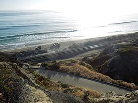
The San Onofre Bluffs area has about 3.5 miles (5.6 km) of sandy beaches. You can reach the beach using six trails cut into the bluffs above. The campground is next to the old U.S. Route 101. It sits right by the sandstone bluffs. San Onofre State Beach includes several different areas. These are San Onofre Bluffs and Beach, San Onofre Surf Beach, and San Mateo campgrounds. Trestles is also part of the park. You can get to Trestles from San Mateo Campgrounds by a nature trail. Remember, alcohol is not allowed on any beaches in the park.
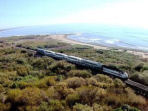
The park also has a marshy area. This is where San Mateo Creek flows into the ocean. Trestles is a very famous surfing spot here. If you look offshore, you might see whales, dolphins, and sea lions! The land along the coast is covered in chaparral plants.
Surfing at San Onofre
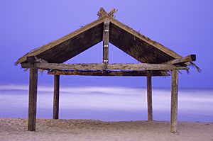
People have been surfing and fishing here since the 1920s. This was even before Camp Pendleton became a Marine training camp during World War II. Surfers have been riding waves at San Onofre since at least the 1940s. They used special redwood boards back then. Famous surfers like Lorrin "Whitey" Harrison and Bob Simmons visited this spot.
San Onofre has several great places to surf along its 3.5 miles (5.6 km) of coast:
- Trestles: This is a world-famous surfing spot. It's known for having consistent, good waves.
- Church: This spot is near Camp Pendleton's beach resort. It's great for sunbathing and watching ducks.
- Surf Beach: This area is divided into three different surf spots. They are called The Point, Old Man's, and Dogpatch.
- Trails: This is the southernmost surf spot in the area. It has both rocky and sandy parts for surfing.
San Onofre Nuclear Generating Station
Between San Onofre Bluffs and San Onofre Surf Beach, you'll find the San Onofre Nuclear Generating Station (SONGS). This power plant was shut down in June 2013.
San Onofre in Popular Culture
- The Beach Boys mentioned "San Onofre" and "Trestles" in their 1963 song, Surfin' U.S.A..
- San Onofre is a main setting in Kim Stanley Robinson's first novel, The Wild Shore. The story takes place in a future after a big disaster.
 | Lonnie Johnson |
 | Granville Woods |
 | Lewis Howard Latimer |
 | James West |


