Sandom Branch facts for kids
Quick facts for kids Sandom Branch |
|
|---|---|

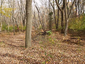
Floodplain of Sandom Branch downstream of DE 1 in 2008
|
|
|
Location of Sandom Branch mouth
|
|
| Other name(s) | Tributary to Blackbird Creek |
| Country | United States |
| State | Delaware |
| County | New Castle |
| Physical characteristics | |
| Main source | divide between Sandom Branch and Duck Creek about 2 miles south of Blackbird, Delaware 50 ft (15 m) 39°20′37″N 075°40′22″W / 39.34361°N 75.67278°W |
| River mouth | Blackbird Creek Blackbird, Delaware 0 ft (0 m) 39°22′27″N 075°39′10″W / 39.37417°N 75.65278°W |
| Length | 2.33 mi (3.75 km) |
| Basin features | |
| Progression | northeast |
| River system | Blackbird Creek |
| Basin size | 2.78 square miles (7.2 km2) |
| Tributaries |
|
Sandom Branch is a small stream, about 2.33 mi (3.75 km) long, located in New Castle County, Delaware. It's like a smaller helper stream, also known as a tributary, that flows into a larger one called Blackbird Creek. Sandom Branch is one of the main streams that feeds into Blackbird Creek before it reaches the ocean's tides.
Where Sandom Branch Begins
Sandom Branch starts in an area about 2 miles south of a town called Blackbird, Delaware. It begins on a high point of land that separates its water from another stream called Duck Creek. Think of this high point as a natural dividing line for water.
The Sandom Branch Watershed
Every stream has a watershed, which is all the land where rain and snow collect and drain into that stream. The Sandom Branch watershed covers an area of about 2.78 square miles (7.2 km2). This means all the water that falls on these 2.78 square miles eventually flows into Sandom Branch.
- Rainfall: The area around Sandom Branch gets about 43.8 inches of rain and snow each year.
- Forests: About 22.6% of the land in this watershed is covered by forests. These forests are important because they help keep the water clean and provide homes for wildlife.
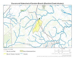
Maps of Sandom Branch
Maps help us see where Sandom Branch flows and how its watershed is shaped. They show us the path of the stream and the land that contributes water to it.
 | Percy Lavon Julian |
 | Katherine Johnson |
 | George Washington Carver |
 | Annie Easley |


