Sanish, North Dakota facts for kids
Quick facts for kids
Sanish, North Dakota
|
|
|---|---|

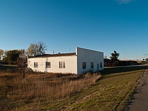
Sanish in 2008
|
|
| Country | United States |
| State | North Dakota |
| County | Mountrail |
| Elevation | 2,120 ft (650 m) |
| Time zone | UTC-6 (Central (CST)) |
| • Summer (DST) | UTC-5 (CDT) |
| Area code(s) | 701 |
| GNIS feature ID | 1031354 |
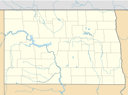
Sanish is a small place in Mountrail County, North Dakota, in the United States. It's called an unincorporated community, which means it doesn't have its own local government like a city or town. Instead, it's managed by the county.
Sanish is located right next to North Dakota Highway 23. It's also very close to Lake Sakakawea, a large lake formed by a dam on the Missouri River. Sanish is about 2.6 miles (4.2 km) west of a town called New Town.
What is Sanish Like?
The Sanish you see today was built in 1953. This happened because the original town of Sanish, which was in a different spot, got covered by water.
The Old Sanish Town
The first Sanish, now called "Old Sanish," was a community where Native Americans lived. When Lake Sakakawea was created, the water rose and covered the old town. This meant everyone living there had to move.
Most of the people from Old Sanish moved to the new Sanish or to nearby New Town. This event changed their lives and the history of the area.
 | Selma Burke |
 | Pauline Powell Burns |
 | Frederick J. Brown |
 | Robert Blackburn |


