Santigny facts for kids
Quick facts for kids
Santigny
|
|
|---|---|
| Country | France |
| Region | Bourgogne-Franche-Comté |
| Department | Yonne |
| Arrondissement | Avallon |
| Canton | Guillon |
| Area
1
|
9.35 km2 (3.61 sq mi) |
| Population
(2006)
|
117 |
| • Density | 12.51/km2 (32.41/sq mi) |
| Time zone | UTC+01:00 (CET) |
| • Summer (DST) | UTC+02:00 (CEST) |
| INSEE/Postal code |
89375 /89420
|
| Elevation | 243–354 m (797–1,161 ft) |
| 1 French Land Register data, which excludes lakes, ponds, glaciers > 1 km2 (0.386 sq mi or 247 acres) and river estuaries. | |
Santigny is a small place in France called a commune. It is located in the Yonne department, which is in the central part of France. Think of a commune as a local area, a bit like a town or a village, with its own local government.
Contents
What is Santigny Like?
Santigny is a quiet area with a small number of people living there. In 2006, about 117 people called Santigny home. The commune covers an area of about 9.35 square kilometers. To give you an idea, that's roughly the size of 935 football fields!
Where is Santigny Located?
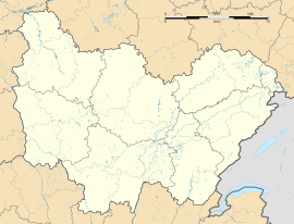
Santigny is found in the Yonne department. This department is part of the Bourgogne-Franche-Comté region in central France. The land in Santigny is not completely flat; its elevation, or how high it is above sea level, ranges from 243 meters to 354 meters. This means it has some gentle hills.
How is Santigny Governed?
Like all communes in France, Santigny is part of a larger system of government.
Administrative Divisions
Santigny belongs to a few different administrative areas:
- It is part of the Avallon arrondissement. An arrondissement is a larger administrative area within a department, often centered around a main town.
- It is also part of the Guillon canton. A canton is a smaller division within an arrondissement, used for elections and some local services.
These divisions help organize the country and make sure that local services, like schools and roads, are managed properly.
See also
 In Spanish: Santigny para niños
 | Sharif Bey |
 | Hale Woodruff |
 | Richmond Barthé |
 | Purvis Young |


