
Sautee Nacoochee, Georgia facts for kids
Quick facts for kids
Sautee Nacoochee
|
|
|---|---|
 |
|

Sautee Nacoochee
Location in Georgia (U.S. state)

Sautee Nacoochee
Location in the United States
|
|
| Country | United States |
| State | Georgia |
| County | White |
| Elevation | 1,483 ft (452 m) |
| Population
(2020)
|
|
| • Total | 332 |
| Time zone | UTC-5 (Eastern (EST)) |
| • Summer (DST) | UTC-4 (EDT) |
| ZIP codes |
30571
|
| Area code(s) | 706 |
| GNIS feature ID | 2629786 |
Sautee Nacoochee is a small community in White County, Georgia, United States. It's located in the Appalachian foothills of northeast Georgia. This area is about 95 miles (153 km) north of Atlanta. The closest town is Helen, which is a popular place for tourists.
Contents
What's in a Name?
The name Sautee Nacoochee comes from two Native American words. What they mean exactly isn't fully known.
Some people think "Sautee" is a changed version of the Cherokee word "Itsati." This word was used for important Cherokee places, like their ancient capital, Echota. It was also the name of their new capital in the 1800s, New Echota.
"Nacoochee" or "Nagutsi" was listed as a Cherokee town in 1734. Its meaning is still a mystery. Some believe it might be connected to the Yuchi people.
A Local Legend
There's a famous folktale about nearby Yonah Mountain. It tells the story of a beautiful Cherokee maiden named Nacoochee. She fell in love with a Chickasaw warrior named Sautee.
Their love was forbidden by the tribal elders. So, the lovers tried to run away together. But a war party followed them. They threw Sautee off the mountain. Heartbroken, Nacoochee then jumped to her death. This sad story is known as a "Lover's Leap."
This legend became very popular thanks to George Williams. He was the son of one of the first white settlers in the area. He wrote about it in his 1871 book, Sketches of Travel in the Old and New World.
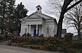
Sautee Valley Historic District
|
Sautee Valley Historic District
|
|
 |
|
| Location | GA 255 and Lynch Mountain Rd., Sautee, Georgia |
|---|---|
| Area | 1,000 acres (400 ha) |
| NRHP reference No. | 86002742 |
| Added to NRHP | August 20, 1986 |
The Sautee Valley Historic District is a special area around Sautee Nacoochee. It's next to the Nacoochee Valley Historic District. This district was added to the National Register of Historic Places in 1986.
It's important for its farming history, old buildings, and overall historical value. The district includes places where ancient villages once stood. It also has buildings from when American settlers arrived.
Both Spanish explorers and later settlers came here looking for gold. This was especially true during the Georgia Gold Rush. The main point of the Sautee Valley Historic District is where Georgia State Route 255 and Lynch Mountain Road meet.
Sautee Nacoochee Center
Sautee Nacoochee is well-known for the Sautee Nacoochee Center. This center is a hub for culture and community events. It's located in a beautifully restored old schoolhouse.
The Sautee-Nacoochee Community Association (SNCA) started the center. This group also helped get both Sautee and Nacoochee Valleys listed on the National Register of Historic Places.
Folk Pottery Museum
In 2006, the Folk Pottery Museum of Northeast Georgia opened. It's on the grounds of the Sautee Nacoochee Center. The museum's building was designed by architect Robert M. Cain from Atlanta.
It has a large main exhibit area, about 3,200 square feet (297 square meters). Here, you can see over 150 pottery pieces on display all the time. There's also space for new, temporary exhibits.
The many cultural programs at the Sautee Nacoochee Center are famous. Because of these programs, Sautee Nacoochee was named one of "The 100 Best Small Arts Towns in America." This was in a book by John Villani.
Population Facts
Sautee Nacoochee was first listed as a census-designated place in the 2010 United States Census.
In 2010, the population was 363 people. By 2020, it had slightly decreased to 332 people.
- 2010: 363 people
- 2020: 332 people
Most people living in Sautee Nacoochee are White. In 2020, about 84% of the population was White (not Hispanic or Latino). Other groups include Black or African American, Asian, and people of mixed races. A small percentage of the population is Hispanic or Latino.
Nearby Towns
Images for kids
-
Sautee Valley Historic District
See also
 In Spanish: Sautee Nacoochee para niños
