Scarborough River facts for kids
Quick facts for kids Scarborough River |
|
|---|---|
| Country | United States of America |
| Physical characteristics | |
| Main source | Scarborough, Maine |
| River mouth | Saco Bay |
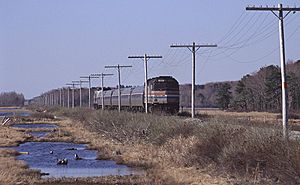
The Scarborough River is a short, important waterway in Scarborough, Maine. It's about 3.7 miles (6 km) long and is a special type of river called an estuary. An estuary is where a river meets the sea, and fresh water mixes with salty ocean water.
This river flows through the large Scarborough Marsh and then empties into Saco Bay. It forms the northern edge of Saco Bay, flowing out between Pine Point Beach and Western Beach. The Scarborough River gets its water from several smaller rivers and streams, including the Nonesuch River, Dunstan River, and Libby River.
How the River Works
In its natural state, the Scarborough River acted like a big storage area for sand and mud in Saco Bay. It would collect sediment (tiny bits of rock and sand) that moved northward along the coast from beaches to the south and eventually from the Saco River.
The river's path, or channel, used to change often because of natural events like storms. When the channel moved, it would leave behind old sandbanks. These sandbanks would then help to refill the sand on nearby beaches, like Pine Point Beach to the south and Western and Ferry beaches to the north. This was a natural way for the beaches to stay sandy and healthy.
History of the Scarborough River
People have lived near the Scarborough River for a very long time. In the early 1600s, an explorer named Christopher Levett recorded the name of the river or the marshes as Owascoag. This name came from the Abenaki Indian people who lived there.
By 1624, many English fishing boats, more than 50 of them, were fishing offshore. Fishermen and their families soon settled along the river's banks. Back then, the main road in Maine ran right along the coastline. To cross the Scarborough River, people used a ferry that went from Pine Point Beach to Ferry Beach.
Changes Over Time
Over the years, people have made changes to the river to make it more useful. In the late 1800s, a small tidal inlet called Little River Inlet was blocked off and its water was sent into the Scarborough River.
Later, in 1962, the Army Corps of Engineers worked to make the river channel more stable. They built a long wall, called a jetty, at the southern edge of the river's mouth. This jetty helps keep the river channel in one place.
A stable channel is helpful for boats, especially for fishing boats and pleasure boats that are kept in the river. It also allows for occasional boat launches from a dock managed by the town. However, because the channel is now stable, it slowly fills up with sediment. This means it needs to be dredged (cleaned out) about every five years. In 2004, the materials removed during dredging were placed on Western Beach, which helped to mimic the natural flow of sand that used to happen.
 | Valerie Thomas |
 | Frederick McKinley Jones |
 | George Edward Alcorn Jr. |
 | Thomas Mensah |


