Scissors Crossing, California facts for kids
Scissors Crossing is a special place in San Diego County, California. It's where two important roads meet: California State Highway 78 and County Road S2. This spot is also famous because it's on the Pacific Crest Trail, a very long hiking path!
Contents
What is Scissors Crossing?
Scissors Crossing is not a town or a city, but a well-known spot in the desert. It's where State Highway 78 and County Road S2 come together. It's a key point for travelers and hikers. About 2 miles (3.2 km) south of Scissors Crossing, you'll find the small community of Shelter Valley.
A Look Back in Time
Scissors Crossing has a rich history. County Road S2, especially south from the crossing, follows an old path called the Southern Emigrant Trail. This trail was also known as the Great Southern Overland Route. It was a major route for people traveling west.
Mail and Stagecoach Routes
This historic path was used by early mail and passenger services. The San Antonio–San Diego Mail Line and the famous Butterfield Overland Mail used this route. These services carried mail and people from Southern California all the way to Fort Yuma. From there, they continued into what are now the states of Arizona and New Mexico.
San Felipe Station
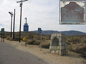
Close to Scissors Crossing, to the northwest, was the site of the San Felipe Station. This was an important stop for the Butterfield Overland Mail. It was a "division station" in the desert. This means it was a place where travelers could rest, get fresh horses, and prepare for the next part of their journey.


