Sedgewick, Alberta facts for kids
Quick facts for kids
Sedgewick
|
|
|---|---|
|
Town
|
|
| Town of Sedgewick | |
| Country | Canada |
| Province | Alberta |
| Region | Central Alberta |
| Census division | 7 |
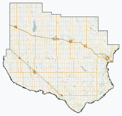
| Municipal district | Flagstaff County |
| Incorporated | |
| • Village | March 6, 1907 |
| • Town | May 1, 1966 |
| Area
(2021)
|
|
| • Land | 2.71 km2 (1.05 sq mi) |
| Elevation | 663 m (2,175 ft) |
| Population
(2021)
|
|
| • Total | 761 |
| • Density | 280.7/km2 (727/sq mi) |
| Time zone | UTC−7 (MST) |
| • Summer (DST) | UTC−6 (MDT) |
| Highways | Highway 13 Highway 869 |
| Waterways | Iron Creek |
Sedgewick is a friendly town located in central Alberta, Canada. It's about 83 km (52 mi) east of Camrose. You can find Sedgewick where Highway 13 and Highway 869 meet. The Canadian Pacific Kansas City railway also runs right through the town, connecting it to other places.
Contents
Sedgewick's Population
Understanding how many people live in a town helps us learn about it. This is called demographics.
How Many People Live Here?
In 2021, Statistics Canada counted the people living in Sedgewick. There were 761 people living in 357 homes. This was a small decrease from 2016, when 811 people lived in the town.
How Much Space Does Sedgewick Cover?
Sedgewick covers a land area of about 2.71 km2 (1.05 sq mi). This means that in 2021, there were about 280 people living in each square kilometer of the town.
Looking Back at 2016
Back in 2016, the town had 811 residents. They lived in 366 homes. The land area was slightly larger at 2.72 km2 (1.05 sq mi). This shows how a town's population can change over time.
 | Madam C. J. Walker |
 | Janet Emerson Bashen |
 | Annie Turnbo Malone |
 | Maggie L. Walker |


