
Seven Mile River (East Brookfield River tributary) facts for kids
Quick facts for kids Seven Mile River |
|
|---|---|

Seven Mile River near Wire Village
|
|
| Physical characteristics | |
| Main source | Browning Pond, Oakham / Spencer 745 ft (227 m) 42°18′29″N 71°59′49″W / 42.30806°N 71.99694°W |
| River mouth | East Brookfield River 600 ft (180 m) 42°13′08″N 72°03′08″W / 42.21889°N 72.05222°W |
| Length | 7.8 mi (12.6 km) |
| Basin features | |
| Basin size | 88 sq mi (230 km2) |
The Seven Mile River is a stream about 9.6-mile-long (15.4 km) in central Massachusetts. It starts at Browning Pond, which is on the border of Oakham and Spencer. From there, it flows south through Spencer.
The river follows Route 31 (North Spencer Road) for a short distance. It then goes under Route 31 where the road becomes Pleasant Street. The river continues south along Old Meadow Road and under Route 9. It flows next to Route 9 until it joins the East Brookfield River. This meeting point is between Lake Lashaway and Quaboag Pond.
Contents
About the Seven Mile River
The Seven Mile River helps drain water from Spencer and nearby towns. Even though it's called "Seven Mile River," modern maps show it's actually closer to ten miles long!
The river starts at about 745 feet (227 m) above sea level. It ends at about 600 feet (180 m) above sea level. This drop of 145-foot (44 m) was once very important.
How the River Helped Industry
The drop in elevation along the river created "waterpower." This power was used to run machines in factories. There are still parts of old dams along the river. Two of these dams were washed away during a flood in the 1950s and were never rebuilt. These old dam parts remind us of a time when Spencer was a big manufacturing town.
Where the River Gets Its Water
Besides small local brooks and streams, the Seven Mile River gets water from two main sources. Turkey Hill Brook flows into it from the north. Cranberry River joins it from the south. This river is also part of the larger Chicopee River Watershed. A watershed is an area of land where all the water drains into a common river or lake.
History of the Seven Mile River
In the 1800s, the Seven Mile River was a busy place. Its waterpower helped many factories in Spencer. Today, most of those factories are gone. Only a sewage treatment plant stands there now.
Sugden Reservoir and Wire Production
One important part of the river's history involves Sugden Reservoir. This reservoir is at the start of Turkey Hill Brook, which feeds into the Seven Mile River. Sugden Reservoir was key to Spencer's wire-making industry.
It provided water to the Lower Wire Village Mill, which made "card wire." This special wire was used in machines that prepared wool and cotton. The mill was first owned by the Prouty Brothers. Later, Richard Sugden bought it and made it better by building the Sugden Reservoir. The company then became known as Wickwire-Spencer. It continued making wire until after World War II.

Images for kids
-
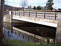
Seven Mile River bridge in Spencer
