Shadeland, Indiana facts for kids
Quick facts for kids
Shadeland, Indiana
|
|
|---|---|

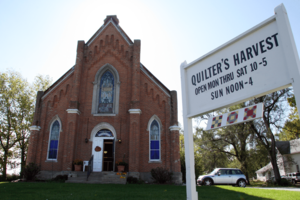
The old church building along State Road 25 in Shadeland
|
|

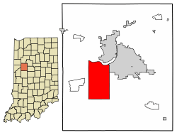
Location of Shadeland in Tippecanoe County, Indiana.
|
|
| Country | United States |
| State | Indiana |
| County | Tippecanoe |
| Townships | Union |
| Area | |
| • Total | 27.33 sq mi (70.79 km2) |
| • Land | 27.11 sq mi (70.21 km2) |
| • Water | 0.23 sq mi (0.58 km2) |
| Elevation | 679 ft (207 m) |
| Population
(2020)
|
|
| • Total | 1,757 |
| • Density | 64.81/sq mi (25.02/km2) |
| Time zone | UTC-5 (Eastern (EST)) |
| • Summer (DST) | UTC-4 (EDT) |
| ZIP code |
47909
|
| Area code(s) | 765 |
| FIPS code | 18-68868 |
| GNIS feature ID | 2397651 |
| Website | http://www.shadeland.in.gov/ |
Shadeland is a town located in Union Township, Tippecanoe County, in the state of Indiana, United States. In 2020, about 1,757 people lived there. Shadeland is also part of the larger Lafayette metropolitan area.
Contents
History of Shadeland
Shadeland had a post office that opened in 1887. This post office helped people send and receive mail. It stayed open for many years before closing in 1915.
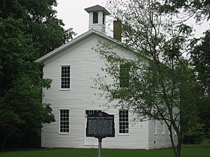
Two important buildings in Shadeland are listed on the National Register of Historic Places. This means they are special places that are protected because of their history. These buildings are the Farmers Institute and the Stidham United Methodist Church.
Geography of Shadeland
Indiana State Road 25 is a main road that goes through Shadeland. You can travel east and west on this road.
Shadeland is unique because its town limits are the same as the borders of Union Township. The people of Union Township decided to make it an official town. They did this to stop the nearby city of Lafayette from expanding and taking over parts of their area.
According to information from 2010, Shadeland covers about 27.3 square miles (70.8 square kilometers). Most of this area, about 27.1 square miles (70.2 square kilometers), is land. The rest, about 0.23 square miles (0.58 square kilometers), is water.
Population and People
| Historical population | |||
|---|---|---|---|
| Census | Pop. | %± | |
| 1990 | 1,674 | — | |
| 2000 | 1,682 | 0.5% | |
| 2010 | 1,610 | −4.3% | |
| 2020 | 1,757 | 9.1% | |
| U.S. Decennial Census | |||
2010 Population Details
In 2010, there were 1,610 people living in Shadeland. These people lived in 616 different homes. About 476 of these homes were families.
The town had about 59 people per square mile (23 people per square kilometer). There were also 675 housing units, which are places where people can live.
Most of the people in Shadeland were White (96.0%). A small number of people were from other groups, including African American (0.4%), Native American (0.6%), and Asian (0.5%). About 3.3% of the population was Hispanic or Latino.
In the homes, about 30.5% had children under 18 years old. Most homes (62.2%) were married couples living together. The average home had 2.61 people, and the average family had 2.94 people.
The average age of people in Shadeland was 43.2 years old. About 21.8% of the residents were under 18. About 13.8% were 65 years old or older. The town had slightly more females (50.8%) than males (49.2%).
See also
 In Spanish: Shadeland (Indiana) para niños
 | Delilah Pierce |
 | Gordon Parks |
 | Augusta Savage |
 | Charles Ethan Porter |


