Shamrock, Oklahoma facts for kids
Quick facts for kids
Shamrock, Oklahoma
|
|
|---|---|

|
|

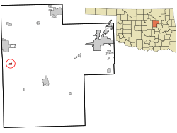
Location within Creek County, and the state of Oklahoma
|
|
| Country | United States |
| State | Oklahoma |
| County | Creek |
| Area | |
| • Total | 0.33 sq mi (0.85 km2) |
| • Land | 0.33 sq mi (0.85 km2) |
| • Water | 0.00 sq mi (0.00 km2) |
| Elevation | 991 ft (302 m) |
| Population
(2020)
|
|
| • Total | 65 |
| • Density | 198.17/sq mi (76.47/km2) |
| Time zone | UTC-6 (Central (CST)) |
| • Summer (DST) | UTC-5 (CDT) |
| ZIP code |
74068
|
| Area code(s) | 539/918 |
| FIPS code | 40-66600 |
| GNIS feature ID | 2413276 |
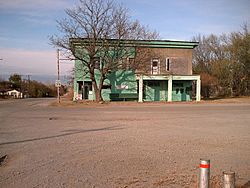
Shamrock (Meskwaki: Shêmwâkeki) is a very small community in Creek County, Oklahoma, United States. It is located south of Drumright and west of Bristow. In 2020, only 65 people lived there. The community was named after Shamrock, Illinois, which was the hometown of James M. Thomas, a local store owner.
Contents
History of Shamrock
How Shamrock Started
In 1908, a man named James M. Thomas moved to this area. He came from Shamrock, Illinois. He decided to open a store here.
Two years later, on July 9, 1910, he set up a post office. He named the new post office "Shamrock" to honor his old hometown.
Railroads and Growth
Between 1915 and 1916, a railroad line was built. It connected Shamrock to other towns like Depew. This railroad was first called the Sapulpa and Oil Fields Railroad. Later, it became part of the St. Louis and San Francisco Railway.
Another railroad, the Atchison, Topeka and Santa Fe Railway, also built a line in 1916. This one connected Shamrock to Drumright.
The railroad tracks were built about three-quarters of a mile away from where the town first started. So, the people of Shamrock decided to move their businesses closer to the new railroad. This helped Shamrock grow. It became an important place for shipping oil and equipment used in oil fields.
Irish Theme and Later Years
The town of Shamrock adopted an Irish theme. Many of its streets were given Irish names. Some of these names included Tipperary, Dublin, Killarney, Blarney, and Cork.
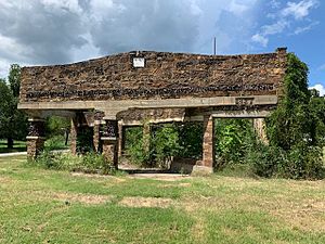
In June 2010, the town leaders voted to officially close down the town. It is now managed by an attorney.
Where is Shamrock?
Shamrock is located at specific geographic coordinates: 35°54′39″N 96°34′48″W / 35.91083°N 96.58000°W.
The United States Census Bureau says that the community covers a total area of about 0.3 square miles (0.8 square kilometers). All of this area is land.
People in Shamrock
| Historical population | |||
|---|---|---|---|
| Census | Pop. | %± | |
| 2020 | 65 | — | |
| U.S. Decennial Census | |||
In the year 2000, there were 125 people living in Shamrock. By 2020, the population had decreased to 65 people.
In 2000, about 35% of the people were under 18 years old. About 14% were 65 years old or older. The average age of people in Shamrock was 35 years old.
See also
 In Spanish: Shamrock (Oklahoma) para niños
 | James Van Der Zee |
 | Alma Thomas |
 | Ellis Wilson |
 | Margaret Taylor-Burroughs |


