
Drumright, Oklahoma facts for kids
Quick facts for kids
Drumright, Oklahoma
|
|
|---|---|

Downtown Drumright (2010)
|
|
| Motto(s):
"Oklahoma's Boomtown"
|
|

Location within Creek County and Oklahoma
|
|
| Country | United States |
| State | Oklahoma |
| Counties | Creek, Payne |
| Area | |
| • Total | 7.39 sq mi (19.15 km2) |
| • Land | 7.39 sq mi (19.14 km2) |
| • Water | 0.00 sq mi (0.01 km2) |
| Elevation | 791 ft (241 m) |
| Population
(2020)
|
|
| • Total | 2,560 |
| • Density | 346.46/sq mi (133.77/km2) |
| Time zone | UTC-6 (Central (CST)) |
| • Summer (DST) | UTC-5 (CDT) |
| ZIP code |
74030
|
| Area code(s) | 539/918 |
| FIPS code | 40-21750 |
| GNIS feature ID | 2410360 |
Drumright is a city in Creek and Payne counties in the U.S. state of Oklahoma. It started as a busy "oil boom" town. This means it grew very quickly because a lot of oil was found nearby.
Over time, as less oil was produced, the city's population became smaller. In 2020, about 2,560 people lived there. Drumright and a nearby city called Cushing were once at the center of a huge oil field in the 1910s and 1920s.
Today, Drumright is known for fun events like The Drumright Monthly Market. Hundreds of people visit this market on the first Saturday of each month to find crafts and tasty foods. The city also hosts the yearly OilPatch Parade and Jamboree Jog, and an Annual Cruising the Hills car show. Famous baseball player Babe Ruth even played on a baseball field here once!
Contents
History of Drumright

Drumright grew almost overnight in 1912. This happened after a "wildcatter" named Tom Slick found oil on Frank Wheeler's farm. A wildcatter is someone who drills for oil in places where no one has found it before. When the oil was found, many people rushed to the area. These included people hoping to find oil, oilfield workers, and merchants who wanted to sell things.
A post office opened in the new community in December 1912. Two local landowners, James W. Fulkerson and Aaron Drumright, planned out the town. It was first called Fulkerson, but later renamed after Aaron Drumright. His farm was part of the new town site.
Oil workers came to town so fast that many lived in tents or small shacks. Because of this, the community was sometimes called "Ragtown." Soon, hotels and boarding houses were built. Other places for workers to spend their money, like dance halls, also appeared. Drumright officially became a town on May 27, 1913.
In 1914, the city built a two-story stone building for an elementary and high school. It was called Washington School and is now a historic place. Two banks also opened in town that year. Drumright became a "first-class city" after a special election in 1916. By 1920, the city had 6,460 people.
A railway line was built to Drumright in 1915, which helped the town grow even more. In 1919, there was a big disagreement during a telephone workers' strike. The Governor of Oklahoma had to send help to make sure everything stayed peaceful.
Drumright also had its own minor league baseball teams, called the Drumright Oilers, from 1920 to 1923. In 1922, famous baseball players Babe Ruth and Bob Meusel played an exhibition game in Drumright. They were on a special tour at the time.
Starting in the 1930s, during the Great Depression, the town began to get smaller. This was because less oil was being produced. A large oil refinery near town closed in the 1950s.
Drumright has also faced challenges from tornadoes. In 1956, a tornado damaged homes, a school, and the public library. Another tornado in 1974 caused a lot of damage to homes and a nursing home.
Geography of Drumright
Drumright is located in the western part of Creek County. A small part of the city also reaches into Payne County. The city is about 26 miles (42 km) west of Sapulpa. It is also about 42 miles (68 km) southwest of Tulsa and 76 miles (122 km) northeast of Oklahoma City.
Drumright is where three state highways meet: Highway 16, Highway 33, and Highway 99. The city covers an area of about 7.39 square miles (19.15 square kilometers). Most of this area is land, with only a tiny bit of water.
Population Changes
| Historical population | |||
|---|---|---|---|
| Census | Pop. | %± | |
| 1920 | 6,460 | — | |
| 1930 | 4,972 | −23.0% | |
| 1940 | 4,303 | −13.5% | |
| 1950 | 5,028 | 16.8% | |
| 1960 | 4,029 | −19.9% | |
| 1970 | 2,740 | −32.0% | |
| 1980 | 3,278 | 19.6% | |
| 1990 | 2,799 | −14.6% | |
| 2000 | 2,905 | 3.8% | |
| 2010 | 2,907 | 0.1% | |
| 2020 | 2,560 | −11.9% | |
| U.S. Decennial Census | |||
In 2000, there were 2,905 people living in Drumright. About 1,209 households were in the city. The population density was about 412 people per square mile (159 people per square kilometer).
Most of the people living in Drumright were White (84.44%). About 8.47% were Native American, and 0.93% were African American. About 5.96% of the people were from two or more races.
In 2000, about 25.5% of the population was under 18 years old. About 20.9% were 65 years or older. The average age in the city was 38 years.
The average income for a household in Drumright was about $27,292 per year. For families, the average income was about $34,761 per year. About 17.3% of the people in Drumright lived below the poverty line. This included 19.7% of those under 18.
Economy and Jobs
Today, Drumright's main industries include manufacturing, oil and gas, education, healthcare, and agriculture.
The city is home to the Central Technology Center. This school opened in 1970 and helps people learn job skills. It employs about 125 people. Drumright also has its own hospital, the Drumright Regional Hospital.
A fun place to visit is the Tidewater Winery. It is in an old building that used to be a school for children of oil refinery workers.
Transportation Around Drumright
Drumright is located where State Highway 33 and State Highway 99 cross. State Highway 16 also ends in Drumright.
The closest small airport is Cushing Municipal Airport, about 12 miles (19 km) away. For bigger flights, the nearest commercial airport is Tulsa International Airport. It is about 50 miles (80 km) east-northeast of Drumright.
Education in Drumright
The Drumright School District has about 500 students. They attend classes in two main school buildings.
- Bradley Elementary serves students from Pre-Kindergarten up to 5th grade.
- Cooper Middle School teaches students in 6th through 8th grades.
- Drumright High School is in the same building and serves students from 9th through 12th grades.
The Central Technology Center, also known as Central Tech, is part of Oklahoma's career and technology education system. It offers many full-time and short-term classes. These classes help students learn skills for different jobs.
Parks and Fun Places
Drumright has many interesting places and events for visitors and residents.
- The Drumright Monthly Market is a popular event. Hundreds of people come to find crafts and special foods. It happens on the first Saturday of every month from April to December.
- Murals can be seen on many buildings in Drumright. These include the Oil Patch Collage Mural, the American Flag Mural, the Way Park Mural, and the Drumright Street Scene of 1920 Mural. More murals are inside the Drumright Historical Museum.
- The Drumright Historical Museum is located in an old train station from 1915. This station is a historic place. The museum shows old railroad cars and tells the story of the first big oil discovery in Oklahoma in 1912. By 1917, the Drumright oil field was producing more oil than any other in the world!
- Whitlock Park has a splashpad, a skateboard park, and a stage for events. It also has pavilions, a playground for younger kids, and walking paths.
- Way Park features a gazebo where musical performances can be held.
- Dunbar Park has a gazebo perfect for picnics.
- Judy Shelton Burris Park includes a Dog Park and a basketball court.
- Centennial Park has a very tall flagpole with an American flag. It also has plaques that remember past city leaders. "The Hollow," located below Centennial Park, offers open areas and native plants to enjoy.
- Garrett Park in Country Club Heights has a basketball court.
- The Deborah Guillot Bright Nature Preserve is a new area that will be built for enjoying nature.
- Drumright is also home to the "purple House," which became famous from a short film.
Historic Sites
Many places in Drumright are listed on the National Register of Historic Places. This means they are important historical sites.
- Jackson Barnett No. 11 Oil Well
- Wheeler No. 1 Oil Well
- Drumright Gasoline Plant No. 2
- First United Methodist Church of Drumright
- Aaron Drumright House
- J.W. Fulkerson House
- Santa Fe Depot (which is now the Drumright Historical Museum)
- Tidal School
- Washington School
Images for kids
-
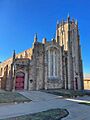
The First United Methodist Church

See also
 In Spanish: Drumright (Oklahoma) para niños
