Sheridan, Montana facts for kids
Quick facts for kids
Sheridan, Montana
|
|
|---|---|

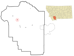
Location of Sheridan, Montana
|
|
| Country | United States |
| State | Montana |
| County | Madison |
| Area | |
| • Total | 1.01 sq mi (2.62 km2) |
| • Land | 1.01 sq mi (2.62 km2) |
| • Water | 0.00 sq mi (0.00 km2) |
| Elevation | 5,115 ft (1,559 m) |
| Population
(2020)
|
|
| • Total | 694 |
| • Density | 686.45/sq mi (264.92/km2) |
| Time zone | UTC-7 (Mountain (MST)) |
| • Summer (DST) | UTC-6 (MDT) |
| ZIP code |
59749
|
| Area code(s) | 406 |
| FIPS code | 30-67600 |
| GNIS feature ID | 0776478 |
Sheridan is a small town in Madison County, Montana, United States. It was named after Philip Sheridan, a famous general from the American Civil War. In 2020, about 694 people lived here.
Sheridan is often called the "heart of the Ruby Valley." This is because it's surrounded by seven different mountain ranges. These include the Tobacco Root Mountains and the Ruby Range. The beautiful Ruby River also flows nearby, just west of town.
The town of Sheridan started in 1863. That's when James Gammell built a sawmill on Mill Creek.
Contents
Geography and Climate
Sheridan is located at about 45.45 degrees North and 112.19 degrees West. This means it's in the western part of the United States. Montana Highway 287 runs right through the town.
The United States Census Bureau says that Sheridan covers about 1.02 square miles (2.62 square kilometers) of land. There is no water area within the town limits.
Sheridan's Climate
Sheridan has a semi-arid climate. This means it's usually dry, but not a desert. It gets some rain, but not a lot. This type of climate is often shown as "BSk" on climate maps.
Population and People
| Historical population | |||
|---|---|---|---|
| Census | Pop. | %± | |
| 1880 | 156 | — | |
| 1890 | 207 | 32.7% | |
| 1900 | 581 | 180.7% | |
| 1910 | 399 | −31.3% | |
| 1920 | 538 | 34.8% | |
| 1930 | 521 | −3.2% | |
| 1940 | 597 | 14.6% | |
| 1950 | 572 | −4.2% | |
| 1960 | 539 | −5.8% | |
| 1970 | 636 | 18.0% | |
| 1980 | 646 | 1.6% | |
| 1990 | 652 | 0.9% | |
| 2000 | 659 | 1.1% | |
| 2010 | 642 | −2.6% | |
| 2020 | 694 | 8.1% | |
| U.S. Decennial Census | |||
How Many People Live Here?
In 2010, there were 642 people living in Sheridan. These people lived in 306 households. About 174 of these households were families. The town had about 629 people per square mile.
Most people in Sheridan are White, making up about 95.3% of the population. A small number of people are African American, Native American, or Asian. About 1.1% of the population was Hispanic or Latino.
The average age in Sheridan in 2010 was 53.1 years old. About 19.2% of the residents were under 18. Also, 29% of the people were 65 years old or older. More females live in Sheridan than males.
Education and Learning
Sheridan has its own schools for kids of all ages. The town is part of the Sheridan Elementary School District and the Sheridan High School District. Both of these are part of Sheridan Public Schools.
Students can attend school from kindergarten all the way through 12th grade. The sports teams at Sheridan High School are called the Panthers.
The Sheridan Public Library is also available for everyone in the area. It's a great place to find books and learn new things.
Local News
If you want to know what's happening in Sheridan, you can read The Madisonian. This newspaper covers news for the Madison and Ruby Valleys. It comes out every week and you can also read it online.
See also
 In Spanish: Sheridan (Montana) para niños
 | Dorothy Vaughan |
 | Charles Henry Turner |
 | Hildrus Poindexter |
 | Henry Cecil McBay |

