
Shorewood Forest, Indiana facts for kids
Quick facts for kids
Shorewood Forest, Indiana
|
|
|---|---|

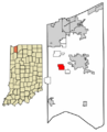
Location of Shorewood Forest in Porter County, Indiana.
|
|
| Country | United States |
| State | Indiana |
| Counties | Porter |
| Township | Union |
| Area | |
| • Total | 2.24 sq mi (5.79 km2) |
| • Land | 1.90 sq mi (4.92 km2) |
| • Water | 0.34 sq mi (0.88 km2) |
| Elevation | 771 ft (235 m) |
| Population
(2020)
|
|
| • Total | 3,033 |
| • Density | 1,597.16/sq mi (616.76/km2) |
| Time zone | UTC-6 (Central (CST)) |
| • Summer (DST) | UTC-5 (CDT) |
| ZIP code |
46385
|
| Area code(s) | 219 |
| FIPS code | 18-69642 |
| GNIS feature ID | 2631622 |
Shorewood Forest is a special kind of community in Union Township, Porter County, in the state of Indiana, United States. It's called a census-designated place (CDP). This means it's an area that looks like a town but doesn't have its own local government.
The heart of Shorewood Forest is a man-made lake called Lake Louise. In 2020, about 3,033 people lived here.
Contents
Exploring Shorewood Forest's Location
Shorewood Forest is located about 6 miles (10 kilometers) west of Valparaiso. Valparaiso is the main city and county seat for Porter County.
How Big is Shorewood Forest?
According to the United States Census Bureau, Shorewood Forest covers a total area of about 2.24 square miles (5.79 square kilometers). Most of this area is land, about 1.90 square miles (4.92 square kilometers). The rest, about 0.34 square miles (0.88 square kilometers), is water. This water area is mostly Lake Louise.
Lake Louise and Local Waterways
Lake Louise is an important part of the community. It's connected to a smaller stream that flows into Salt Creek. Salt Creek is part of a larger water system called the Little Calumet River watershed. A watershed is an area of land where all the water drains into a common river, lake, or ocean.
Who Lives in Shorewood Forest?
| Historical population | |||
|---|---|---|---|
| Census | Pop. | %± | |
| 2020 | 3,033 | — | |
| U.S. Decennial Census | |||
The population of Shorewood Forest has grown over the years. In 2010, there were 2,708 people living there. By 2020, the population had increased to 3,033 people. This information comes from the official U.S. Census.
Images for kids
-
Map showing Shorewood Forest in Porter County, Indiana.
See also
 In Spanish: Shorewood Forest (Indiana) para niños
