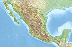
Sierra de Picachos facts for kids
Quick facts for kids Sierra de Picachos |
|
|---|---|
| Geography | |
| Location | Nuevo Leon, Mexico |
| Range coordinates | 26°02′N 99°33′W / 26.03°N 99.55°W |
The Sierra de Picachos is a mountain range in Nuevo Leon, Mexico. It's a chain of mountains. The highest point in this range is 4,990 feet (1,521 meters) tall. This peak is located at 26° 03′ 54″ North and 99° 54′ 56″ West.
Contents
Exploring the Sierra de Picachos
The Sierra de Picachos is about 35 miles (55 kilometers) northeast of Monterrey, a big city. The mountain range stretches for about 40 miles (55 kilometers) from north to south. It is also about 15 miles (25 kilometers) wide. In total, it covers a large area of 542 square miles (1,405 square kilometers).
The mountains here range in height from 1,300 feet (400 meters) to 4,990 feet (1,521 meters). Several peaks are taller than 4,200 feet (1,300 meters). The Sierra de Picachos is separate from the main Sierra Madre Oriental mountains. Highway 85, which goes from Nuevo Laredo to Monterrey, runs through a pass that divides them.
Plants and Animals of the Sierra
Most of the land in the Sierra de Picachos is covered in a type of semi-desert shrubland. This area is called Tamaulipan matorral. It has many woody shrubs, small trees, cacti, and other plants that store water.
Higher up, above 2,600 feet (800 meters), you'll find an oak forest. This forest covers about 15 percent of the Sierra de Picachos. You can also find two types of pine trees among the oaks: Arizona Pine and Mexican pine.
The Sierra is home to several mammals. These include the American black bear and the Cougar, also known as a mountain lion.
Protecting the Mountains
The rocky peaks of the Sierra de Picachos are very noticeable. Because they are also close to Monterrey, many efforts have been made to protect this natural area.
In 2003, the state of Nuevo Leon declared a large part of the Sierra a Protected Natural Area. This protected area covers 185,329 acres (75,853 hectares). Most of this land is privately owned. However, people have not caused much harm to the environment there.
Scientists also studied the birds in the Sierra de Picachos. From 1997 to 2000, they found 146 different kinds of birds living there!
Weather in the Sierra de Picachos
The climate in the Sierra de Picachos is mostly dry, or semi-arid. It can be like a desert in some parts. Higher up, it gets a bit more humid.
Summers are very hot here. Winters are cool for Mexico, and it often freezes. The amount of rain changes a lot each year. It can be anywhere from about 12 inches (300 millimeters) to 32 inches (800 millimeters) of rain annually. Most of the rain falls in the summer, from May to October. Winters are usually dry.
The weather in Higueras, Nuevo Leon, a town at the base of the Picachos, is a good example of the climate in the lower parts of the Sierra.
| Climate data for Higueras, Nuevo Leon. Elevation: 1,620 ft (494 m) (1988-2010) | |||||||||||||
|---|---|---|---|---|---|---|---|---|---|---|---|---|---|
| Month | Jan | Feb | Mar | Apr | May | Jun | Jul | Aug | Sep | Oct | Nov | Dec | Year |
| Record high °C (°F) | 35.0 (95.0) |
38.5 (101.3) |
42.0 (107.6) |
43.0 (109.4) |
43.0 (109.4) |
42.0 (107.6) |
40.0 (104.0) |
39.0 (102.2) |
39.0 (102.2) |
36.0 (96.8) |
35.0 (95.0) |
34.0 (93.2) |
43.0 (109.4) |
| Mean daily maximum °C (°F) | 19.7 (67.5) |
22.1 (71.8) |
26.0 (78.8) |
29.6 (85.3) |
31.8 (89.2) |
32.8 (91.0) |
33.2 (91.8) |
33.0 (91.4) |
30.2 (86.4) |
27.0 (80.6) |
22.8 (73.0) |
18.7 (65.7) |
27.2 (81.0) |
| Daily mean °C (°F) | 13.0 (55.4) |
14.9 (58.8) |
18.7 (65.7) |
22.6 (72.7) |
25.6 (78.1) |
27.1 (80.8) |
27.5 (81.5) |
27.3 (81.1) |
24.8 (76.6) |
21.1 (70.0) |
16.7 (62.1) |
12.6 (54.7) |
21.0 (69.8) |
| Mean daily minimum °C (°F) | 6.2 (43.2) |
7.7 (45.9) |
11.5 (52.7) |
15.6 (60.1) |
19.4 (66.9) |
21.4 (70.5) |
21.7 (71.1) |
21.6 (70.9) |
19.4 (66.9) |
15.2 (59.4) |
10.5 (50.9) |
6.5 (43.7) |
14.7 (58.5) |
| Record low °C (°F) | −5 (23) |
−7 (19) |
−2 (28) |
1 (34) |
6 (43) |
9 (48) |
10 (50) |
11 (52) |
9 (48) |
0 (32) |
−2 (28) |
−8 (18) |
−8 (18) |
| Average precipitation mm (inches) | 27.0 (1.06) |
17.0 (0.67) |
16.0 (0.63) |
21.0 (0.83) |
56.0 (2.20) |
65.0 (2.56) |
71.0 (2.80) |
89.0 (3.50) |
126.0 (4.96) |
42.0 (1.65) |
15.0 (0.59) |
26.0 (1.02) |
571.0 (22.48) |
| Average precipitation days (≥ 0.1 mm) | 5.5 | 4.6 | 3.3 | 3.3 | 5.3 | 5.9 | 5.3 | 6.9 | 8.6 | 5.6 | 4.4 | 6.4 | 65.1 |
| Source: Weatherbase: Higueras, Nuevo Leon | |||||||||||||
The climate is often classified as Bsh (Koppen) or Bsak (Trewartha). This means it's a dry, hot steppe climate. At higher elevations, you can find subtropical climates (Cw). These are usually warmer and have more rain.
See also
 In Spanish: Sierra de Picachos para niños
 | Precious Adams |
 | Lauren Anderson |
 | Janet Collins |


