Sierra de Santa Cruz (Guatemala) facts for kids
Quick facts for kids Sierra de Santa Cruz |
|
|---|---|
| Highest point | |
| Peak | (Guatemala) |
| Elevation | 1,100 m (3,600 ft) |
| Dimensions | |
| Length | 55 km (34 mi) south-west to north-east |
| Width | 13 km (8.1 mi) |
| Geography | |
| Country | Guatemala |
| Department | Izabal |
| Geology | |
| Age of rock | Mesozoic (Cretaceous) |
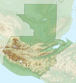
The Sierra de Santa Cruz is a mountain range in eastern Guatemala. It is located north of Lake Izabal, in the Izabal area. This mountain range stretches about 55 kilometers (34 miles) long and 13 kilometers (8 miles) wide. It runs from the southwest to the northeast.
What is the Sierra de Santa Cruz?
The Sierra de Santa Cruz is a smaller mountain range. Its highest points reach about 1,100 meters (3,600 feet) above sea level. These mountains are an important part of Guatemala's natural landscape. They help shape the land and provide homes for many plants and animals.
Animals of the Sierra de Santa Cruz
The Sierra de Santa Cruz is home to some special animals. One example is a type of frog called Craugastor trachydermus. This frog is only found in this mountain range, which makes it very unique!
Unfortunately, the Craugastor trachydermus frog is considered critically endangered. This means there are very few of them left in the wild. They are at a very high risk of disappearing forever. Protecting places like the Sierra de Santa Cruz helps keep these rare animals safe.
See also
 In Spanish: Sierra de Santa Cruz (Guatemala) para niños
 | May Edward Chinn |
 | Rebecca Cole |
 | Alexa Canady |
 | Dorothy Lavinia Brown |


