Silver Bow Basin facts for kids
Quick facts for kids Silver Bow Basin |
|
|---|---|
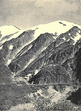
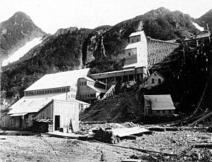
Silver Bow Basin, 1908
|
|
| Floor elevation | 1,250 ft (380 m) |
| Geography | |
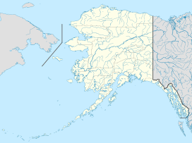
The Silver Bow Basin is a valley found about 2.4 miles (3.9 km) northeast of Juneau, Alaska, in the USA. It sits along Gold Creek, north of a place called Icy Gulch. It's also about 1.5 miles (2.4 km) north of Gastineau Peak. A path from Juneau goes right up to the mountainside. This basin is famous because it was where gold was first found in the Juneau area. This important discovery led to the creation of the town of Juneau itself!
Contents
Why Is It Called Silver Bow Basin?
There are two main ideas about how the Silver Bow Basin got its name.
Named by Richard Harris?
One idea is that Richard Harris named it. He might have named it after a mine in Silver Bow, Montana.
Named by Montana Miners?
Another idea is that a group of miners from Montana named it. They might have chosen the name to honor their last mining camp back in Montana.
The History of Gold Mining
The Silver Bow Basin has a rich history, especially when it comes to gold.
Early Gold Discoveries
In 1880, two prospectors, Richard Harris and Joe Juneau, found gold in the basin's Gold Creek. This type of gold is called placer gold, which means it's found in loose sand or gravel. This discovery was so important that it led to the founding of the town of Juneau.
Mining Operations Grow
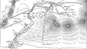
For the next nine years, miners used a method called sluicing to collect thousands of ounces of gold. Sluicing uses water to separate gold from dirt. An engineer from Sitka, named George E. Pilz, helped a lot with developing the mines. He even gave Harris and Juneau money and supplies to start their search. By the end of the 1880s, large-scale hydraulic mining was happening. This method uses powerful jets of water to wash away rock and soil. A 3.5-mile (5.6 km) wagon road was built to reach the mines, winding its way up the hill.
Different Types of Mines
Both quartz mines (where gold is found in rock veins) and placer mines operated in the basin. However, because of the cold weather, milling (processing the ore) could only happen for about five or six months each year.
Major Mines in the Basin
- The largest mine was called the Perseverance.
- The Fuller First Mine was the first quartz mine in the basin. In 1890, Archie Campbell set up a special mill there.
- The Silver-Bow Basin Mining Company owned over fifty placer claims on the basin's flat floor.
- The Eastern Alaska Mining and Milling Company had a mill at the very end of the basin.
In 1890, the Silver Bow Basin Mining Company's properties were taken over by the Nowell Gold Mining Company. They continued to mine placer gold until 1902.
Later Mining Developments
In 1897, the Alaska-Juneau Gold Mining Company was formed. This company bought many claims in the basin to mine for lower-grade gold ore. In 1899, the Lervey Basin placer claim opened about a mile above Silver Bow Basin.
By 1915, a 2-mile (3.2 km) tunnel was being dug through the ridge between Sheep Creek and Silver Bow Basin. This tunnel was meant to connect to a mine shaft and transport the mined ore to mills located on the Gastineau Channel. It is believed that over 50,000 ounces (1,400 kg) of gold were produced from this area in total.
Community Growth
As the mining community grew, a new church parish was created in 1885. This was for the Cathedral of the Nativity of the Blessed Virgin Mary, which is the main church for the Roman Catholic Diocese of Juneau.
Geography of Silver Bow Basin
The Silver Bow Basin was formed by a glacier that once stretched to the mouth of Gold Creek. This glacier dug out the basin and built up piles of rock and dirt called moraines. After the glacier melted, a lake filled the basin. This lake was separated from the lower parts of the creek by a solid rock wall.
Creeks and Rocks
Lurvey Creek splits into North Lurvey Creek and East Lurvey Creek above the basin. The old lake beds in the basin contain gold. Even though the creek was once covered in ice, some areas near the basin were not affected by the glaciation. The basin, which was a lake after the ice age, is now filled with gravel from several creeks, including Gold, Icy, Lurvey, Nugget, and Quartz Gulches.
What the Basin Contains
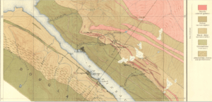
The ores found in the basin are mainly gold, with small amounts of silver, zinc, or lead. You can also find granite rocks in the northwestern part of the basin.
The Silver Bow Basin is about 3,000 feet (910 m) long and 1,000 feet (300 m) wide. It sits at an altitude of 1,250 feet (380 m) above sea level.
 | William Lucy |
 | Charles Hayes |
 | Cleveland Robinson |


