
Sinking Creek Mountain facts for kids
Quick facts for kids Sinking Creek Mountain |
|
|---|---|

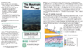
Sinking Creek Mountain
Location in Virginia
|
|
| Location | Craig County Virginia, United States |
| Nearest town | New Castle, Virginia |
| Area | 6,411 acres (25.94 km2) |
| Administrator | U.S. Forest Service |
Sinking Creek Mountain is a special wild area in western Virginia, located within the George Washington and Jefferson National Forests. It's considered so important that the Wilderness Society calls it a "Mountain Treasure." This means they believe it should be protected from things like logging and building new roads.
This amazing place has unique natural features like bogs (wet, marshy areas), springs, and "sag ponds." These ponds were formed by huge, ancient landslides, some of the biggest ever seen in the eastern United States. Some of these landslides stretched for as long as 3 miles! Because of these different land types, the area is home to many kinds of plants and animals.
Sinking Creek Mountain is also part of a larger natural area called the Sinking Creek Valley Cluster.
Contents
Exploring Sinking Creek Mountain
This wild area is found in the Appalachian Mountains of Southwestern Virginia. It's about 3 miles south of a town called New Castle, Virginia. Roads like Va 42 and Va 621 run along its sides, and Hall Road (Forest Road 209) follows its southeastern edge.
While there are no official hiking trails here, you can still explore! You can get into the area from Earn Knob Road (Forest Road 5021) on the west side, or Enterprise Road (Forest Road 742) on the east.

The map next to this text shows the boundaries of this special wildland, as identified by the Wilderness Society. You can find more detailed maps, like topographic maps, and even aerial views online. If you look at the coordinates at the top right of this page, you can find lots of information, including satellite data and weather.
You can also use old logging roads to explore. Many parts of the Appalachian Mountains were used for timber in the early 1900s. This left behind old roads that are now getting overgrown but can still be walked on. You can find these old roads and even old railroad paths by looking at historical maps from the United States Geological Survey (USGS). The Sinking Creek Mountain wild area is shown on USGS maps called Looney, Catawba, and Craig Springs.
Nature and Wildlife
Sinking Creek Mountain is part of a larger natural region known for its forests and valleys. The northern part of the mountain is especially important for animals like black bears. These animals need large areas away from people to live and thrive.
Some parts of the mountain ridge, and certain hidden valleys, have very old forests. These are called old-growth forests, meaning the trees have been growing there for a very long time without being cut down.
The ancient landslides changed the soil in some areas. This created special places where evergreen plants grow, which are not as common in other parts of the mountain where leafy trees are more typical. You can also find ferns in the swamps and ponds that formed because of these landslides.
Mountain Features and Waterfalls
The main feature of this area is Sinking Creek Mountain itself. It's a long ridge that reaches about 3600 feet high and forms the northwestern border of the area. Two notable spots along this ridge are Chimney Rock, which is 3638 feet high, and Earn Knob, at 3600 feet.
On the northern end of the area, you can find Meadow Creek Falls, a beautiful waterfall that drops about 500 feet!
All the water in this area eventually flows into Craig Creek, which then goes north to the James River. This means the mountain is part of the larger James River watershed.
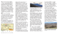
Amazing Ancient Landslides


Sinking Creek Mountain is famous for its huge landslides that happened a very long time ago, probably between 10,000 and 20,000 years ago, before people lived in this area. These landslides stretch over 20 miles on the eastern side of the mountain and are some of the biggest in the world!
Imagine rocks as big as 1.5 square miles moving down the hillside! Some of these giant rocks stayed in one piece, while others broke apart as they slid.
You can actually see signs of these landslides if you drive along Hall Road (Forest Road 209) on the southeastern border of the area. The images to the left give you more information about these incredible natural events.
How the Forest Service Manages the Area
The Forest Service manages this land. They look at different areas to see if they should be designated as "wilderness." When an area is called "wilderness," it gets a lot of protection from development.
The Forest Service also has a system to classify areas based on the types of outdoor activities visitors can enjoy. Most of Sinking Creek Mountain is managed as "Black Bear Habitat," which means it's kept wild for bears. The far eastern side is designated as a "Scenic Corridor," meaning it's a beautiful area to view.
In 2002, the Forest Service approved a timber sale (where trees are cut for wood) called the Enterprise timber sale, covering 65 acres on the eastern end. For this sale, Enterprise Road was extended by 1.2 miles. However, this new part of the road is now closed to cars and trucks.
A powerline also runs through the area, from north to south, near the end of Earn Knob Road.
A Bit of History
Sinking Creek Mountain also has a connection to history! In 1872, a person named Addison Caldwell, from the community of Sinking Creek, walked 26 miles across Sinking Creek Mountain and Brush Mountain. He did this to become the very first student at Virginia Tech university. Today, the Virginia Tech corps of cadets honors this event with an annual "Caldwell March."
Images for kids
-
Sinking Creek Landslide, page 1
-
Sinking Creek Landslide, page 2
