Siyazan District facts for kids
Quick facts for kids
Siyazan District
|
|
|---|---|

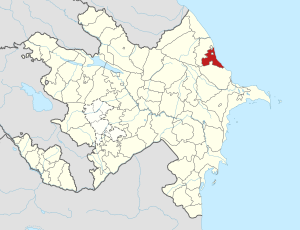
Map of Azerbaijan showing Siyazan District
|
|
| Country | |
| Region | Guba-Khachmaz |
| Established | 2 April 1992 |
| Capital | Siyazan |
| Settlements | 34 |
| Area | |
| • Total | 700 km2 (300 sq mi) |
| Population
(2020)
|
|
| • Total | 42,600 |
| • Density | 61/km2 (158/sq mi) |
| Time zone | UTC+4 (AZT) |
| Postal code |
5300
|
The Siyazan District (Azerbaijani: Siyəzən rayonu) is one of the 66 areas, called districts, in Azerbaijan. It is located in the north-east part of the country. This district is part of the Guba-Khachmaz Economic Region, which is a group of districts with similar economies.
Siyazan District shares its borders with the Shabran and Khizi districts. It also borders small parts of the Quba that are separated from the main Quba area. The biggest city and capital of the district is Siyazan. In 2020, about 42,600 people lived in the Siyazan District.
Contents
What's in a Name?
The name "Siyazan" might come from the Persian language. One idea is that it means "White Women." This could be a way to describe the first people who lived there, called Tats.
Another idea is that the name comes from the Persian word siyah, which means "black."
A Look at History
Long ago, there were villages in this area called Agh Siyazan ("White Siyazan") and Gara Siyazan ("Black Siyazan"). The city of Siyazan was once known as Gizilburun (Azerbaijani: Qızılburun).
Between 1911 and 1916, a big pipeline was built to carry water from Baku to Shollar. Many workers came to this area for the construction. The "Gizilburun" railway station also helped these places grow into towns where people lived.
Later, in 1938 and 1939, geologists found oil in the Siyazan District. This discovery led to the drilling of the first oil wells. More and more people moved to the district to work in the oil industry.
The Siyazan District was first part of the Absheron District. But on February 11, 1939, it joined with Khizi and Siyazan to form a new district. Gizilburun, which was renamed Siyazan in 1954, became its main center. However, in 1959, the district was closed down and became part of the Shabran District.
The Siyazan District was re-opened on April 2, 1992. This happened by an order from the Supreme Soviet of Azerbaijan.
Geography and Nature
Siyazan District is in the north-eastern part of Azerbaijan. It is located in a flat area called the Samur-Davachi lowland, right by the Caspian Sea. The Greater Caucasus mountains are also nearby.
A famous mountain called Besh Barmag is in the district. It stands about 500 meters (1,640 feet) tall. The land here has rocks and soil from very old times, called the Paleogene and Neogene periods.
The lowlands in the south-west have a semi-desert look. But the mountainous parts have meadows and forests. The soil there is often grey or chestnut-brown. Two rivers, the Atachay and Gilgilchay, flow through the district. They get their water from snow and rain in the mountains.
The weather in Siyazan is usually warm and dry, with a subtropical climate. In January, the average temperature is around 1.5 to 4 degrees Celsius (35-39°F). In July, it can be between 15 and 25 degrees Celsius (59-77°F). Summers are often dry. The district gets about 300–650 mm (12-26 inches) of rain each year. The main type of soil is gray-brown.
People of Siyazan
In January 2015, about 40,500 people lived in the Siyazan district. Most people (about 65.61%) live in cities, while fewer (33.39%) live in rural areas. About 49.8% of the people are men, and 50.2% are women.
Most people in the district are Azerbaijanis. But there are also smaller groups of people like Lezgins, Russians, Turks, Tatars, and Ukrainians living there.
Economy: How People Make a Living
Siyazan is known as an industrial district. This means that many businesses here make things in factories. The main natural resources found here are oil, natural gas, sand, gravel, and clay. The most important industry is mining, which involves taking these resources from the ground.
Industry
The district has several factories and businesses. There are 4 large or medium-sized factories and 8 smaller ones. You can also find two flour mills, bakeries, furniture shops, and places that make plastic goods.
In 2016, the district produced goods worth about 11,121.2 thousand Azerbaijani Manats (AZN). Most of this production (61.3%) came from state-owned companies. Private companies made 38.3% of the goods, and small business owners made 0.4%.
In 2016, the district produced natural gas pipes and other pipes. It also sold 52.1 thousand tons of oil and 10.1 million cubic meters of gas. About 1,250 people worked in the industry in 2016, and their average monthly pay was 678.4 Manats.
Agriculture
Out of 70,300 hectares of land in the district, about 38,11 hectares are used for farming. About 8,900 hectares are planted with crops. The main types of farming here are growing grain and raising livestock (animals like cows and sheep).
There are 6 farming businesses, including a large chicken farm called Siyazan-Broiler. There are also 56 individual farmers who run their own businesses.
In 2016, the district produced agricultural products worth 72,184.8 thousand Manats. Most of this (94.2%) came from animal products, and 5.8% came from plants.
In 2016, farmers harvested 6,083 tons of grain, 195.1 tons of corn, and 358 tons of potatoes. They also grew 1,148 tons of vegetables, 1,002 tons of melons, 1,202 tons of fruits, and 242 tons of grapes. New trees were planted, including 100 hectares of nuts and 18 hectares of olives.
By early 2017, the district had 13,024 cattle and 54,375 sheep and goats. Farmers produced 19,066.9 tons of meat (including 16,924.9 tons of poultry), 12,287 tons of milk, 12.3 million eggs, and 89 tons of wool.
Education and Culture
Siyazan District has several schools for children and young people. There are six secondary schools, where students go after primary school. There is also a sports school for athletes and a music school for those who want to learn instruments. A boarding school is also available in the city of Siyazan.
For healthcare, the district has a central hospital, a regional diagnostic center, a central polyclinic, and a children's hospital.
Historical Places and Monuments
Siyazan District is home to many old and interesting places.
Ancient Structures
- Flexible parabolic barrier (4th-7th centuries): This was a strong wall that stretched from the Beshbarmag mountain to the Caspian Sea.
- Gil-gilchay defense fortress complex (5th century): This fortress system included the Chirag Fortress and went through several villages in Siyazan.
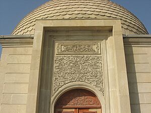
- Pir Khalil Tomb (18th century): This old tomb is in the Gil-Gilchay settlement and is still standing today.
- Remains of the castle (Middle Ages): These are the old parts of a religious tower.
- The Sheikh Heydar Tomb (15th century): This tomb is in the old Shikhlar village cemetery.
- Remains of Caravanserai (15th-17th centuries): This was a roadside inn for travelers, located about 87 km from Baku on the Baku-Devechi highway.
- The town (medieval): An old town site located in the northern part of Siyazan city.
- Waterfall: Located near the village of Zarat.
- Stone cave: Found in the village of Dib.
- Gil-Gilchay railway station (1898): An old train station.
- Zarat railway station (1913): Another old train station.
- Water Pipeline (1906): Located near the city of Siyazan.
- Golubbur railway station (1913): Built in 1913.
- An ancient water reservoir (1913): Located near the Gizilburun station.
- Hidir Zinja Mausoleum (Beshbarmaq): A special building for a holy person.
Memorial Monuments
The district also has monuments that remember important people and events:
- Statue of Jafar Jabbarly: A monument to a famous Azerbaijani writer.
- Statue of Mikayil Mushfig: A monument to a well-known Azerbaijani poet.
- "1941-1945" Monument Complex: Remembers the people who fought in World War II.
- "20 January" Monument Complex: Honors those who died in a tragic event on January 20, 1990.
- "Neftchi Martyrs" Monument Complex: Remembers oil workers who lost their lives.
See also
 In Spanish: Raión de Siazán para niños


