Smarr, Georgia facts for kids
Quick facts for kids
Smarr, Georgia
|
|
|---|---|
| Country | United States |
| State | Georgia |
| County | Monroe |
| Area | |
| • Total | 1.70 sq mi (4.4 km2) |
| • Land | 1.70 sq mi (4.4 km2) |
| • Water | 0.0 sq mi (0 km2) |
| Elevation | 615 ft (187 m) |
| Population
(2020)
|
|
| • Total | 218 |
| • Density | 128.2/sq mi (49.51/km2) |
| Time zone | UTC−5 (Eastern (EST)) |
| • Summer (DST) | UTC−4 (EDT) |
| ZIP Code |
31029 (Forsyth)
|
| FIPS code | 13-71296 |
| GNIS feature ID | 333068 |
Smarr is a small community in Monroe County, Georgia, in the United States. It is known as an unincorporated community, which means it's not officially a city or town. It is also a census-designated place (CDP). This means the U.S. Census Bureau counts its population for official records. In 2020, 218 people lived in Smarr.
History of Smarr
Smarr started way back in 1838. It grew when a railroad line was built through the area. The community was named after its founder.
Over time, the name changed a bit. It was first called "Smarrs" or "Smarrs Station." A post office opened there in 1872, using the name "Smarr's Station." Later, in 1895, the name was made shorter to just "Smarrs."
Where is Smarr?
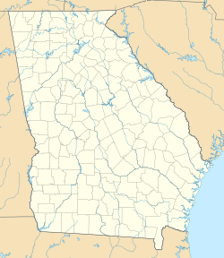
Smarr is located in the middle part of Monroe County, Georgia. It sits right on U.S. Route 41, which is a main road.
If you travel northwest on this road for about 5 miles (8 km), you will reach Forsyth. Forsyth is the main town and county seat of Monroe County. If you go southeast for about 20 miles (32 km), you will get to Macon.
The U.S. Census Bureau says that Smarr covers an area of about 1.7 square miles (4.4 square kilometers). All of this area is land.
People in Smarr
| Historical population | |||
|---|---|---|---|
| Census | Pop. | %± | |
| 2020 | 218 | — | |
| U.S. Decennial Census 2020 |
|||
Smarr was first officially listed as a census-designated place during the 2020 U.S. Census. This means it was recognized as a specific area for counting people. In 2020, the population was 218 people.
 | Emma Amos |
 | Edward Mitchell Bannister |
 | Larry D. Alexander |
 | Ernie Barnes |


