
Smithland, Kentucky facts for kids
Quick facts for kids
Smithland, Kentucky
|
|
|---|---|

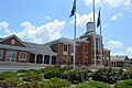
Current Livingston County Courthouse
|
|

Location of Smithland in Livingston County, Kentucky.
|
|
| Country | United States |
| State | Kentucky |
| County | Livingston |
| Area | |
| • Total | 0.51 sq mi (1.31 km2) |
| • Land | 0.51 sq mi (1.31 km2) |
| • Water | 0.00 sq mi (0.00 km2) |
| Elevation | 345 ft (105 m) |
| Population
(2020)
|
|
| • Total | 240 |
| • Density | 474.31/sq mi (183.02/km2) |
| Time zone | UTC-6 (Central (CST)) |
| • Summer (DST) | UTC-5 (CDT) |
| ZIP code |
42081
|
| Area code(s) | 270 & 364 |
| FIPS code | 21-71382 |
| GNIS feature ID | 2405474 |
Smithland is a small city in Livingston County, Kentucky. It is located where the Ohio and Cumberland Rivers meet. In 2020, about 240 people lived there. Smithland is also the main town, or county seat, of Livingston County.
Smithland is part of the larger Paducah area, which includes parts of Kentucky and Illinois.
Contents
Exploring Smithland's History
Smithland has some very old buildings. These buildings tell us about the city's past.
Historic Homes and Buildings
The Gower House is one of the oldest buildings in Smithland. It was built around 1780. This house was once an inn, a place where travelers could stay. It was built right where the Cumberland and Ohio rivers meet. The Gower House is so important that it was added to the National Register of Historic Places in 1973.
Another historic home in Smithland is the Richard Olive House. It was built around 1841.
Smithland's Location and Size
Smithland is not a very big city. It covers an area of about 0.6 square miles (1.31 square kilometers). All of this area is land.
People of Smithland
In 2000, there were 401 people living in Smithland. There were 157 households, which are groups of people living together. About 105 of these were families.
Population Changes Over Time
The number of people living in Smithland has changed a lot over the years. In 1850, there were 882 people. By 2010, the population had dropped to 301. In 2020, it was 240 people.

Learning in Smithland
The schools in Smithland are managed by Livingston County Schools. Students attend Livingston Central High School.
Smithland also has a place where you can borrow books. It is called the Livingston County Public Library.
Famous People from Smithland
- Carter W. Clarke was a U.S. Army General. He was important in the investigation after the Pearl Harbor Attack.
Images for kids
-
Current Livingston County Courthouse
-

Location of Smithland in Livingston County, Kentucky.
See also
 In Spanish: Smithland (Kentucky) para niños
