Snydertown, Northumberland County, Pennsylvania facts for kids
Quick facts for kids
Snydertown,
Northumberland County, Pennsylvania |
||
|---|---|---|
|
Borough
|
||

Snydertown, Pennsylvania
|
||
|
||

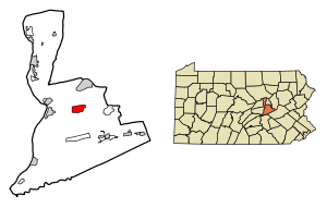
Location of Snydertown in Northumberland County, Pennsylvania.
|
||
| Country | United States | |
| State | Pennsylvania | |
| County | Northumberland | |
| Incorporated | 1871 | |
| Government | ||
| • Type | Borough Council | |
| Area | ||
| • Total | 3.49 sq mi (9.04 km2) | |
| • Land | 3.43 sq mi (8.89 km2) | |
| • Water | 0.06 sq mi (0.15 km2) | |
| Elevation
(benchmark at borough center)
|
534 ft (163 m) | |
| Highest elevation
(hill at northeast boundary)
|
1,042 ft (318 m) | |
| Lowest elevation
(Susquehanna River)
|
470 ft (140 m) | |
| Population
(2020)
|
||
| • Total | 325 | |
| • Density | 94.67/sq mi (36.55/km2) | |
| Time zone | UTC-5 (Eastern (EST)) | |
| • Summer (DST) | UTC-4 (EDT) | |
| Zip code |
17877
|
|
| Area code(s) | 570 | |
| FIPS code | 42-71688 | |
| GNIS feature ID | 1215518 | |
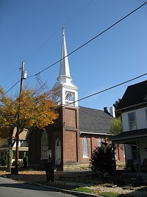
Snydertown is a small town, called a borough, in Northumberland County, Pennsylvania, United States. A borough is like a small city or town with its own local government. In 2020, about 325 people lived there.
Contents
History of Snydertown
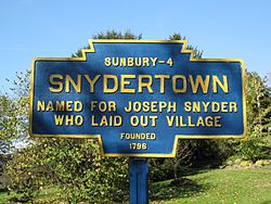
The land where Snydertown is now was first owned by a person named Godfrey Rockefeller. Later, his land was bought by Joseph Snyder. The town was named Snydertown in his honor. Snydertown officially became a borough in 1871. This means it got its own local government, separate from the larger Shamokin Township.
Geography and Nature of Snydertown
Snydertown is located in Pennsylvania at coordinates 40°52′24″N 76°40′14″W / 40.87333°N 76.67056°W. It covers an area of about 3.5 square miles (9.0 square kilometers). All of this area is land.
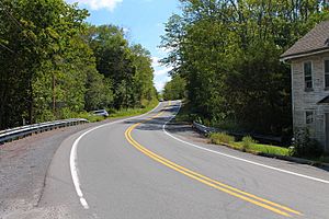
A stream called Shamokin Creek flows through Snydertown. Most of the land in the borough is hilly, but it becomes flat near Shamokin Creek. Much of Snydertown is covered by forests, but you can also find some farmland there.
People and Population in Snydertown
| Historical population | |||
|---|---|---|---|
| Census | Pop. | %± | |
| 1880 | 260 | — | |
| 1890 | 242 | −6.9% | |
| 1900 | 276 | 14.0% | |
| 1910 | 288 | 4.3% | |
| 1920 | 321 | 11.5% | |
| 1930 | 273 | −15.0% | |
| 1940 | 342 | 25.3% | |
| 1950 | 314 | −8.2% | |
| 1960 | 278 | −11.5% | |
| 1970 | 267 | −4.0% | |
| 1980 | 358 | 34.1% | |
| 1990 | 416 | 16.2% | |
| 2000 | 357 | −14.2% | |
| 2010 | 339 | −5.0% | |
| 2020 | 325 | −4.1% | |
| Sources: | |||
In the year 2000, there were 357 people living in Snydertown. These people lived in 136 homes, and 99 of those were families. The population density was about 102 people per square mile.
About 31.6% of the homes had children under 18 living there. Most homes (61%) were married couples living together. About 22.1% of all homes were single people living alone. The average home had 2.6 people.
The population was spread out by age. About 23.8% were under 18 years old. Around 31.1% were between 25 and 44 years old. The median age, which is the middle age of all the people, was 39 years.
The average income for a household in Snydertown was $40,250 in 2000. For families, the average income was $41,563. About 7.6% of all the people in Snydertown lived below the poverty line. This included 10.4% of those under 18.
See also
 In Spanish: Snydertown para niños
 | Shirley Ann Jackson |
 | Garett Morgan |
 | J. Ernest Wilkins Jr. |
 | Elijah McCoy |


